
One Hundred Forge
100 Forge Cir,
Pennington, NJ 08534
$2,603 - $3,265
1-2 Beds
Bedrooms
2 bd
Bathrooms
3 ba
Square Feet
1,224 sq ft
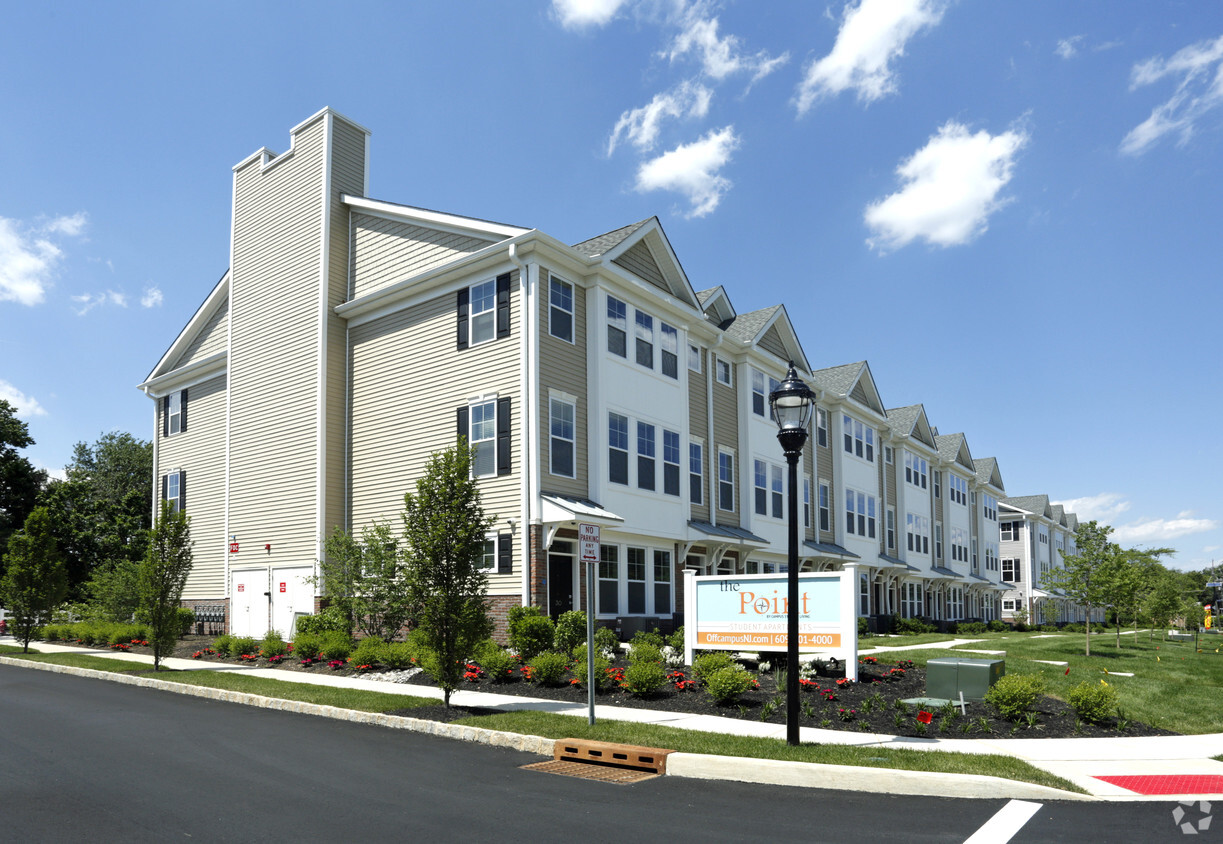
Brand New Community! Fully furnished two bedroom/three bathroom and fully furnished three bedroom/three and a half bathroom apartments minutes from campus. Stainless Steel appliances. Full size washer and dryer in every apartment. Energy efficient LED lighting throughout . All gas appliances. Covered bus stop. Manicured grounds. On-site friendly management. Bright exterior LED lighting and security cameras. Controlled access private parking. On-line bill pay and maintenance requests.
Brand New Community! Fully furnished two bedroom/three bathroom and fully furnished three bedroom/three and a half bathroom apartments minutes from campus. Stainless Steel appliances. Full size washer and dryer in every apartment. Energy efficient LED lighting throughout . All gas appliances. Covered bus stop. Manicured grounds. On-site friendly management. Bright exterior LED lighting and security cameras. Controlled access private parking. On-line bill pay and maintenance requests.
The Point is a townhouse community located in Mercer County and the 08638 ZIP Code. This area is served by the Ewing Township Public School District attendance zone.
Unique Features
Ewing Township sits at a crossroads of history and everyday convenience, where a Revolutionary War battlefield and a 77-mile canal trail are practically in your backyard. Bordering Trenton and hugging the Delaware River, this Mercer County township offers easy access to both New Jersey's capital city and the Philadelphia metro area. The Delaware and Raritan Canal State Park Trail draws hikers, cyclists, and joggers year-round, while the West Branch of Shabakunk Creek provides a rare slice of natural landscape dating back to colonial times. College of New Jersey anchors the township's intellectual energy, bringing steady activity to local shops and eateries.
Renters can choose from garden-style apartment communities, townhomes, and spacious two- and three-bedroom layouts offering more square footage than you'd typically find closer to the city. The township's proximity to Trenton-Mercer Airport and major commuter routes makes regional travel straightforward.
Learn more about living in Ewing| Colleges & Universities | Distance | ||
|---|---|---|---|
| Colleges & Universities | Distance | ||
| Drive: | 6 min | 2.2 mi | |
| Drive: | 6 min | 3.1 mi | |
| Drive: | 9 min | 3.6 mi | |
| Drive: | 20 min | 8.2 mi |


Transportation options available in Ewing include Hamilton Avenue, located 3.9 miles from The Point. The Point is near Trenton Mercer, located 4.8 miles or 10 minutes away.
| Transit / Subway | Distance | ||
|---|---|---|---|
| Transit / Subway | Distance | ||
|
|
Drive: | 7 min | 3.9 mi |
| Drive: | 8 min | 4.0 mi | |
|
|
Drive: | 10 min | 6.0 mi |
|
|
Drive: | 18 min | 9.6 mi |
|
|
Drive: | 22 min | 13.5 mi |
| Commuter Rail | Distance | ||
|---|---|---|---|
| Commuter Rail | Distance | ||
| Drive: | 7 min | 3.7 mi | |
|
|
Drive: | 8 min | 3.9 mi |
|
|
Drive: | 8 min | 3.9 mi |
|
|
Drive: | 11 min | 4.7 mi |
|
|
Drive: | 12 min | 6.5 mi |
| Airports | Distance | ||
|---|---|---|---|
| Airports | Distance | ||
|
Trenton Mercer
|
Drive: | 10 min | 4.8 mi |
Scores provided by
Traffic
BusyAirport
CalmBusinesses
CalmScores provided by
HowLoud What is a Sound Score Rating? A Sound Score Rating aggregates noise caused by vehicle traffic, airplane traffic and local sources. How It WorksTime and distance from The Point.
| Shopping Centers | Distance | ||
|---|---|---|---|
| Shopping Centers | Distance | ||
| Walk: | 11 min | 0.6 mi | |
| Walk: | 13 min | 0.7 mi | |
| Walk: | 14 min | 0.7 mi |
| Parks and Recreation | Distance | ||
|---|---|---|---|
| Parks and Recreation | Distance | ||
|
Drexel Woods Park
|
Drive: | 6 min | 2.9 mi |
|
Lawrence Nature Center
|
Drive: | 6 min | 2.9 mi |
|
New Jersey State Museum Planetarium
|
Drive: | 5 min | 3.0 mi |
|
Sayen House & Gardens
|
Drive: | 16 min | 7.8 mi |
|
Terhune Orchards
|
Drive: | 15 min | 7.9 mi |
| Hospitals | Distance | ||
|---|---|---|---|
| Hospitals | Distance | ||
| Drive: | 4 min | 2.0 mi | |
| Drive: | 13 min | 5.9 mi | |
| Drive: | 14 min | 7.1 mi |
| Military Bases | Distance | ||
|---|---|---|---|
| Military Bases | Distance | ||
| Drive: | 34 min | 21.4 mi | |
| Drive: | 38 min | 21.9 mi | |
| Drive: | 50 min | 28.2 mi |

1573 Parkside Ave
Ewing, NJ 08638


")


