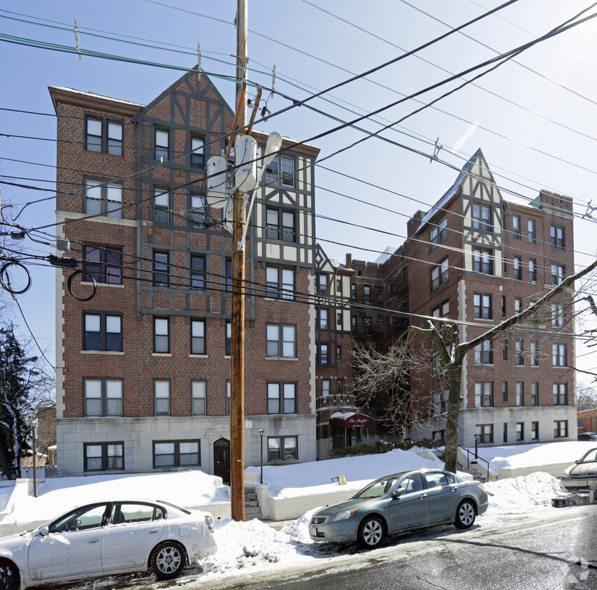
305 Lakeview Apartments
305 Pennsylvania Ave,
Paterson, NJ 07503
$1,800 - $2,950
1-2 Beds


At The Mayfair, experience stylish living. This community can be found in the 07504 area of Paterson. Come for a visit to see the current floorplan options. The professional leasing staff is waiting to show you all that this community has in store. At The Mayfair you'll feel right at home. Stop by the community today.
The Mayfair is an apartment community located in Passaic County and the 07504 ZIP Code. This area is served by the Paterson Public attendance zone.
Tub/Shower
Heating
Oven
Range
Eastside is a suburban Paterson neighborhood about 20 miles away from New York City. Eastside’s southern border rests on Interstate 80 while its eastern border is situated along the Passaic River, ensuring residents have access to outdoor fun and easy travel. Favorite parks within the neighborhood include the picturesque Eastside Park along with Roberto Clemente Park. Family-friendly eateries like pizzerias and ice cream shops dot the area as well. Service stores and grocers can be found in the area, but residents can travel to Center City Mall, located in the heart of Downtown Paterson, for other retail needs. Downtown Paterson is minutes away from Eastside and is home to several specialty shops and local restaurants and bars.
Eastside’s rental options consist of apartments with a few houses and condos available in brick front buildings, row homes, and more.
Learn more about living in EastsideCompare neighborhood and city base rent averages by bedroom.
| Eastside | Paterson, NJ | |
|---|---|---|
| Studio | $1,122 | $1,107 |
| 1 Bedroom | $1,455 | $1,439 |
| 2 Bedrooms | $1,551 | $1,911 |
| 3 Bedrooms | $1,792 | $2,447 |
| Colleges & Universities | Distance | ||
|---|---|---|---|
| Colleges & Universities | Distance | ||
| Drive: | 2 min | 1.5 mi | |
| Drive: | 8 min | 3.7 mi | |
| Drive: | 9 min | 4.5 mi | |
| Drive: | 10 min | 5.2 mi |
 The GreatSchools Rating helps parents compare schools within a state based on a variety of school quality indicators and provides a helpful picture of how effectively each school serves all of its students. Ratings are on a scale of 1 (below average) to 10 (above average) and can include test scores, college readiness, academic progress, advanced courses, equity, discipline and attendance data. We also advise parents to visit schools, consider other information on school performance and programs, and consider family needs as part of the school selection process.
Transportation options available in Paterson include Grove Street, located 12.0 miles from The Mayfair. The Mayfair is near Newark Liberty International, located 20.2 miles or 25 minutes away, and LaGuardia, located 22.8 miles or 35 minutes away.
| Transit / Subway | Distance | ||
|---|---|---|---|
| Transit / Subway | Distance | ||
|
|
Drive: | 17 min | 12.0 mi |
|
|
Drive: | 18 min | 12.3 mi |
|
|
Drive: | 17 min | 12.9 mi |
| Commuter Rail | Distance | ||
|---|---|---|---|
| Commuter Rail | Distance | ||
|
|
Drive: | 3 min | 1.7 mi |
|
|
Drive: | 4 min | 1.8 mi |
|
|
Drive: | 5 min | 2.6 mi |
|
|
Drive: | 5 min | 3.0 mi |
|
|
Drive: | 7 min | 3.9 mi |
| Airports | Distance | ||
|---|---|---|---|
| Airports | Distance | ||
|
Newark Liberty International
|
Drive: | 25 min | 20.2 mi |
|
LaGuardia
|
Drive: | 35 min | 22.8 mi |
Time and distance from The Mayfair.
| Shopping Centers | Distance | ||
|---|---|---|---|
| Shopping Centers | Distance | ||
| Drive: | 2 min | 1.1 mi | |
| Drive: | 4 min | 1.5 mi | |
| Drive: | 4 min | 2.0 mi |
| Parks and Recreation | Distance | ||
|---|---|---|---|
| Parks and Recreation | Distance | ||
|
Rifle Camp Park Observatory
|
Drive: | 7 min | 4.1 mi |
|
Van Saun County Park
|
Drive: | 11 min | 6.5 mi |
|
Bergen County Zoo
|
Drive: | 11 min | 6.6 mi |
|
Presby Memorial Iris Gardens
|
Drive: | 12 min | 7.1 mi |
|
Saddle River County Park
|
Drive: | 15 min | 7.1 mi |
| Hospitals | Distance | ||
|---|---|---|---|
| Hospitals | Distance | ||
| Drive: | 4 min | 2.5 mi | |
| Drive: | 9 min | 5.1 mi | |
| Drive: | 9 min | 6.3 mi |
| Military Bases | Distance | ||
|---|---|---|---|
| Military Bases | Distance | ||
| Drive: | 34 min | 22.4 mi | |
| Drive: | 31 min | 23.5 mi |
What Are Walk Score®, Transit Score®, and Bike Score® Ratings?
Walk Score® measures the walkability of any address. Transit Score® measures access to public transit. Bike Score® measures the bikeability of any address.
What is a Sound Score Rating?
A Sound Score Rating aggregates noise caused by vehicle traffic, airplane traffic and local sources