
The Watson
11901 Burnet Rd,
Austin, TX 78758
$1,227 - $7,950
Studio - 3 Beds
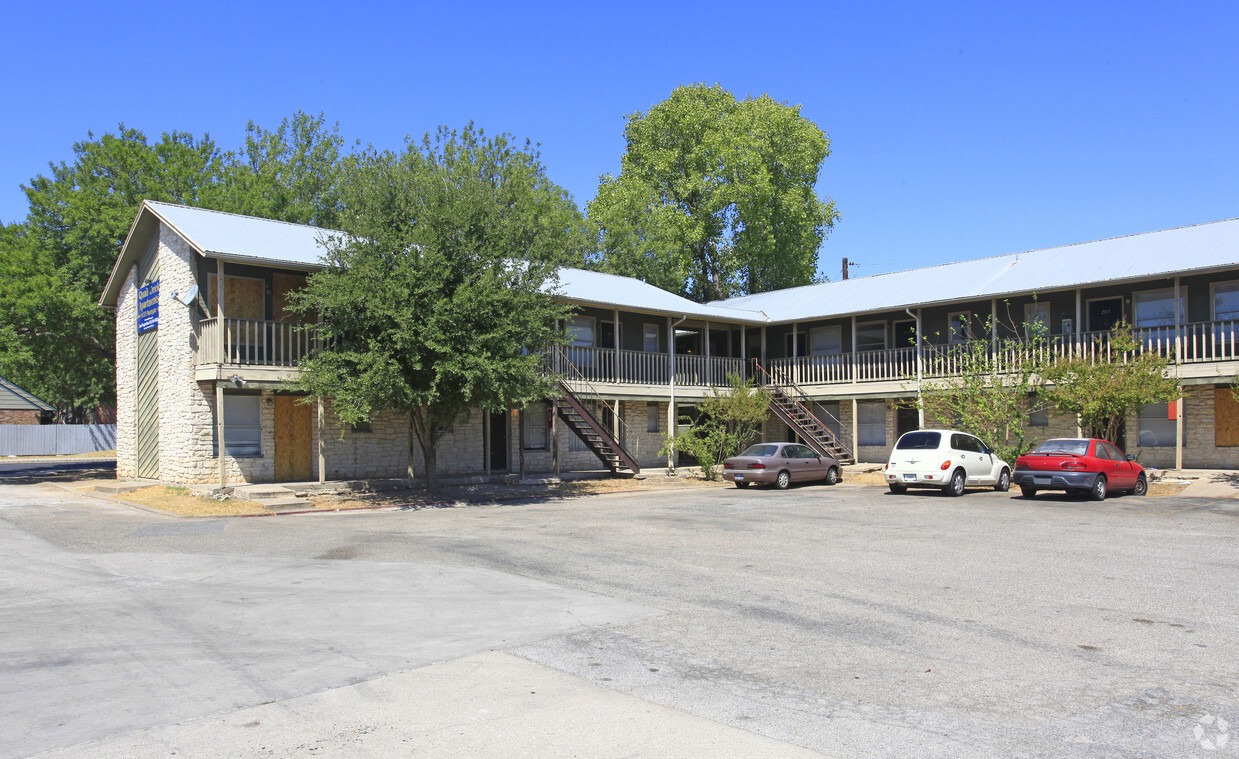
Come enjoy Austin living at Ventura South. The 9133 Northgate Blvd location in the 78758 neighborhood of Austin has much to offer its residents. Let the knowledgeable leasing staff show you everything this community has in store. Make your move to Ventura South. Contact us or stop in to schedule a tour.
The Horseshoe is an apartment community located in Travis County and the 78758 ZIP Code. This area is served by the Austin Independent School District attendance zone.
Air Conditioning
High Speed Internet Access
Refrigerator
Tub/Shower
North Austin encompasses several smaller neighborhoods on the north side of downtown. These include Georgian Acres, North Lamar, Walnut Forest, Eubank Acres, Oak Ridge, and several others. North Austin extends from the intersection of I-35 and Highway 183 north to Scofield Ridge Parkway. Those choosing rentals in North Austin can use I-35 or the Mopac Expressway to quickly reach Downtown Austin, and bus service is readily available.
The crown jewel of North Austin is Walnut Creek Metropolitan Park, a large park containing a swimming pool, a playground, numerous hiking and biking trails, picnic shelters, and a BMX Pump Track. North Austin is also home to Austin Community College: Northridge Campus and J.J. Pickle Research Campus, part of the University of Texas at Austin. No matter which part of North Austin you choose for your apartment, you’ll be close to top-rated shops and restaurants, including the Shops at Arbor Walk and the Domain.
Learn more about living in North AustinCompare neighborhood and city base rent averages by bedroom.
| North Austin | Austin, TX | |
|---|---|---|
| Studio | $1,057 | $1,210 |
| 1 Bedroom | $1,300 | $1,402 |
| 2 Bedrooms | $1,716 | $1,834 |
| 3 Bedrooms | $2,163 | $2,444 |
| Colleges & Universities | Distance | ||
|---|---|---|---|
| Colleges & Universities | Distance | ||
| Drive: | 6 min | 2.8 mi | |
| Drive: | 12 min | 8.0 mi | |
| Drive: | 14 min | 9.4 mi | |
| Drive: | 16 min | 9.5 mi |


Transportation options available in Austin include Mckalla Station, located 1.6 miles from The Horseshoe. The Horseshoe is near Austin-Bergstrom International, located 19.5 miles or 30 minutes away.
| Transit / Subway | Distance | ||
|---|---|---|---|
| Transit / Subway | Distance | ||
| Drive: | 4 min | 1.6 mi | |
| Drive: | 4 min | 2.0 mi | |
| Drive: | 7 min | 3.6 mi | |
| Drive: | 8 min | 4.2 mi | |
| Drive: | 11 min | 6.0 mi |
| Commuter Rail | Distance | ||
|---|---|---|---|
| Commuter Rail | Distance | ||
|
|
Drive: | 16 min | 10.5 mi |
|
|
Drive: | 40 min | 30.0 mi |
| Airports | Distance | ||
|---|---|---|---|
| Airports | Distance | ||
|
Austin-Bergstrom International
|
Drive: | 30 min | 19.5 mi |
Scores provided by
Traffic
-Airport
-Businesses
-Scores provided by
HowLoud What is a Sound Score Rating? A Sound Score Rating aggregates noise caused by vehicle traffic, airplane traffic and local sources. How It WorksTime and distance from The Horseshoe.
| Shopping Centers | Distance | ||
|---|---|---|---|
| Shopping Centers | Distance | ||
| Walk: | 4 min | 0.2 mi | |
| Walk: | 13 min | 0.7 mi | |
| Drive: | 3 min | 1.4 mi |
| Parks and Recreation | Distance | ||
|---|---|---|---|
| Parks and Recreation | Distance | ||
|
The Stephen F. Austin Planetarium
|
Drive: | 7 min | 3.1 mi |
|
Beverly S. Sheffield Northwest District Park
|
Drive: | 8 min | 3.3 mi |
|
Balcones District Park
|
Drive: | 8 min | 3.9 mi |
|
Walnut Creek Park
|
Drive: | 7 min | 4.0 mi |
|
Bull Creek Greenbelt
|
Drive: | 8 min | 4.3 mi |
| Hospitals | Distance | ||
|---|---|---|---|
| Hospitals | Distance | ||
| Drive: | 6 min | 3.6 mi | |
| Drive: | 7 min | 3.7 mi | |
| Drive: | 8 min | 4.0 mi |
| Military Bases | Distance | ||
|---|---|---|---|
| Military Bases | Distance | ||
| Drive: | 85 min | 68.6 mi | |
| Drive: | 91 min | 74.8 mi | |
| Drive: | 117 min | 91.7 mi |
What Are Walk Score®, Transit Score®, and Bike Score® Ratings?
Walk Score® measures the walkability of any address. Transit Score® measures access to public transit. Bike Score® measures the bikeability of any address.
What is a Sound Score Rating?
A Sound Score Rating aggregates noise caused by vehicle traffic, airplane traffic and local sources.

9133 Northgate Blvd
Austin, TX 78758


