
26FIFTY
2650 Telegraph Ave,
Berkeley, CA 94704
$2,795 - $3,395
Studio - 2 Beds

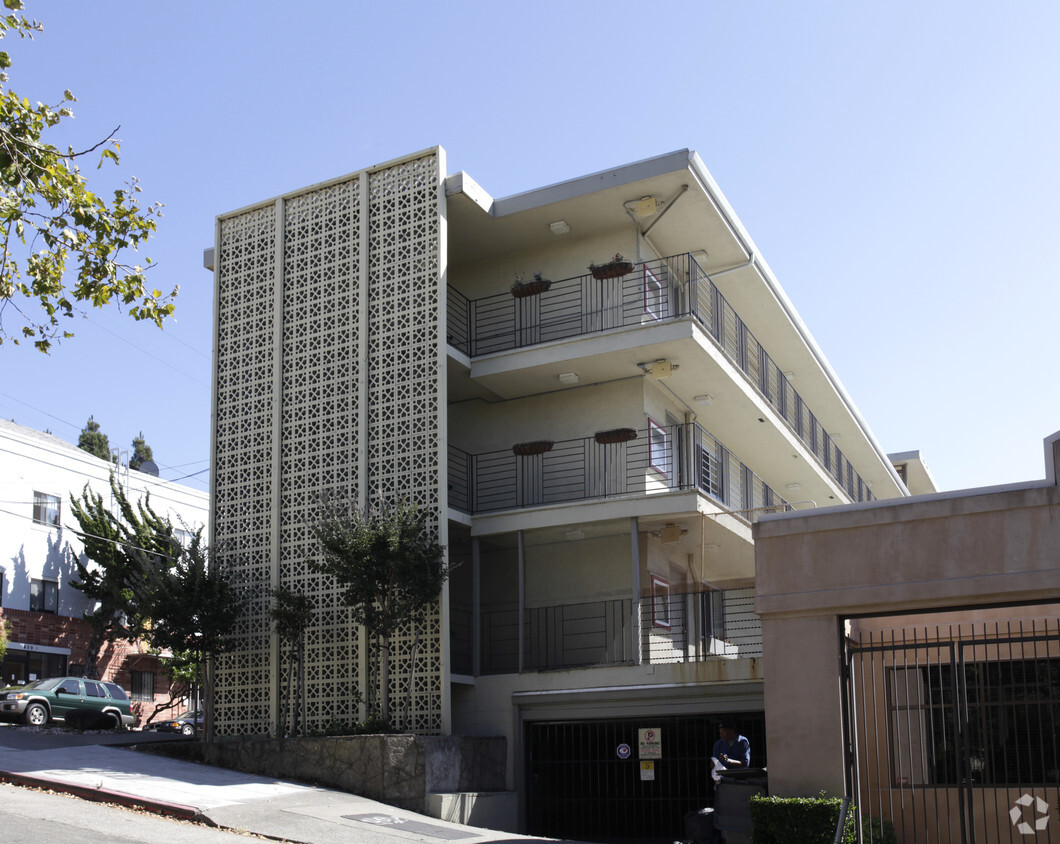

Explore Oakland living at Telegraph Hill. This community is located at 2945 Mcclure St. in the 94609 area of Oakland. From amenities to availability, the professional leasing team is ready to match you with your perfect floorplan. Be sure to check out the current floorplan options. Stop by the leasing office to talk about your next apartment.
Telegraph Hill is an apartment community located in Alameda County and the 94609 ZIP Code. This area is served by the Oakland Unified attendance zone.
Pill Hill is a small neighborhood located about a mile north of Downtown Oakland. Various medical facilities are located in the neighborhood, hence the name. Along with pharmacies and doctor’s offices, Pill Hill is home to the Alta Bates Summit Medical Center. Pill Hill has apartments and condos available for rent. The iconic Telegraph Avenue runs through Pill Hill so residents have access to cafes, coffee shops, and grocery stores within walking distance, but many residents take advantage of the neighborhood’s central location by traveling into neighboring communities for more shopping, dining, and entertainment options. Explore eateries on Piedmont Avenue, or head to Adams Point to access Lake Merritt. Pill Hill is nestled between Interstate 580 and 980 so it’s a great choice for anyone who wants to be able to travel across the Bay Area with ease into other major cities like Berkeley and San Francisco.
Learn more about living in Pill Hill| Colleges & Universities | Distance | ||
|---|---|---|---|
| Colleges & Universities | Distance | ||
| Walk: | 3 min | 0.2 mi | |
| Drive: | 4 min | 1.4 mi | |
| Drive: | 7 min | 2.8 mi | |
| Drive: | 9 min | 3.3 mi |


Transportation options available in Oakland include 19Th St Oakland Station, located 0.9 mile from Telegraph Hill. Telegraph Hill is near Metro Oakland International, located 10.5 miles or 18 minutes away, and San Francisco International, located 22.6 miles or 35 minutes away.
| Transit / Subway | Distance | ||
|---|---|---|---|
| Transit / Subway | Distance | ||
|
|
Walk: | 17 min | 0.9 mi |
|
|
Drive: | 3 min | 1.2 mi |
|
|
Drive: | 3 min | 1.2 mi |
|
|
Drive: | 2 min | 1.3 mi |
|
|
Drive: | 6 min | 3.7 mi |
| Commuter Rail | Distance | ||
|---|---|---|---|
| Commuter Rail | Distance | ||
|
|
Drive: | 6 min | 2.1 mi |
|
|
Drive: | 7 min | 3.4 mi |
|
|
Drive: | 9 min | 5.5 mi |
| Drive: | 16 min | 10.1 mi | |
| Drive: | 17 min | 10.2 mi |
| Airports | Distance | ||
|---|---|---|---|
| Airports | Distance | ||
|
Metro Oakland International
|
Drive: | 18 min | 10.5 mi |
|
San Francisco International
|
Drive: | 35 min | 22.6 mi |
Time and distance from Telegraph Hill.
| Shopping Centers | Distance | ||
|---|---|---|---|
| Shopping Centers | Distance | ||
| Walk: | 6 min | 0.3 mi | |
| Walk: | 15 min | 0.8 mi | |
| Walk: | 19 min | 1.0 mi |
| Parks and Recreation | Distance | ||
|---|---|---|---|
| Parks and Recreation | Distance | ||
|
Lakeside Park Garden Center
|
Walk: | 21 min | 1.1 mi |
|
Lakeside Park
|
Drive: | 4 min | 1.4 mi |
|
Morcom Rose Garden
|
Drive: | 5 min | 1.4 mi |
|
Rotary Nature Center
|
Drive: | 4 min | 1.5 mi |
|
Juan Bautista de Anza National Historic Trail
|
Drive: | 4 min | 1.7 mi |
| Hospitals | Distance | ||
|---|---|---|---|
| Hospitals | Distance | ||
| Walk: | 6 min | 0.3 mi | |
| Walk: | 15 min | 0.8 mi | |
| Drive: | 3 min | 1.5 mi |
| Military Bases | Distance | ||
|---|---|---|---|
| Military Bases | Distance | ||
| Drive: | 13 min | 4.5 mi | |
| Drive: | 13 min | 4.8 mi |
What Are Walk Score®, Transit Score®, and Bike Score® Ratings?
Walk Score® measures the walkability of any address. Transit Score® measures access to public transit. Bike Score® measures the bikeability of any address.
What is a Sound Score Rating?
A Sound Score Rating aggregates noise caused by vehicle traffic, airplane traffic and local sources
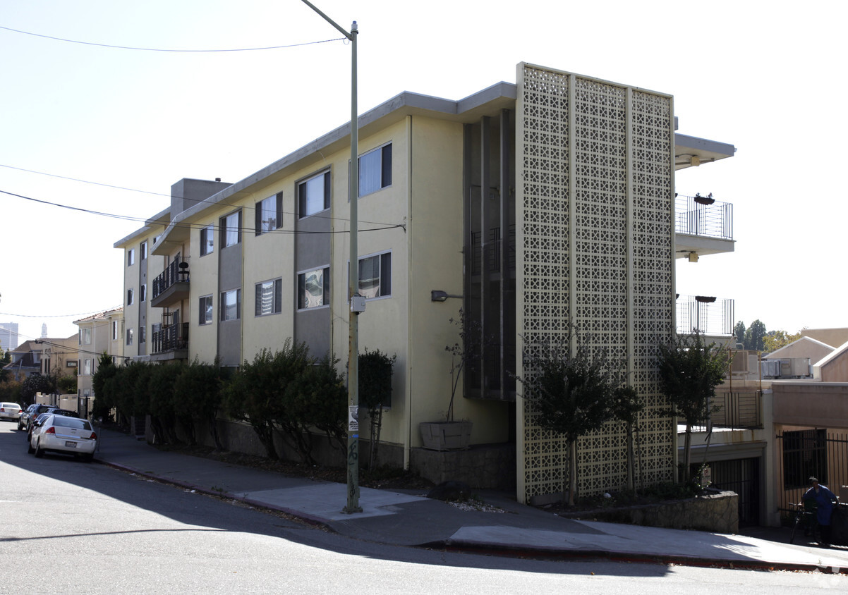
2945 McClure St
Oakland, CA 94609


