
Isle House
39 Bruton St,
San Francisco, CA 94130
$3,050 - $6,998
Studio - 3 Beds

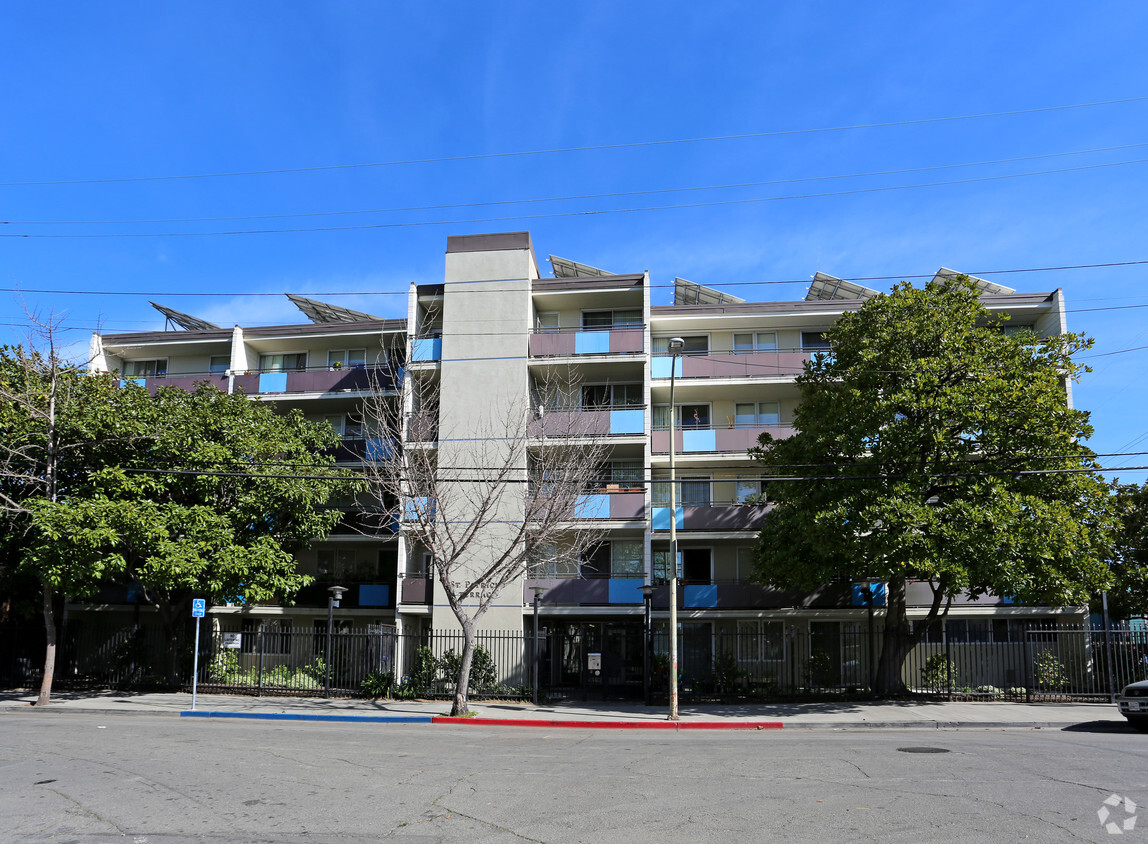
Enjoy Oakland living at St. Patrick's Terrace. Based in the 94607 Zip code of Oakland on Center St., renters have a quick connection to great entertainment options within a few miles. Make a visit to see the current floorplan options. The leasing staff is ready to match you with the perfect floorplan. Find your new home at St. Patrick's Terrace. Contact or drop by the leasing office to check the availability and set up a tour today.
St. Patrick's Terrace is an apartment community located in Alameda County and the 94607 ZIP Code. This area is served by the Oakland Unified attendance zone.
A Bay Area locale on the rise, West Oakland is poised to be one of the most popular Oakland neighborhoods for its relatively affordable rentals and proximity to public transit. West Oakland is tucked into the area formed by Interstate 880, 980, and 580 complex just across the bay from San Francisco. Oakland’s recent swell in popularity has made West Oakland a common spot for the commuting crowd outside of the Golden Gate City. You’ll find a few parks and plenty of coffee shops and trendy restaurants just off the industrial areas that line the bay.
Modern apartment rentals in mid-rise buildings and charming homes in long-standing houses showcase the contrast of this Bay Area neighborhood. Commuting into San Francisco takes just 15 minutes via car, or 20 via BART, the Bay Area’s public transportation system.
Learn more about living in West Oakland| Colleges & Universities | Distance | ||
|---|---|---|---|
| Colleges & Universities | Distance | ||
| Drive: | 4 min | 1.5 mi | |
| Drive: | 7 min | 2.7 mi | |
| Drive: | 6 min | 2.8 mi | |
| Drive: | 8 min | 3.3 mi |

Transportation options available in Oakland include West Oakland Station, located 0.4 mile from St. Patrick's Terrace. St. Patrick's Terrace is near Metro Oakland International, located 10.5 miles or 16 minutes away, and San Francisco International, located 21.3 miles or 33 minutes away.
| Transit / Subway | Distance | ||
|---|---|---|---|
| Transit / Subway | Distance | ||
|
|
Walk: | 8 min | 0.4 mi |
|
|
Drive: | 4 min | 1.8 mi |
|
|
Drive: | 4 min | 1.9 mi |
|
|
Drive: | 4 min | 2.2 mi |
|
|
Drive: | 5 min | 2.2 mi |
| Commuter Rail | Distance | ||
|---|---|---|---|
| Commuter Rail | Distance | ||
|
|
Drive: | 5 min | 2.1 mi |
|
|
Drive: | 7 min | 2.4 mi |
|
|
Drive: | 9 min | 5.0 mi |
| Drive: | 15 min | 8.8 mi | |
| Drive: | 15 min | 8.9 mi |
| Airports | Distance | ||
|---|---|---|---|
| Airports | Distance | ||
|
Metro Oakland International
|
Drive: | 16 min | 10.5 mi |
|
San Francisco International
|
Drive: | 33 min | 21.3 mi |
Time and distance from St. Patrick's Terrace.
| Shopping Centers | Distance | ||
|---|---|---|---|
| Shopping Centers | Distance | ||
| Walk: | 8 min | 0.4 mi | |
| Drive: | 3 min | 1.2 mi | |
| Drive: | 4 min | 1.8 mi |
| Parks and Recreation | Distance | ||
|---|---|---|---|
| Parks and Recreation | Distance | ||
|
Jack London Square
|
Drive: | 4 min | 1.9 mi |
|
Juan Bautista de Anza National Historic Trail
|
Drive: | 4 min | 2.2 mi |
|
Middle Harbor Shoreline Park
|
Drive: | 5 min | 2.2 mi |
|
Oakland Museum of California
|
Drive: | 5 min | 2.2 mi |
|
Lakeside Park Garden Center
|
Drive: | 5 min | 2.5 mi |
| Hospitals | Distance | ||
|---|---|---|---|
| Hospitals | Distance | ||
| Drive: | 7 min | 2.7 mi | |
| Drive: | 7 min | 3.1 mi | |
| Drive: | 7 min | 3.1 mi |
| Military Bases | Distance | ||
|---|---|---|---|
| Military Bases | Distance | ||
| Drive: | 8 min | 2.5 mi | |
| Drive: | 12 min | 4.8 mi |
What Are Walk Score®, Transit Score®, and Bike Score® Ratings?
Walk Score® measures the walkability of any address. Transit Score® measures access to public transit. Bike Score® measures the bikeability of any address.
What is a Sound Score Rating?
A Sound Score Rating aggregates noise caused by vehicle traffic, airplane traffic and local sources
1212 Center St
Oakland, CA 94607


