
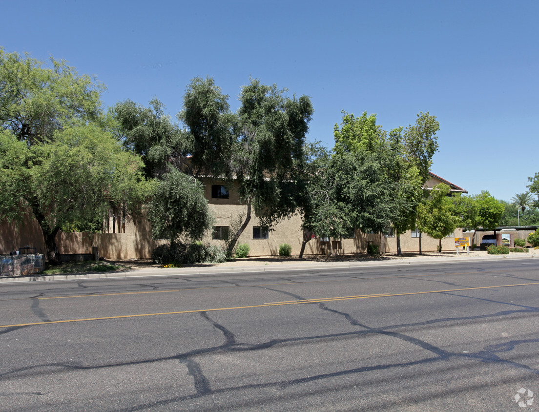
Navona
10141 E Williams Field Rd,
Mesa, AZ 85212
$1,650 - $3,312 Total Monthly Price
1-3 Beds

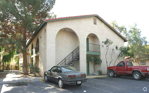

Experience Mesa living at Sierra Shadows. The 85204 location is an ideal place for residents. From pricing to features, the leasing staff is ready to match you with your perfect new apartment. Come for a visit to check out the apartment floorplan options. Contact us or drop by the leasing office to schedule your tour and see Sierra Shadows.
Sierra Shadows is an apartment community located in Maricopa County and the 85204 ZIP Code. This area is served by the Mesa Unified School District attendance zone.
High Speed Internet Access
Smoke Free
Heating
Kitchen
From the fine arts to arts education and hiking – Central Mesa has everything you could ever want in a neighborhood. This large residential suburb is quite breathtaking with the Usery Mountains in the distance.
Residents are delighted by the direct access to major freeways as well as the city’s light rail system. With the Phoenix Mesa Airport just a few miles south, traveling abroad is made simple. Golf courses, country clubs, and parks abound in Central Mesa. The hands-on art museum for kids, I.D.E.A Museum, is in walking distance of the Arizona Museum of Natural History and Pioneer Park.
Culinary fare is plentiful and includes vegan, Tex-Mex, Italian, and Thai to name a few. Many large corporations as well as local business reside in Central Mesa.
Learn more about living in Central MesaCompare neighborhood and city base rent averages by bedroom.
| Central Mesa | Mesa, AZ | |
|---|---|---|
| Studio | $1,088 | $1,085 |
| 1 Bedroom | $1,228 | $1,286 |
| 2 Bedrooms | $1,416 | $1,522 |
| 3 Bedrooms | $2,082 | $2,091 |
| Colleges & Universities | Distance | ||
|---|---|---|---|
| Colleges & Universities | Distance | ||
| Drive: | 4 min | 1.9 mi | |
| Drive: | 5 min | 2.3 mi | |
| Drive: | 7 min | 3.7 mi | |
| Drive: | 9 min | 5.6 mi |


Transportation options available in Mesa include Stapley Dr/Main St, located 0.9 mile from Sierra Shadows. Sierra Shadows is near Phoenix Sky Harbor International, located 13.9 miles or 23 minutes away, and Phoenix-Mesa Gateway, located 14.6 miles or 23 minutes away.
| Transit / Subway | Distance | ||
|---|---|---|---|
| Transit / Subway | Distance | ||
|
|
Walk: | 18 min | 0.9 mi |
|
|
Drive: | 2 min | 1.6 mi |
|
|
Drive: | 3 min | 1.8 mi |
|
|
Drive: | 4 min | 2.4 mi |
|
|
Drive: | 6 min | 2.8 mi |
| Commuter Rail | Distance | ||
|---|---|---|---|
| Commuter Rail | Distance | ||
|
|
Drive: | 45 min | 34.5 mi |
| Airports | Distance | ||
|---|---|---|---|
| Airports | Distance | ||
|
Phoenix Sky Harbor International
|
Drive: | 23 min | 13.9 mi |
|
Phoenix-Mesa Gateway
|
Drive: | 23 min | 14.6 mi |
Scores provided by
Traffic
-Airport
-Businesses
-Scores provided by
HowLoud What is a Sound Score Rating? A Sound Score Rating aggregates noise caused by vehicle traffic, airplane traffic and local sources. How It WorksTime and distance from Sierra Shadows.
| Shopping Centers | Distance | ||
|---|---|---|---|
| Shopping Centers | Distance | ||
| Walk: | 8 min | 0.4 mi | |
| Walk: | 14 min | 0.7 mi | |
| Walk: | 15 min | 0.8 mi |
| Parks and Recreation | Distance | ||
|---|---|---|---|
| Parks and Recreation | Distance | ||
|
Arizona Museum of Natural History
|
Drive: | 5 min | 2.5 mi |
|
i.d.e.a. Museum
|
Drive: | 5 min | 2.7 mi |
|
Riparian Preserve at Water Ranch
|
Drive: | 11 min | 6.7 mi |
|
ASU Center for Meteorite Studies
|
Drive: | 17 min | 8.5 mi |
|
Desert Arboretum Park
|
Drive: | 17 min | 9.1 mi |
| Hospitals | Distance | ||
|---|---|---|---|
| Hospitals | Distance | ||
| Drive: | 8 min | 5.5 mi | |
| Drive: | 9 min | 5.9 mi | |
| Drive: | 9 min | 6.3 mi |
| Military Bases | Distance | ||
|---|---|---|---|
| Military Bases | Distance | ||
| Drive: | 23 min | 17.1 mi | |
| Drive: | 52 min | 41.6 mi | |
| Drive: | 114 min | 93.3 mi |
Pets Allowed Fitness Center Pool
Pets Allowed Fitness Center Pool In Unit Washer & Dryer Stainless Steel Appliances Ceiling Fans Controlled Access
Pets Allowed Fitness Center In Unit Washer & Dryer Stainless Steel Appliances Package Service Gated Playground
Pets Allowed Fitness Center Pool Dishwasher Grill Hardwood Floors Individual Locking Bedrooms
What Are Walk Score®, Transit Score®, and Bike Score® Ratings?
Walk Score® measures the walkability of any address. Transit Score® measures access to public transit. Bike Score® measures the bikeability of any address.
What is a Sound Score Rating?
A Sound Score Rating aggregates noise caused by vehicle traffic, airplane traffic and local sources.

622 S Stapley Dr
Mesa, AZ 85204


