
Peninsula Pines Apartments
842-858 Antoinette Ln,
South San Francisco, CA 94080
$3,096 - $10,000
2-3 Beds
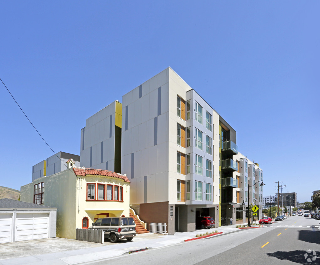
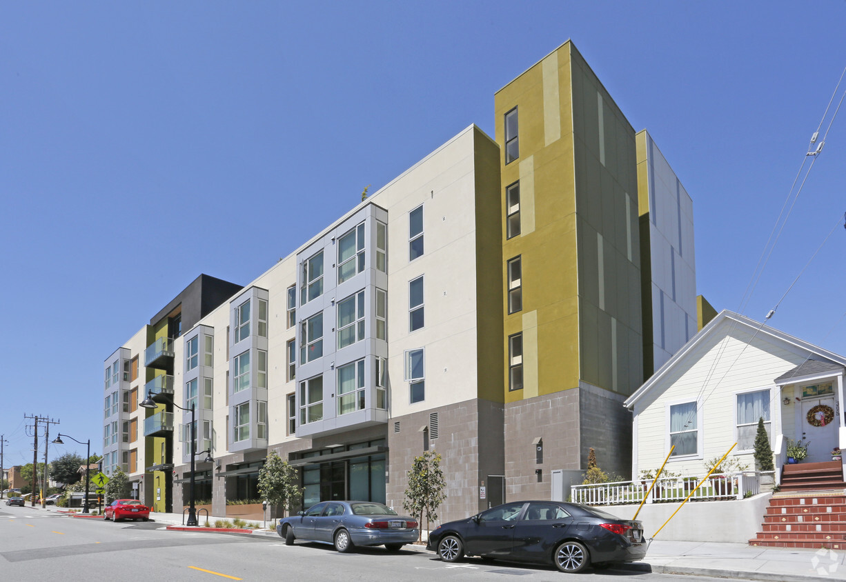
Check out Rotary Terrace in South San Francisco, CA. Located at 310 Miller Ave in South San Francisco, this community is a terrific place to live. At Rotary Terrace, you'll have access to top features and amenities. Some of these include: smoke-free options, convenient on-site parking options, and a state-of-the-art fitness center. The leasing team is eager to show off our wonderful community. It's time to come home to Rotary Terrace. Contact us or stop in to schedule a tour.
Rotary Terrace is an apartment community located in San Mateo County and the 94080 ZIP Code. This area is served by the South San Francisco Unified attendance zone.
Air Conditioning
Refrigerator
Tub/Shower
Heating
Downtown South San Francisco mixes a small-town feel with urban appeal. Walk down Grand Avenue and you’ll find rows of hip boutiques, diverse eateries, and cozy cafes in classic brick buildings. Outside of Grand Avenue, and a stretch of Linden Avenue, Downtown South San Francisco is mostly residential. Renters have their pick of numerous apartments, condos, and houses in the neighborhood.
A host of area parks and trails offer abundant opportunities to enjoy nature without having to sacrifice the convenience of living downtown. The neighborhood is proximate to the Bayshore Freeway, South San Francisco Caltrain Station, and San Francisco International Airport, connecting Downtown South San Francisco to the rest of the Bay Area and beyond.
Learn more about living in Downtown South San Francisco| Colleges & Universities | Distance | ||
|---|---|---|---|
| Colleges & Universities | Distance | ||
| Drive: | 11 min | 5.0 mi | |
| Drive: | 16 min | 8.3 mi | |
| Drive: | 13 min | 9.1 mi | |
| Drive: | 14 min | 9.5 mi |


Transportation options available in South San Francisco include San Bruno Station, located 2.0 miles from Rotary Terrace. Rotary Terrace is near San Francisco International, located 4.2 miles or 10 minutes away, and Metro Oakland International, located 28.7 miles or 42 minutes away.
| Transit / Subway | Distance | ||
|---|---|---|---|
| Transit / Subway | Distance | ||
|
|
Drive: | 5 min | 2.0 mi |
| Drive: | 6 min | 2.1 mi | |
|
|
Drive: | 5 min | 2.3 mi |
|
|
Drive: | 5 min | 2.4 mi |
|
|
Drive: | 6 min | 3.0 mi |
| Commuter Rail | Distance | ||
|---|---|---|---|
| Commuter Rail | Distance | ||
| Walk: | 9 min | 0.5 mi | |
| Drive: | 5 min | 2.3 mi | |
| Drive: | 9 min | 5.2 mi | |
| Drive: | 9 min | 5.5 mi | |
| Drive: | 9 min | 6.2 mi |
| Airports | Distance | ||
|---|---|---|---|
| Airports | Distance | ||
|
San Francisco International
|
Drive: | 10 min | 4.2 mi |
|
Metro Oakland International
|
Drive: | 42 min | 28.7 mi |
Time and distance from Rotary Terrace.
| Shopping Centers | Distance | ||
|---|---|---|---|
| Shopping Centers | Distance | ||
| Drive: | 4 min | 1.6 mi | |
| Drive: | 4 min | 1.6 mi | |
| Drive: | 5 min | 1.8 mi |
| Parks and Recreation | Distance | ||
|---|---|---|---|
| Parks and Recreation | Distance | ||
|
Candlestick Point State Recreation Area
|
Drive: | 13 min | 6.3 mi |
|
Bayside Park
|
Drive: | 9 min | 6.4 mi |
|
San Bruno Mountain State Park
|
Drive: | 17 min | 7.3 mi |
|
Charles F. Hagar Planetarium
|
Drive: | 17 min | 9.0 mi |
|
San Francisco State Univ. Observatory
|
Drive: | 17 min | 9.0 mi |
| Hospitals | Distance | ||
|---|---|---|---|
| Hospitals | Distance | ||
| Drive: | 4 min | 2.0 mi | |
| Drive: | 10 min | 4.7 mi | |
| Drive: | 9 min | 5.4 mi |
| Military Bases | Distance | ||
|---|---|---|---|
| Military Bases | Distance | ||
| Drive: | 29 min | 12.9 mi | |
| Drive: | 39 min | 23.2 mi |
What Are Walk Score®, Transit Score®, and Bike Score® Ratings?
Walk Score® measures the walkability of any address. Transit Score® measures access to public transit. Bike Score® measures the bikeability of any address.
What is a Sound Score Rating?
A Sound Score Rating aggregates noise caused by vehicle traffic, airplane traffic and local sources

310 Miller Ave
South San Francisco, CA 94080


