
Equinox
2808 Silver Ln NE,
Saint Anthony, MN 55421
$1,345 - $1,885 Plus Fees
1-2 Beds 12 Month Lease
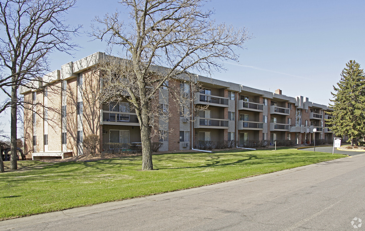
Enjoy a prime location minutes from both Minneapolis and St. Paul with spacious and comfortable floor plans at a great value. Rosetree, located in Roseville just off Highway 36, offers one and two bedroom homes with great amenities including patios and balconies, central air and ample parking. You've found a great place to live at Rosetree! Showings by appointment only.
Rosetree is an apartment community located in Ramsey County and the 55113 ZIP Code. This area is served by the Roseville Public School District attendance zone.
Unique Features
Laundry Facilities
Elevator
Controlled Access
Recycling
Air Conditioning
Dishwasher
High Speed Internet Access
Walk-In Closets
Roseville holds a rare geographic distinction as one of only two Twin Cities suburbs that share borders with both Minneapolis and Saint Paul, making it a natural landing spot for renters who want easy access to two major cities without paying downtown prices. Sitting in Ramsey County across 14 square miles, this city of roughly 36,000 carries a settled, self-sufficient character built around a strong retail corridor, well-maintained parks, and a steady local economy.
The city's layout offers a mix of quiet residential pockets and busier commercial stretches along roads like Snelling Avenue and County Road B. Rosedale Center anchors much of the retail energy, drawing shoppers from across the metro. Every September, the Wild Rice Festival celebrates Minnesota's Indigenous heritage through traditional dancing, storytelling, and food rooted in Ojibwe and Dakota culture.
Learn more about living in Roseville| Colleges & Universities | Distance | ||
|---|---|---|---|
| Colleges & Universities | Distance | ||
| Drive: | 7 min | 3.7 mi | |
| Drive: | 9 min | 4.7 mi | |
| Drive: | 11 min | 5.8 mi | |
| Drive: | 12 min | 7.0 mi |


Transportation options available in Roseville include Western Ave Station, located 4.1 miles from Rosetree. Rosetree is near Minneapolis-St Paul International/Wold-Chamberlain, located 15.7 miles or 25 minutes away.
| Transit / Subway | Distance | ||
|---|---|---|---|
| Transit / Subway | Distance | ||
| Drive: | 8 min | 4.1 mi | |
| Drive: | 9 min | 4.2 mi | |
| Drive: | 9 min | 4.4 mi | |
| Drive: | 10 min | 4.8 mi | |
| Drive: | 11 min | 5.3 mi |
| Commuter Rail | Distance | ||
|---|---|---|---|
| Commuter Rail | Distance | ||
|
|
Drive: | 10 min | 6.3 mi |
|
|
Drive: | 17 min | 9.6 mi |
|
|
Drive: | 17 min | 12.5 mi |
|
|
Drive: | 27 min | 21.0 mi |
|
|
Drive: | 28 min | 22.6 mi |
| Airports | Distance | ||
|---|---|---|---|
| Airports | Distance | ||
|
Minneapolis-St Paul International/Wold-Chamberlain
|
Drive: | 25 min | 15.7 mi |
Scores provided by
Traffic
BusyAirport
CalmBusinesses
ActiveScores provided by
HowLoud What is a Sound Score Rating? A Sound Score Rating aggregates noise caused by vehicle traffic, airplane traffic and local sources. How It WorksTime and distance from Rosetree.
| Shopping Centers | Distance | ||
|---|---|---|---|
| Shopping Centers | Distance | ||
| Walk: | 10 min | 0.6 mi | |
| Drive: | 4 min | 1.4 mi | |
| Drive: | 4 min | 2.1 mi |
| Parks and Recreation | Distance | ||
|---|---|---|---|
| Parks and Recreation | Distance | ||
|
Harriet Alexander Nature Center
|
Walk: | 10 min | 0.5 mi |
|
Como Park Ski Center
|
Drive: | 6 min | 3.2 mi |
|
Como Park
|
Drive: | 8 min | 3.7 mi |
|
Marjorie McNeely Conservatory
|
Drive: | 8 min | 3.8 mi |
|
Como Park Zoo
|
Drive: | 9 min | 3.9 mi |
| Hospitals | Distance | ||
|---|---|---|---|
| Hospitals | Distance | ||
| Drive: | 10 min | 5.0 mi | |
| Drive: | 9 min | 5.8 mi | |
| Drive: | 9 min | 5.9 mi |
| Military Bases | Distance | ||
|---|---|---|---|
| Military Bases | Distance | ||
| Drive: | 23 min | 14.5 mi |
Pets Allowed Fitness Center Pool Dishwasher Refrigerator Clubhouse Maintenance on site
High-Speed Internet Laundry Facilities
Pets Allowed Pool Dishwasher Microwave Granite Countertops
What Are Walk Score®, Transit Score®, and Bike Score® Ratings?
Walk Score® measures the walkability of any address. Transit Score® measures access to public transit. Bike Score® measures the bikeability of any address.
What is a Sound Score Rating?
A Sound Score Rating aggregates noise caused by vehicle traffic, airplane traffic and local sources.

655 Highway 36 W
Roseville, MN 55113


