
Kinect at Southport
2301 Jefferson Blvd,
Sacramento, CA 95691
Studio - 3 Beds $1,775 - $3,059

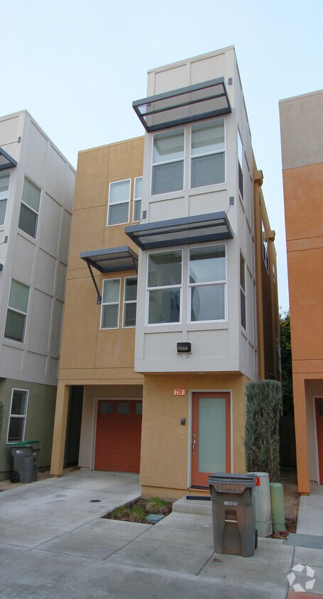
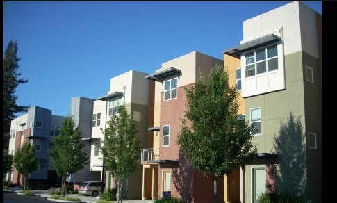
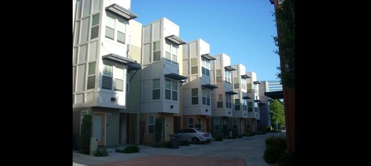

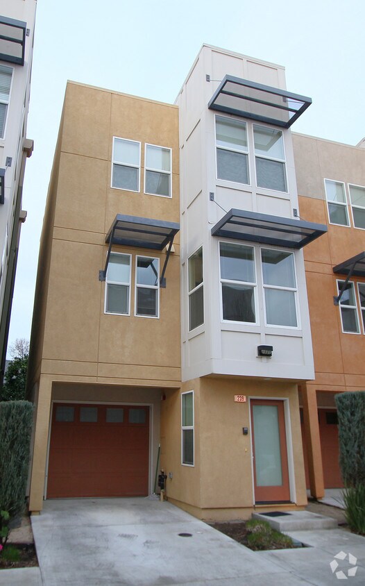
Discover your new apartment at River's Side in West Sacramento, CA. This property is situated at 239-291 McDowell Ln in West Sacramento. From pricing to features, the professional leasing team is available to help you find your perfect new place. Contact us today to see available floor plans and make your move to River's Side.
River's Side is a townhouse community located in Yolo County and the 95605 ZIP Code. This area is served by the Washington Unified attendance zone.
Washer/Dryer
Air Conditioning
High Speed Internet Access
Granite Countertops
West Sacramento enjoys the unique privilege of being a fairly quiet residential community right next door to a thriving metropolis. Separated from the state capital only by the Sacramento River, West Sac (as the locals call it) shares virtually all of Sacramento’s resources, cultural and otherwise. The I Street Bridge and Tower Bridge both feed straight into Sacramento’s historic district and downtown entertainment district. On West Sacramento’s side of the river, one of the biggest attractions is the shopping, but scenic areas like River Walk Park and venues like Raley Field give folks plenty to do in their own neighborhood.
Learn more about living in West Sacramento| Colleges & Universities | Distance | ||
|---|---|---|---|
| Colleges & Universities | Distance | ||
| Drive: | 9 min | 5.2 mi | |
| Drive: | 13 min | 5.7 mi | |
| Drive: | 20 min | 12.0 mi | |
| Drive: | 19 min | 13.0 mi |


Transportation options available in West Sacramento include Sacramento Valley Station, located 0.9 mile from River's Side. River's Side is near Sacramento International, located 11.0 miles or 17 minutes away.
| Transit / Subway | Distance | ||
|---|---|---|---|
| Transit / Subway | Distance | ||
|
|
Walk: | 16 min | 0.9 mi |
|
|
Drive: | 2 min | 1.2 mi |
|
|
Drive: | 3 min | 1.2 mi |
|
|
Drive: | 3 min | 1.3 mi |
|
|
Drive: | 3 min | 1.3 mi |
| Commuter Rail | Distance | ||
|---|---|---|---|
| Commuter Rail | Distance | ||
| Walk: | 14 min | 0.8 mi | |
|
|
Drive: | 17 min | 13.6 mi |
|
|
Drive: | 29 min | 20.6 mi |
|
|
Drive: | 30 min | 22.8 mi |
|
|
Drive: | 43 min | 35.0 mi |
| Airports | Distance | ||
|---|---|---|---|
| Airports | Distance | ||
|
Sacramento International
|
Drive: | 17 min | 11.0 mi |
Time and distance from River's Side.
| Shopping Centers | Distance | ||
|---|---|---|---|
| Shopping Centers | Distance | ||
| Walk: | 16 min | 0.9 mi | |
| Drive: | 3 min | 1.2 mi | |
| Drive: | 7 min | 1.6 mi |
| Parks and Recreation | Distance | ||
|---|---|---|---|
| Parks and Recreation | Distance | ||
|
California State Railroad Museum
|
Walk: | 12 min | 0.6 mi |
|
Old Sacramento Historic District
|
Walk: | 13 min | 0.7 mi |
|
California State Capitol Museum
|
Drive: | 4 min | 1.8 mi |
|
Discovery County Park
|
Drive: | 6 min | 2.7 mi |
|
Natomas Oaks Park
|
Drive: | 6 min | 2.9 mi |
| Hospitals | Distance | ||
|---|---|---|---|
| Hospitals | Distance | ||
| Drive: | 6 min | 2.9 mi | |
| Drive: | 8 min | 3.6 mi | |
| Drive: | 9 min | 5.4 mi |
| Military Bases | Distance | ||
|---|---|---|---|
| Military Bases | Distance | ||
| Drive: | 25 min | 12.4 mi |
What Are Walk Score®, Transit Score®, and Bike Score® Ratings?
Walk Score® measures the walkability of any address. Transit Score® measures access to public transit. Bike Score® measures the bikeability of any address.
What is a Sound Score Rating?
A Sound Score Rating aggregates noise caused by vehicle traffic, airplane traffic and local sources
239-291 McDowell Ln
West Sacramento, CA 95605


