
Azure National Landing
3130 S Potomac Ave,
Arlington, VA 22202
$2,384 - $8,541 Total Monthly Price
Studio - 3 Beds

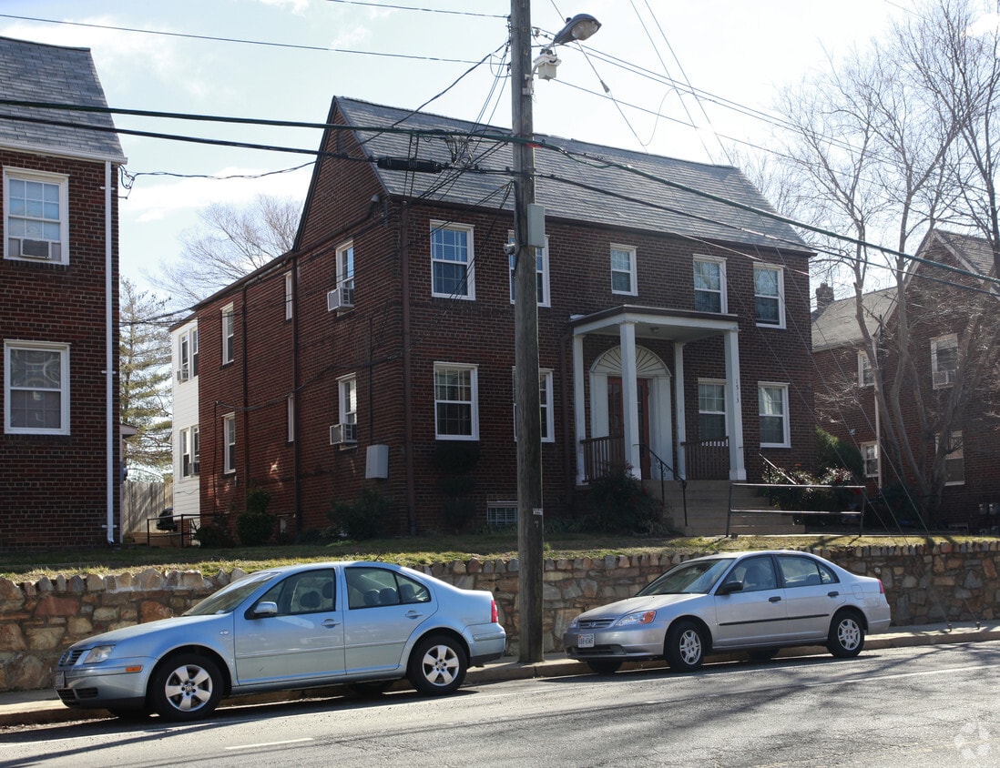

Discover Rhodes Street in Arlington. This community can be found in the 22209 area of Arlington. Schedule a time to check out the apartment floorplan options. From location to floorplan options, the community staff is ready and waiting to help you find the perfect place. Come see Rhodes Street today.
Rhodes Street is an apartment community located in Arlington County and the 22209 ZIP Code. This area is served by the Arlington County Public Schools attendance zone.
Air Conditioning
Dishwasher
Hardwood Floors
Heating
Arlington sits directly across the Potomac River from Washington, D.C., making it one of the most strategically positioned communities in the country. As the smallest self-governing county by area in the United States, it packs an outsized presence into just 27 square miles, anchored by major institutions like the Pentagon, Arlington National Cemetery, and Ronald Reagan Washington National Airport. George Mason University's Arlington campus and Marymount University add strong educational roots, while the defense, government services, and technology sectors form the backbone of the local economy.
The city's distinct neighborhoods give renters real choices in how they want to live. The Rosslyn-Ballston corridor draws those who want high-rise apartment communities with Metro access and walkable streets. Clarendon brings a livelier street-level energy, while Courthouse and Virginia Square offer a calmer pace.
Learn more about living in Arlington| Colleges & Universities | Distance | ||
|---|---|---|---|
| Colleges & Universities | Distance | ||
| Drive: | 5 min | 1.6 mi | |
| Drive: | 6 min | 2.2 mi | |
| Drive: | 5 min | 2.7 mi | |
| Drive: | 8 min | 3.1 mi |


Transportation options available in Arlington include Court House, Orange,Silver Line Center Platform, located 0.6 mile from Rhodes Street. Rhodes Street is near Ronald Reagan Washington Ntl, located 5.4 miles or 10 minutes away, and Washington Dulles International, located 24.8 miles or 40 minutes away.
| Transit / Subway | Distance | ||
|---|---|---|---|
| Transit / Subway | Distance | ||
| Walk: | 10 min | 0.6 mi | |
|
|
Walk: | 14 min | 0.7 mi |
|
|
Drive: | 4 min | 1.6 mi |
|
|
Drive: | 3 min | 1.7 mi |
|
|
Drive: | 5 min | 1.9 mi |
| Commuter Rail | Distance | ||
|---|---|---|---|
| Commuter Rail | Distance | ||
|
|
Drive: | 8 min | 3.8 mi |
|
|
Drive: | 9 min | 4.9 mi |
|
|
Drive: | 10 min | 5.1 mi |
|
|
Drive: | 16 min | 7.8 mi |
|
|
Drive: | 17 min | 7.8 mi |
| Airports | Distance | ||
|---|---|---|---|
| Airports | Distance | ||
|
Ronald Reagan Washington Ntl
|
Drive: | 10 min | 5.4 mi |
|
Washington Dulles International
|
Drive: | 40 min | 24.8 mi |
Scores provided by
Traffic
-Airport
-Businesses
-Scores provided by
HowLoud What is a Sound Score Rating? A Sound Score Rating aggregates noise caused by vehicle traffic, airplane traffic and local sources. How It WorksTime and distance from Rhodes Street.
| Shopping Centers | Distance | ||
|---|---|---|---|
| Shopping Centers | Distance | ||
| Walk: | 6 min | 0.3 mi | |
| Walk: | 17 min | 0.9 mi | |
| Drive: | 4 min | 1.5 mi |
| Parks and Recreation | Distance | ||
|---|---|---|---|
| Parks and Recreation | Distance | ||
|
Fort Bennett Park and Palisades Trail
|
Walk: | 14 min | 0.8 mi |
|
Old Stone House
|
Drive: | 5 min | 1.9 mi |
|
Fort C.F. Smith Park & Historic Site
|
Drive: | 6 min | 2.1 mi |
|
Lincoln Memorial
|
Drive: | 5 min | 2.4 mi |
|
Theodore Roosevelt Island Park
|
Drive: | 6 min | 3.1 mi |
| Hospitals | Distance | ||
|---|---|---|---|
| Hospitals | Distance | ||
| Drive: | 7 min | 2.4 mi | |
| Drive: | 4 min | 2.8 mi | |
| Drive: | 7 min | 2.8 mi |
| Military Bases | Distance | ||
|---|---|---|---|
| Military Bases | Distance | ||
| Drive: | 4 min | 1.8 mi |
Pets Allowed Fitness Center Pool Dishwasher Refrigerator Kitchen

Pets Allowed Fitness Center In Unit Washer & Dryer Balcony Courtyard Concierge EV Charging
Pets Allowed Fitness Center Pool Maintenance on site Stainless Steel Appliances Gated
What Are Walk Score®, Transit Score®, and Bike Score® Ratings?
Walk Score® measures the walkability of any address. Transit Score® measures access to public transit. Bike Score® measures the bikeability of any address.
What is a Sound Score Rating?
A Sound Score Rating aggregates noise caused by vehicle traffic, airplane traffic and local sources.
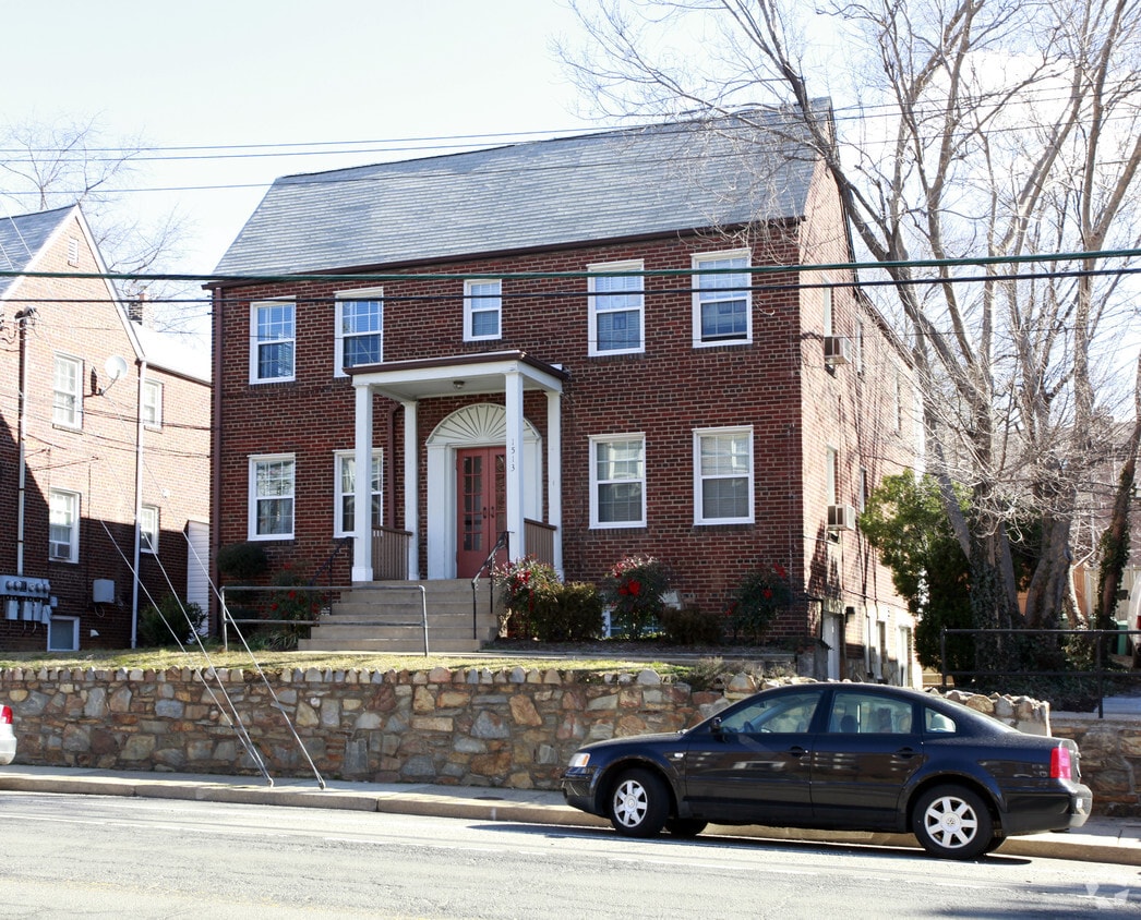
1513 N Rhodes St
Arlington, VA 22209


