
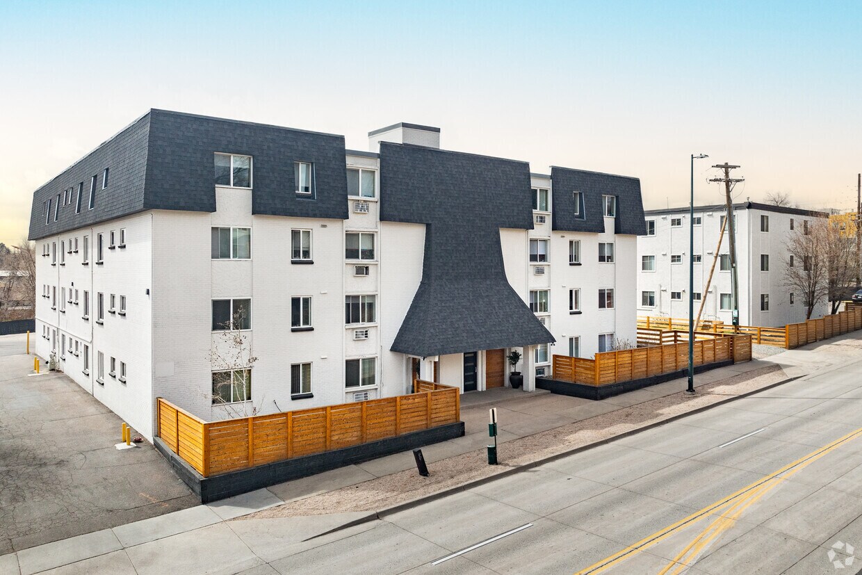
Cortland on Blake
1451 24th St,
Denver, CO 80205
$1,380 - $7,484
Studio - 3 Beds


Welcome to Riverpoint Apartmentsan exceptional fusion of convenience, amenities, and affordability in the heart of Denver. Tailored for those seeking city living without the premium price, our community places you in close proximity to Denver's attractions, shopping, and entertainment, all within a budget-friendly lifestyle that doesn't compromise on comfort or style. Choose from spacious 1 and 2 bedroom units, some recently updated with brand-new appliances and fixtures, and revel in the convenience of free parking. Enjoy secure access to the 1330 building and take advantage of our onsite laundry facilities. Your ideal Denver living space awaits at Riverpoint Apartmentswhere affordability meets excellence!
(PAST) Riverpoint (1330) is an apartment community located in Denver County and the 80223 ZIP Code. This area is served by the Denver County 1 attendance zone.
Air Conditioning
Walk-In Closets
Tub/Shower
Disposal
Ruby Hill is a fairly large neighborhood located just minutes south of downtown Denver, filled with gorgeous natural landmarks. Numerous parks, trails, and the South Platte River provide great areas for enjoying the outdoors, and Ruby Hill Park’s slopes are excellent for sledding in the winter (plus the views of the Denver skyline are unbeatable).
A string of shops and restaurants along Federal Boulevard to the west makes it easy to pick up your groceries or grab a quick bite to eat anytime. Several public schools in the neighborhood and the surrounding area ensure that local students are able to walk to class quickly and safely.
Learn more about living in Ruby Hill| Colleges & Universities | Distance | ||
|---|---|---|---|
| Colleges & Universities | Distance | ||
| Drive: | 6 min | 3.5 mi | |
| Drive: | 9 min | 4.7 mi | |
| Drive: | 9 min | 4.7 mi | |
| Drive: | 9 min | 4.7 mi |


Transportation options available in Denver include I-25-Broadway, located 1.3 miles from (PAST) Riverpoint (1330). (PAST) Riverpoint (1330) is near Denver International, located 29.5 miles or 40 minutes away.
| Transit / Subway | Distance | ||
|---|---|---|---|
| Transit / Subway | Distance | ||
|
|
Drive: | 3 min | 1.3 mi |
|
|
Drive: | 3 min | 1.4 mi |
|
|
Drive: | 4 min | 1.8 mi |
|
|
Drive: | 4 min | 2.2 mi |
|
|
Drive: | 5 min | 2.3 mi |
| Commuter Rail | Distance | ||
|---|---|---|---|
| Commuter Rail | Distance | ||
|
|
Drive: | 10 min | 5.2 mi |
|
|
Drive: | 10 min | 5.5 mi |
| Drive: | 12 min | 7.4 mi | |
| Drive: | 21 min | 7.4 mi | |
| Drive: | 13 min | 7.4 mi |
| Airports | Distance | ||
|---|---|---|---|
| Airports | Distance | ||
|
Denver International
|
Drive: | 40 min | 29.5 mi |
Time and distance from (PAST) Riverpoint (1330).
| Shopping Centers | Distance | ||
|---|---|---|---|
| Shopping Centers | Distance | ||
| Walk: | 9 min | 0.5 mi | |
| Drive: | 2 min | 1.2 mi | |
| Drive: | 4 min | 1.6 mi |
| Parks and Recreation | Distance | ||
|---|---|---|---|
| Parks and Recreation | Distance | ||
|
Washington Park
|
Drive: | 7 min | 2.7 mi |
|
History Colorado Center
|
Drive: | 9 min | 4.1 mi |
|
Chamberlin & Mt. Evans Observatories
|
Drive: | 8 min | 4.1 mi |
|
Denver Botanic Gardens at York St.
|
Drive: | 13 min | 5.1 mi |
|
Civic Center Park
|
Drive: | 10 min | 5.3 mi |
| Hospitals | Distance | ||
|---|---|---|---|
| Hospitals | Distance | ||
| Drive: | 7 min | 2.8 mi | |
| Drive: | 6 min | 3.5 mi | |
| Drive: | 7 min | 4.5 mi |
| Military Bases | Distance | ||
|---|---|---|---|
| Military Bases | Distance | ||
| Drive: | 46 min | 21.7 mi | |
| Drive: | 76 min | 62.6 mi | |
| Drive: | 86 min | 72.2 mi |
What Are Walk Score®, Transit Score®, and Bike Score® Ratings?
Walk Score® measures the walkability of any address. Transit Score® measures access to public transit. Bike Score® measures the bikeability of any address.
What is a Sound Score Rating?
A Sound Score Rating aggregates noise caused by vehicle traffic, airplane traffic and local sources
1330 W Mississippi Ave
Denver, CO 80223


