
Hanover Burlingame
1881 Rollins Rd,
Burlingame, CA 94010
$3,231 - $9,108 Total Monthly Price
Studio - 3 Beds


Discover a new home at Pinedera in Millbrae. The location of this community is on S. El Camino Real in the 94030 area of Millbrae. From amenities to availability, the professional leasing team is ready to help you find your new apartment. Make sure you to see the current floorplan options. Come see Pinedera today.
Pinedera is an apartment community located in San Mateo County and the 94030 ZIP Code. This area is served by the Millbrae Elementary School District attendance zone.
Controlled Access
Gated
24 Hour Access
Property Manager on Site
Air Conditioning
Smoke Free
Double Pane Windows
Heating
Sitting at the northern edge of San Mateo County, Millbrae occupies a compact four square miles between San Francisco International Airport and the foothills of the Peninsula, giving it a geographic specificity that shapes nearly everything about daily life here. The city traces its name to Darius Ogden Mills, who purchased the land in the 1860s and combined his surname with the Scottish word for rolling hills. That history still echoes in the quiet residential streets that run from the bay shoreline up toward the hills, where single-family neighborhoods give way to walkable corridors along El Camino Real.
Millbrae's economy benefits directly from its proximity to SFO and the broader Peninsula job market, making it a practical base for those working across San Mateo County or commuting north to San Francisco. The city covers a tight footprint, so most areas feel accessible and grounded rather than spread out.
Learn more about living in Millbrae| Colleges & Universities | Distance | ||
|---|---|---|---|
| Colleges & Universities | Distance | ||
| Drive: | 13 min | 6.5 mi | |
| Drive: | 14 min | 7.8 mi | |
| Drive: | 19 min | 12.2 mi | |
| Drive: | 19 min | 12.6 mi |


Transportation options available in Millbrae include Millbrae (Caltrain Transfer Platform), located 0.3 mile from Pinedera. Pinedera is near San Francisco International, located 2.9 miles or 7 minutes away, and Metro Oakland International, located 30.5 miles or 39 minutes away.
| Transit / Subway | Distance | ||
|---|---|---|---|
| Transit / Subway | Distance | ||
|
|
Walk: | 5 min | 0.3 mi |
|
|
Drive: | 5 min | 2.3 mi |
| Drive: | 6 min | 2.5 mi | |
| Drive: | 6 min | 2.6 mi | |
| Drive: | 6 min | 2.7 mi |
| Commuter Rail | Distance | ||
|---|---|---|---|
| Commuter Rail | Distance | ||
| Walk: | 4 min | 0.2 mi | |
| Drive: | 4 min | 1.5 mi | |
| Drive: | 5 min | 2.6 mi | |
| Drive: | 5 min | 3.1 mi | |
| Drive: | 8 min | 5.5 mi |
| Airports | Distance | ||
|---|---|---|---|
| Airports | Distance | ||
|
San Francisco International
|
Drive: | 7 min | 2.9 mi |
|
Metro Oakland International
|
Drive: | 39 min | 30.5 mi |
Scores provided by
Traffic
-Airport
-Businesses
-Scores provided by
HowLoud What is a Sound Score Rating? A Sound Score Rating aggregates noise caused by vehicle traffic, airplane traffic and local sources. How It WorksTime and distance from Pinedera.
| Shopping Centers | Distance | ||
|---|---|---|---|
| Shopping Centers | Distance | ||
| Walk: | 3 min | 0.2 mi | |
| Walk: | 6 min | 0.3 mi | |
| Walk: | 11 min | 0.6 mi |
| Parks and Recreation | Distance | ||
|---|---|---|---|
| Parks and Recreation | Distance | ||
|
Bayside Park
|
Drive: | 4 min | 2.5 mi |
|
Japanese Tea Garden (San Mateo)
|
Drive: | 8 min | 4.3 mi |
|
San Mateo Arboretum
|
Drive: | 9 min | 4.7 mi |
|
Coyote Point Recreational Area
|
Drive: | 10 min | 4.8 mi |
|
CuriOdyssey
|
Drive: | 11 min | 4.8 mi |
| Hospitals | Distance | ||
|---|---|---|---|
| Hospitals | Distance | ||
| Walk: | 5 min | 0.3 mi | |
| Drive: | 9 min | 5.3 mi | |
| Drive: | 13 min | 8.8 mi |
| Military Bases | Distance | ||
|---|---|---|---|
| Military Bases | Distance | ||
| Drive: | 32 min | 16.8 mi | |
| Drive: | 44 min | 27.6 mi | |
| Drive: | 44 min | 27.8 mi |
What Are Walk Score®, Transit Score®, and Bike Score® Ratings?
Walk Score® measures the walkability of any address. Transit Score® measures access to public transit. Bike Score® measures the bikeability of any address.
What is a Sound Score Rating?
A Sound Score Rating aggregates noise caused by vehicle traffic, airplane traffic and local sources.
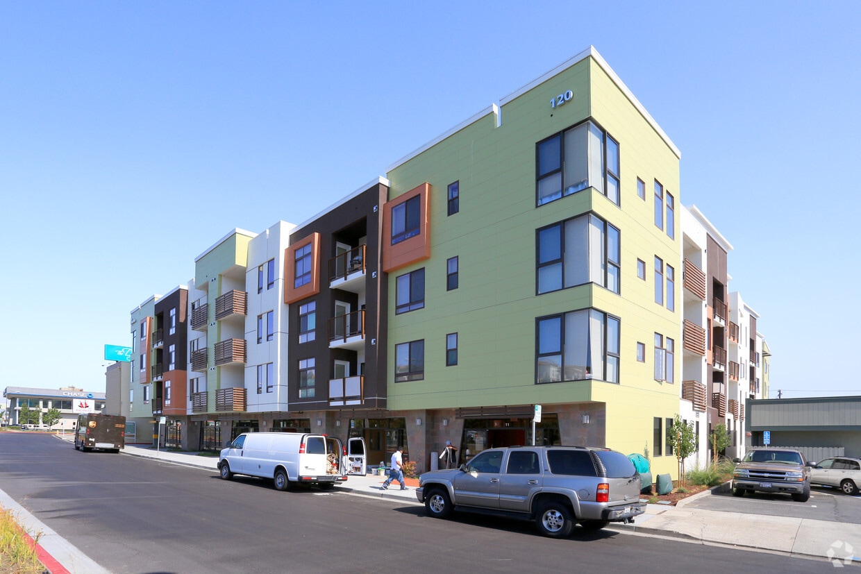
120 S El Camino Real
Millbrae, CA 94030


