
ReNew Howard Crossing
8732 Town and Country Blvd,
Ellicott City, MD 21043
$1,529 - $3,439
1-2 Beds

Bedrooms
1 - 2 bd
Bathrooms
1 - 2 ba
Square Feet
740 - 1,226 sq ft
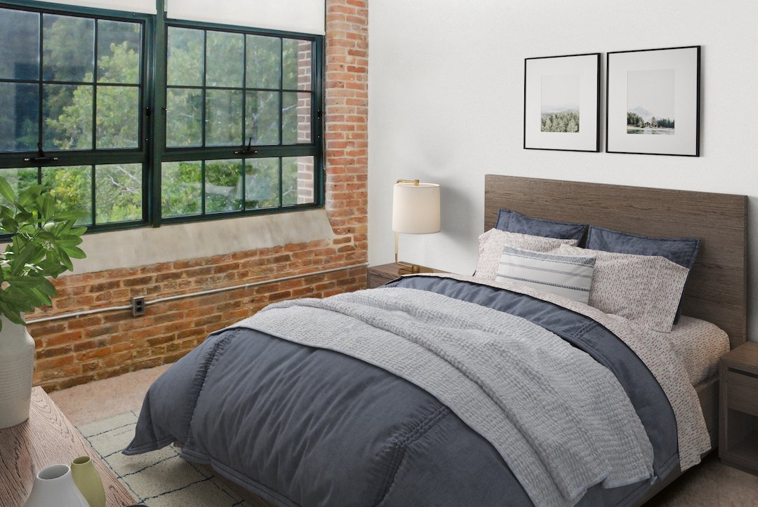
This beautiful 1918 building was once the largest textile mill in the country. This historic structure has been carefully preserved and restored with all the latest features, amenities, materials and finishes that define a modern luxury apartment community. Please visit for additional information and all floor plans.
This beautiful 1918 building was once the largest textile mill in the country. This historic structure has been carefully preserved and restored with all the latest features, amenities, materials and finishes that define a modern luxury apartment community. Please visit for additional information and all floor plans.
Oella Mill is an apartment community located in Baltimore County and the 21043 ZIP Code. This area is served by the Baltimore County Public Schools attendance zone.
Unique Features
Fitness Center
Furnished Units Available
Concierge
Clubhouse
Washer/Dryer
Air Conditioning
Dishwasher
Loft Layout
High Speed Internet Access
Hardwood Floors
Walk-In Closets
Microwave
Ellicott City is the county seat of Howard County, Maryland, and holds a distinction few communities can claim — its historic downtown sits around the oldest surviving railroad station in the United States, built in 1830 as the first terminus of the original B&O Railroad line. Positioned between Baltimore and Washington, D.C., the community blends preserved 18th- and 19th-century architecture with newer residential development that fans out across 31 square miles of rolling Maryland terrain. Fort Meade and BWI Airport are within easy reach, giving the area a steady economic foundation alongside Howard County's well-regarded school system.
Neighborhoods here shift noticeably depending on where you land. The Route 40 corridor offers a lively stretch of international markets and eateries, while the Long Gate area provides a more suburban feel with convenient access to retail and major commuter routes.
Learn more about living in Ellicott City| Colleges & Universities | Distance | ||
|---|---|---|---|
| Colleges & Universities | Distance | ||
| Drive: | 13 min | 4.8 mi | |
| Drive: | 17 min | 5.9 mi | |
| Drive: | 17 min | 8.4 mi | |
| Drive: | 24 min | 9.4 mi |


Transportation options available in Ellicott City include Rogers Avenue, located 8.9 miles from Oella Mill. Oella Mill is near Baltimore/Washington International Thurgood Marshall, located 10.8 miles or 22 minutes away, and Ronald Reagan Washington Ntl, located 35.9 miles or 59 minutes away.
| Transit / Subway | Distance | ||
|---|---|---|---|
| Transit / Subway | Distance | ||
| Drive: | 24 min | 8.9 mi | |
|
|
Drive: | 19 min | 9.4 mi |
| Drive: | 23 min | 10.3 mi | |
| Drive: | 24 min | 10.6 mi | |
| Drive: | 24 min | 11.0 mi |
| Commuter Rail | Distance | ||
|---|---|---|---|
| Commuter Rail | Distance | ||
| Drive: | 18 min | 7.8 mi | |
| Drive: | 17 min | 7.9 mi | |
| Drive: | 17 min | 7.9 mi | |
| Drive: | 19 min | 9.4 mi | |
| Drive: | 19 min | 9.4 mi |
| Airports | Distance | ||
|---|---|---|---|
| Airports | Distance | ||
|
Baltimore/Washington International Thurgood Marshall
|
Drive: | 22 min | 10.8 mi |
|
Ronald Reagan Washington Ntl
|
Drive: | 59 min | 35.9 mi |
Scores provided by
Traffic
CalmAirport
CalmBusinesses
CalmScores provided by
HowLoud What is a Sound Score Rating? A Sound Score Rating aggregates noise caused by vehicle traffic, airplane traffic and local sources. How It WorksTime and distance from Oella Mill.
| Shopping Centers | Distance | ||
|---|---|---|---|
| Shopping Centers | Distance | ||
| Drive: | 7 min | 2.6 mi | |
| Drive: | 10 min | 3.4 mi | |
| Drive: | 10 min | 3.7 mi |
| Parks and Recreation | Distance | ||
|---|---|---|---|
| Parks and Recreation | Distance | ||
|
Benjamin Banneker Historical Park and Museum
|
Drive: | 4 min | 1.1 mi |
|
Banneker Planetarium
|
Drive: | 13 min | 4.8 mi |
|
Carrie Murray Nature Center
|
Drive: | 17 min | 6.7 mi |
|
Gwynns Falls - Leakin Park
|
Drive: | 17 min | 6.8 mi |
|
Mt Pleasant - Howard County Conservancy
|
Drive: | 16 min | 8.0 mi |
| Hospitals | Distance | ||
|---|---|---|---|
| Hospitals | Distance | ||
| Drive: | 12 min | 4.5 mi | |
| Drive: | 16 min | 6.4 mi | |
| Drive: | 18 min | 8.1 mi |
| Military Bases | Distance | ||
|---|---|---|---|
| Military Bases | Distance | ||
| Drive: | 32 min | 16.2 mi | |
| Drive: | 46 min | 29.1 mi | |
| Drive: | 53 min | 32.5 mi |

Pets Allowed Fitness Center Pool Dishwasher In Unit Washer & Dryer
What Are Walk Score®, Transit Score®, and Bike Score® Ratings?
Walk Score® measures the walkability of any address. Transit Score® measures access to public transit. Bike Score® measures the bikeability of any address.
What is a Sound Score Rating?
A Sound Score Rating aggregates noise caused by vehicle traffic, airplane traffic and local sources.
840 Oella Ave
Ellicott City, MD 21043


