
The Juniper
1081 Juniper St NE,
Atlanta, GA 30309
$1,925 - $18,935
Studio - 3 Beds


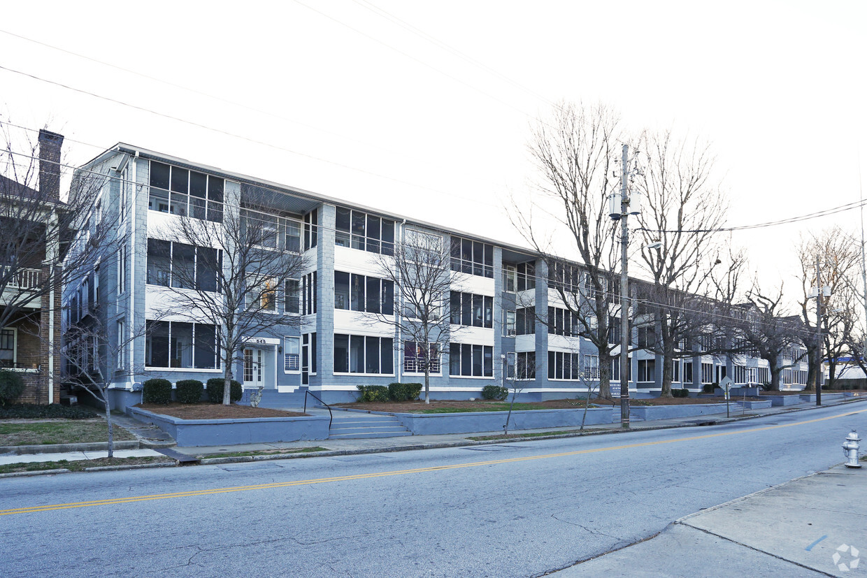
North High Ridge Apartments in Atlanta, GA is ready for you to move in. This apartment community is located at 1088 N. Avenue in the 30307 area of Atlanta. Make sure you to see the current floorplan options. This community offers a variety of features and amenities. These include: hardwood floors, washers and dryers, and high-speed internet access. Come see North High Ridge Apartments today.
North High Ridge Apartments is an apartment community located in Fulton County and the 30307 ZIP Code. This area is served by the Atlanta Public Schools attendance zone.
Controlled Access
Pet Play Area
Property Manager on Site
Renters Insurance Program
Washer/Dryer
Air Conditioning
Dishwasher
High Speed Internet Access
Poncey-Highland is one of Atlanta’s trendiest neighborhoods revered for its central location and abundant amenities. The neighborhood received its name for its proximity to the intersection of Ponce de Leon and North Highland Avenues during the 1970s. Today, Poncey-Highland is encircled by several equally popular neighborhoods: the historic Old Fourth Ward, Virginia-Highland, Inman Park, and Little Five Points. The neighborhood is also just two miles from Downtown Atlanta, which is home to some of the city’s most popular destinations including Centennial Park, Mercedes Benz Stadium, World of Coke, and more.
Poncey-Highland residents have easy access to a plethora of shopping and dining options like Ponce City Market, a historic factory building that has been transformed into a mixed-use hub housing a food hall, shops, and vibrant rooftop with a bar, carnival-style rides, mini-golf, and more.
Learn more about living in Poncey-HighlandCompare neighborhood and city base rent averages by bedroom.
| Poncey-Highland | Atlanta, GA | |
|---|---|---|
| Studio | $1,317 | $1,497 |
| 1 Bedroom | $1,704 | $1,623 |
| 2 Bedrooms | $2,723 | $1,923 |
| 3 Bedrooms | $3,806 | $2,238 |
| Colleges & Universities | Distance | ||
|---|---|---|---|
| Colleges & Universities | Distance | ||
| Drive: | 5 min | 1.7 mi | |
| Drive: | 6 min | 3.0 mi | |
| Drive: | 9 min | 3.4 mi | |
| Drive: | 9 min | 3.4 mi |


Transportation options available in Atlanta include Inman Park/Reynoldstown, located 1.2 miles from North High Ridge Apartments. North High Ridge Apartments is near Hartsfield - Jackson Atlanta International, located 12.1 miles or 20 minutes away.
| Transit / Subway | Distance | ||
|---|---|---|---|
| Transit / Subway | Distance | ||
|
|
Drive: | 3 min | 1.2 mi |
|
|
Drive: | 3 min | 1.4 mi |
|
|
Drive: | 4 min | 2.2 mi |
|
|
Drive: | 4 min | 2.3 mi |
|
|
Drive: | 5 min | 2.4 mi |
| Commuter Rail | Distance | ||
|---|---|---|---|
| Commuter Rail | Distance | ||
|
|
Drive: | 9 min | 4.8 mi |
| Airports | Distance | ||
|---|---|---|---|
| Airports | Distance | ||
|
Hartsfield - Jackson Atlanta International
|
Drive: | 20 min | 12.1 mi |
Scores provided by
Traffic
-Airport
-Businesses
-Scores provided by
HowLoud What is a Sound Score Rating? A Sound Score Rating aggregates noise caused by vehicle traffic, airplane traffic and local sources. How It WorksTime and distance from North High Ridge Apartments.
| Shopping Centers | Distance | ||
|---|---|---|---|
| Shopping Centers | Distance | ||
| Walk: | 2 min | 0.1 mi | |
| Walk: | 3 min | 0.2 mi | |
| Walk: | 9 min | 0.5 mi |
| Parks and Recreation | Distance | ||
|---|---|---|---|
| Parks and Recreation | Distance | ||
|
Freedom Park Bird and Butterfly Garden
|
Walk: | 15 min | 0.8 mi |
|
Fernbank Museum of Natural History
|
Drive: | 5 min | 1.7 mi |
|
Trees Atlanta TreeHouse
|
Drive: | 4 min | 1.7 mi |
|
Atlanta BeltLine Eastside Trail
|
Drive: | 4 min | 1.9 mi |
|
Trees Atlanta
|
Drive: | 6 min | 2.5 mi |
| Hospitals | Distance | ||
|---|---|---|---|
| Hospitals | Distance | ||
| Drive: | 3 min | 1.6 mi | |
| Drive: | 4 min | 2.1 mi | |
| Drive: | 6 min | 3.1 mi |
| Military Bases | Distance | ||
|---|---|---|---|
| Military Bases | Distance | ||
| Drive: | 15 min | 7.7 mi | |
| Drive: | 24 min | 11.9 mi |
What Are Walk Score®, Transit Score®, and Bike Score® Ratings?
Walk Score® measures the walkability of any address. Transit Score® measures access to public transit. Bike Score® measures the bikeability of any address.
What is a Sound Score Rating?
A Sound Score Rating aggregates noise caused by vehicle traffic, airplane traffic and local sources.
1088 N Avenue
Atlanta, GA 30307


