
Envy by Gomes
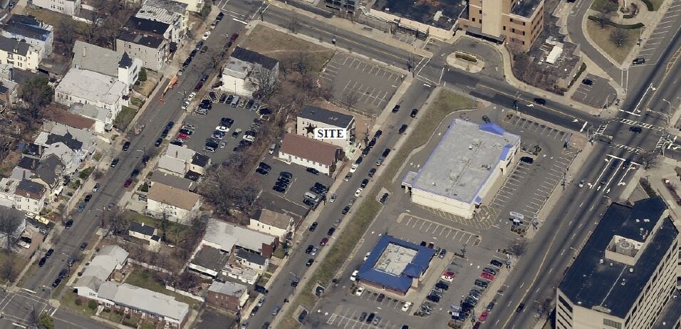
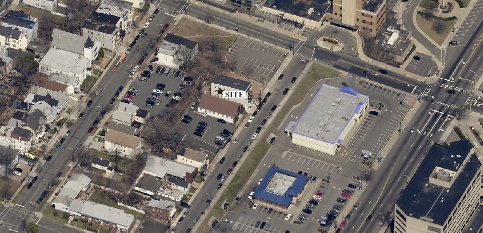
58-84 Norfolk St,
Newark, NJ 07103
$2,000 - $2,815
1-2 Beds

Newark-University Heights Multifamily is an apartment community located in Essex County and the 07103 ZIP Code. This area is served by the The Newark Public attendance zone.
The Fairmount neighborhood lies on the upper west side of Newark, tucked between University Heights and Lower Vailsburg. Fairmount is an urban locality made up of multifamily homes as well as the Holy Sepulcher Cemetery and Fairmount — a 150-acre Victorian resting ground with guided tours of mausoleums. The Fairmount community has many local restaurants and boutiques within a 10-minute drive. It's also a short drive to higher-education institutions and a bustling downtown area with retail and recreational options.
There’s a variety of apartments and townhomes here, all set within a convenient, walkable grid that makes it easy to explore the rest of the surrounding area. The Essex Freeway forms the northern border, making it easy to commute as well.
Learn more about living in Fairmount| Colleges & Universities | Distance | ||
|---|---|---|---|
| Colleges & Universities | Distance | ||
| Walk: | 15 min | 0.8 mi | |
| Walk: | 17 min | 0.9 mi | |
| Drive: | 2 min | 1.3 mi | |
| Drive: | 8 min | 3.2 mi |


Transportation options available in Newark include Norfolk Street, located 0.8 mile from Newark-University Heights Multifamily. Newark-University Heights Multifamily is near Newark Liberty International, located 6.3 miles or 11 minutes away, and LaGuardia, located 28.0 miles or 42 minutes away.
| Transit / Subway | Distance | ||
|---|---|---|---|
| Transit / Subway | Distance | ||
|
|
Walk: | 14 min | 0.8 mi |
|
|
Walk: | 15 min | 0.8 mi |
|
|
Walk: | 16 min | 0.8 mi |
|
|
Drive: | 2 min | 1.2 mi |
|
|
Drive: | 3 min | 1.5 mi |
| Commuter Rail | Distance | ||
|---|---|---|---|
| Commuter Rail | Distance | ||
|
|
Drive: | 3 min | 1.5 mi |
|
|
Drive: | 3 min | 1.7 mi |
|
|
Drive: | 3 min | 2.0 mi |
|
|
Drive: | 4 min | 2.5 mi |
|
|
Drive: | 5 min | 2.9 mi |
| Airports | Distance | ||
|---|---|---|---|
| Airports | Distance | ||
|
Newark Liberty International
|
Drive: | 11 min | 6.3 mi |
|
LaGuardia
|
Drive: | 42 min | 28.0 mi |
Time and distance from Newark-University Heights Multifamily.
| Shopping Centers | Distance | ||
|---|---|---|---|
| Shopping Centers | Distance | ||
| Walk: | 6 min | 0.3 mi | |
| Walk: | 14 min | 0.8 mi | |
| Walk: | 19 min | 1.0 mi |
| Parks and Recreation | Distance | ||
|---|---|---|---|
| Parks and Recreation | Distance | ||
|
Newark Museum and Dreyfuss Planetarium
|
Drive: | 3 min | 1.4 mi |
|
Branch Brook Park
|
Drive: | 6 min | 2.5 mi |
|
Kearny Marsh
|
Drive: | 9 min | 4.5 mi |
|
Edison National Historic Site
|
Drive: | 9 min | 4.7 mi |
|
Richard W. DeKorte Park
|
Drive: | 14 min | 7.3 mi |
| Hospitals | Distance | ||
|---|---|---|---|
| Hospitals | Distance | ||
| Walk: | 3 min | 0.2 mi | |
| Drive: | 2 min | 1.2 mi | |
| Drive: | 3 min | 1.7 mi |
| Military Bases | Distance | ||
|---|---|---|---|
| Military Bases | Distance | ||
| Drive: | 16 min | 10.2 mi | |
| Drive: | 27 min | 13.7 mi | |
| Drive: | 32 min | 18.1 mi |
What Are Walk Score®, Transit Score®, and Bike Score® Ratings?
Walk Score® measures the walkability of any address. Transit Score® measures access to public transit. Bike Score® measures the bikeability of any address.
What is a Sound Score Rating?
A Sound Score Rating aggregates noise caused by vehicle traffic, airplane traffic and local sources
101 Camden St
Newark, NJ 07103


