
Eagle Rock Apartments
1052 Redwood Hwy,
Mill Valley, CA 94941
$1,995 - $2,395
Studio - 1 Bed

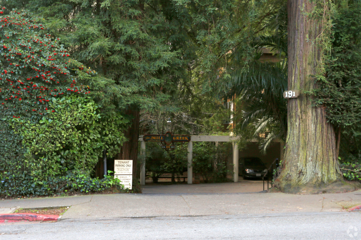
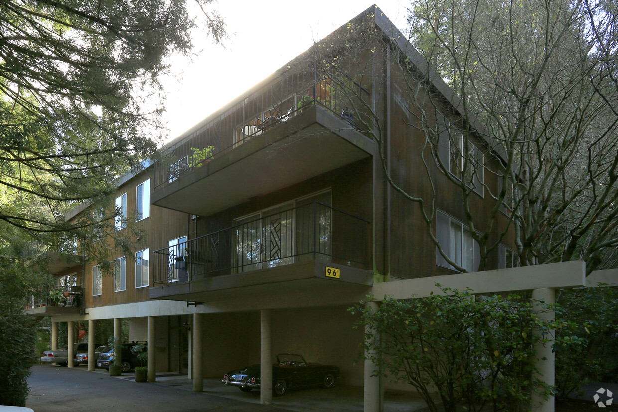
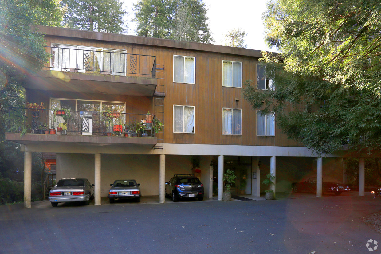

Find your home at Mill Creek Apartments in Mill Valley, CA. Situated in Mill Valley's 94941 Zip code, moving here gives you a variety of nearby highlights to enjoy. The professional leasing staff will be ready to help you find the perfect fit. Make a visit to view the available floorplans. Drop by Mill Creek Apartments today.
Mill Creek Apartments is an apartment community located in Marin County and the 94941 ZIP Code. This area is served by the Mill Valley Elementary attendance zone.
Dishwasher
High Speed Internet Access
Refrigerator
Tub/Shower
If you drive out of San Francisco, across the Golden Gate Bridge, and past the majestic mountains along the Redwood Highway, in about 14 miles you'll reach Mill Valley. Situated in the shadow of Mount Tamalpais, Mill Valley is a picture-perfect city offering gorgeous views, art galleries, and exciting festivals and community events. If you want an apartment in Mill Valley, be aware that while it was named one of the top 100 cities in which to live by Money Magazine, it was also listed as one of the "most expensive zip codes in America" by Forbes.
Mill Valley's adorable downtown provides terrific shops, art galleries, boutiques, and restaurants, mainly along Miller Avenue and Throckmorton Avenue. When residents aren't enjoying the downtown area, they're enjoying the numerous parks and hiking trails -- including the famous Dipsea Trail, a challenging seven-mile trail that begins with a steep staircase located in Old Mill Park, a scenic park located along a creek in a grove of redwoods.
Learn more about living in Mill Valley| Colleges & Universities | Distance | ||
|---|---|---|---|
| Colleges & Universities | Distance | ||
| Drive: | 15 min | 8.5 mi | |
| Drive: | 21 min | 12.7 mi | |
| Drive: | 23 min | 13.0 mi | |
| Drive: | 26 min | 14.4 mi |


Transportation options available in Mill Valley include Hyde And Bay, located 13.1 miles from Mill Creek Apartments. Mill Creek Apartments is near San Francisco International, located 27.6 miles or 45 minutes away, and Metro Oakland International, located 35.3 miles or 49 minutes away.
| Transit / Subway | Distance | ||
|---|---|---|---|
| Transit / Subway | Distance | ||
|
|
Drive: | 23 min | 13.1 mi |
|
|
Drive: | 23 min | 13.2 mi |
|
|
Drive: | 23 min | 13.2 mi |
|
|
Drive: | 24 min | 13.5 mi |
|
|
Drive: | 24 min | 13.6 mi |
| Commuter Rail | Distance | ||
|---|---|---|---|
| Commuter Rail | Distance | ||
| Drive: | 11 min | 5.8 mi | |
| Drive: | 12 min | 7.7 mi | |
| Drive: | 16 min | 11.1 mi | |
| Drive: | 22 min | 14.5 mi | |
| Drive: | 24 min | 15.4 mi |
| Airports | Distance | ||
|---|---|---|---|
| Airports | Distance | ||
|
San Francisco International
|
Drive: | 45 min | 27.6 mi |
|
Metro Oakland International
|
Drive: | 49 min | 35.3 mi |
Time and distance from Mill Creek Apartments.
| Shopping Centers | Distance | ||
|---|---|---|---|
| Shopping Centers | Distance | ||
| Walk: | 3 min | 0.2 mi | |
| Drive: | 3 min | 1.3 mi | |
| Drive: | 3 min | 1.6 mi |
| Parks and Recreation | Distance | ||
|---|---|---|---|
| Parks and Recreation | Distance | ||
|
Muir Woods National Monument
|
Drive: | 9 min | 3.0 mi |
|
Friends of Mt. Tam
|
Drive: | 8 min | 3.0 mi |
|
Richardson Bay Audubon Center
|
Drive: | 7 min | 3.4 mi |
|
Baltimore Canyon Open Space
|
Drive: | 17 min | 5.6 mi |
|
Mount Tamalpais State Park
|
Drive: | 26 min | 8.0 mi |
| Hospitals | Distance | ||
|---|---|---|---|
| Hospitals | Distance | ||
| Drive: | 13 min | 7.1 mi | |
| Drive: | 19 min | 11.4 mi |
| Military Bases | Distance | ||
|---|---|---|---|
| Military Bases | Distance | ||
| Drive: | 23 min | 12.6 mi | |
| Drive: | 24 min | 12.9 mi | |
| Drive: | 37 min | 19.6 mi |
What Are Walk Score®, Transit Score®, and Bike Score® Ratings?
Walk Score® measures the walkability of any address. Transit Score® measures access to public transit. Bike Score® measures the bikeability of any address.
What is a Sound Score Rating?
A Sound Score Rating aggregates noise caused by vehicle traffic, airplane traffic and local sources
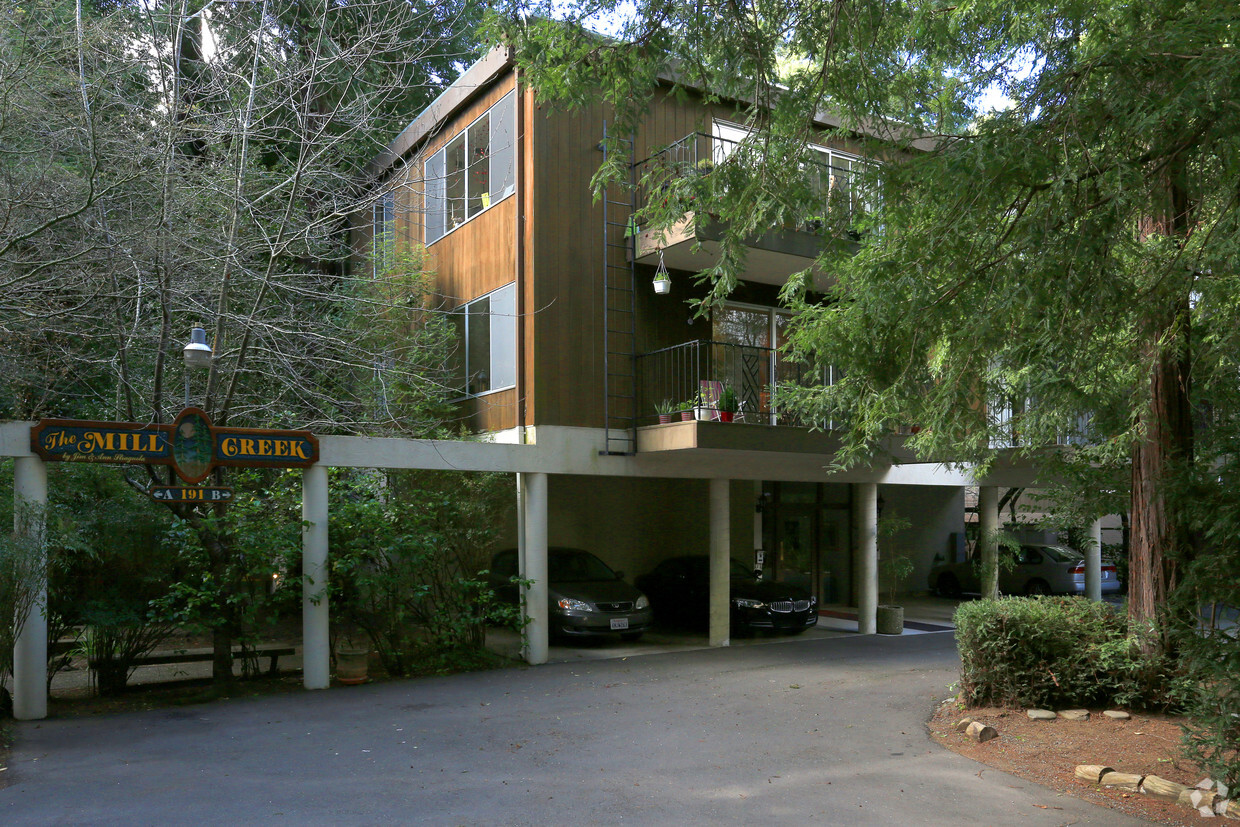
191 Throckmorton Ave
Mill Valley, CA 94941


