
Isle House
39 Bruton St,
San Francisco, CA 94130
$3,050 - $6,745
Studio - 3 Beds
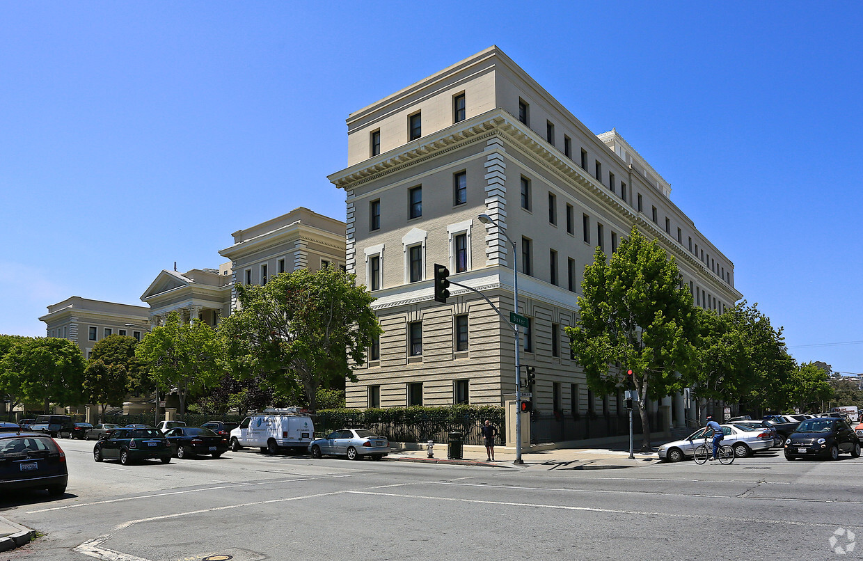
Combining the goals of historic preservation and affordable housing, four buildings of the former Southern Pacific Railroad/Harkness Hospital complex were renovated as 36 units of low-income family housing. Mercy Family Plaza consists of the former Huntington Social Hall, Nurses Annex, Power House, and utility building. The Huntington Social Hall, a two-story structure, was converted into four 3-bedroom apartments around the original terrazzo and tile entry stairs. The Nurses Annex was reconfigured to accommodate 24 of the project's 36 residential units, and the bridge was converted into an airy laundry room. The Power House was converted into eight two-story units. The fourth building, a small, one-story utility building adjacent to the Nurses Annex, was converted for use as a recreation room. There are 42 parking space available. 1 Studio, 1 One-bedroom and 1 Two-bedroom Affordable Rental Units are available at 1509-1599 Hayes Street. Rents range from $1,966-$2,753 per month. Households must earn less than the maximum income levels below: Area Median Income – 80% HCD 1 person - $109,700; 2 persons - $125,350; 3 persons - $141,000; 4 persons - $156,650; 5 persons - $169,200; 6 persons - $181,750; 7 persons - $194,250 Applications information found on DAHLIA at the San Francisco Housing Portal. Applications due by 5pm on 03/20/2025. To apply, please click on Property Website link. Units available through the San Francisco Mayor’s Office of Housing and Community Development and are subject to monitoring and other restrictions.
Mercy Family Plaza is an apartment community located in San Francisco County and the 94117 ZIP Code. This area is served by the San Francisco Unified attendance zone.
Laundry Facilities
Elevator
Controlled Access
Recycling
High Speed Internet Access
Granite Countertops
Refrigerator
Tub/Shower
Rent your apartment in the Panhandle neighborhood and enjoy San Francisco's Golden Gate Park any time you want. The neighborhood is only a block wide for much of its 10-block length, so most neighborhood rentals are within steps of Golden Gate Park's panhandle and the trails leading into the heart of that famous open space.
Find your neighbors at a picnic area in the panhandle or at a number of attractions at Golden Gate Park, such as the tranquil Japanese Gardens, the zoo, or the California Academy of Sciences. Explore the park's Spreckels Lake, where model boat lovers launch their creations. Head to the western edge of the park and find Ocean Beach roughly four miles away.
You'll find Tony's Cable Car Restaurant, a local burger hangout complete with old-style neon signs, less than a mile from the panhandle. The closest shopping malls include the Westfield San Francisco Centre and the Potrero Center, both about three miles east.
Learn more about living in Panhandle| Colleges & Universities | Distance | ||
|---|---|---|---|
| Colleges & Universities | Distance | ||
| Walk: | 15 min | 0.8 mi | |
| Walk: | 20 min | 1.1 mi | |
| Drive: | 7 min | 2.2 mi | |
| Drive: | 8 min | 2.6 mi |


Transportation options available in San Francisco include Duboce And Noe, located 0.7 mile from Mercy Family Plaza. Mercy Family Plaza is near San Francisco International, located 14.5 miles or 24 minutes away, and Metro Oakland International, located 22.0 miles or 34 minutes away.
| Transit / Subway | Distance | ||
|---|---|---|---|
| Transit / Subway | Distance | ||
|
|
Walk: | 14 min | 0.7 mi |
|
|
Walk: | 18 min | 0.9 mi |
| Walk: | 18 min | 1.0 mi | |
|
|
Walk: | 19 min | 1.0 mi |
|
|
Drive: | 4 min | 1.2 mi |
| Commuter Rail | Distance | ||
|---|---|---|---|
| Commuter Rail | Distance | ||
| Drive: | 7 min | 3.6 mi | |
| Drive: | 7 min | 3.6 mi | |
| Drive: | 9 min | 4.4 mi | |
| Drive: | 9 min | 4.4 mi | |
| Drive: | 13 min | 6.6 mi |
| Airports | Distance | ||
|---|---|---|---|
| Airports | Distance | ||
|
San Francisco International
|
Drive: | 24 min | 14.5 mi |
|
Metro Oakland International
|
Drive: | 34 min | 22.0 mi |
Time and distance from Mercy Family Plaza.
| Shopping Centers | Distance | ||
|---|---|---|---|
| Shopping Centers | Distance | ||
| Walk: | 14 min | 0.8 mi | |
| Walk: | 21 min | 1.1 mi | |
| Drive: | 4 min | 1.4 mi |
| Parks and Recreation | Distance | ||
|---|---|---|---|
| Parks and Recreation | Distance | ||
|
Buena Vista Park
|
Walk: | 10 min | 0.5 mi |
|
Conservatory of Flowers
|
Walk: | 18 min | 1.0 mi |
|
Randall Museum
|
Walk: | 19 min | 1.0 mi |
|
California Academy of Sciences
|
Drive: | 6 min | 1.8 mi |
|
Steinhart Aquarium
|
Drive: | 6 min | 1.8 mi |
| Hospitals | Distance | ||
|---|---|---|---|
| Hospitals | Distance | ||
| Walk: | 13 min | 0.7 mi | |
| Walk: | 14 min | 0.7 mi | |
| Walk: | 14 min | 0.8 mi |
| Military Bases | Distance | ||
|---|---|---|---|
| Military Bases | Distance | ||
| Drive: | 12 min | 4.1 mi | |
| Drive: | 12 min | 4.7 mi | |
| Drive: | 17 min | 8.1 mi |
What Are Walk Score®, Transit Score®, and Bike Score® Ratings?
Walk Score® measures the walkability of any address. Transit Score® measures access to public transit. Bike Score® measures the bikeability of any address.
What is a Sound Score Rating?
A Sound Score Rating aggregates noise caused by vehicle traffic, airplane traffic and local sources

1509 Hayes St
San Francisco, CA 94117


