$2,500
/ Month
100 McLean Ave
Yonkers, NY 10705
Favorites
McLean avenue

Favorites
Check Back Soon for Upcoming Availability
| Beds | Baths | Average SF |
|---|---|---|
| 3 Bedrooms 3 Bedrooms 3 Br | 1 Bath 1 Bath 1 Ba | — |
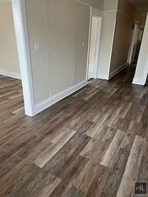
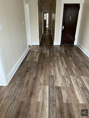
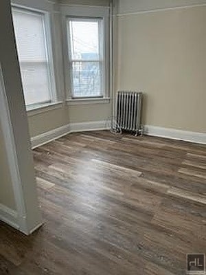
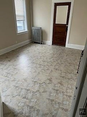
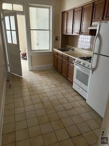
About This Property
Description coming soon, please contact your Highline Residential agent for more information===Ref:1734097===
McLean avenue is an apartment community located in Westchester County and the 10705 ZIP Code.
100 McLean Ave,
Yonkers,
NY
10705
Appropriately named, Park Hill rests on a bluff overlooking the Hudson River and has several parks. The neighborhood is also located between Van Cortlandt Park and Tibbets Brook Park. This charming locale is known for its scenic views and quaint houses in a variety of styles including Victorians, Tudor-style, and Queen Annes, but there are apartments, condos, and townhomes available for rent as well. Along with restaurants, grocers, and stores along South Broadway, Park Hill is located directly south of Getty Square, the city’s downtown district. For even more shopping, dining, and entertainment options, residents can travel into New York’s boroughs via Route 9 or the Saw Mill River Parkway. There are also several bus stops in Park Hill and a train station is just a few blocks away.
Learn more about living in Park HillBelow are rent ranges for similar nearby apartments
Education
| Colleges & Universities | Distance | ||
|---|---|---|---|
| Colleges & Universities | Distance | ||
| Drive: | 4 min | 2.3 mi | |
| Drive: | 7 min | 3.9 mi | |
| Drive: | 9 min | 4.4 mi | |
| Drive: | 9 min | 5.0 mi |
McLean avenue is within 4 minutes or 2.3 miles from Manhattan College. It is also near Sarah Lawrence College and Lehman College.
Transportation options available in Yonkers include Van Cortlandt Park-242 Street, located 2.2 miles from McLean avenue. McLean avenue is near LaGuardia, located 15.1 miles or 26 minutes away, and Westchester County, located 22.3 miles or 31 minutes away.
| Transit / Subway | Distance | ||
|---|---|---|---|
| Transit / Subway | Distance | ||
|
|
Drive: | 4 min | 2.2 mi |
|
|
Drive: | 5 min | 2.6 mi |
|
|
Drive: | 7 min | 3.0 mi |
|
|
Drive: | 8 min | 3.4 mi |
|
|
Drive: | 5 min | 3.6 mi |
| Commuter Rail | Distance | ||
|---|---|---|---|
| Commuter Rail | Distance | ||
|
|
Walk: | 18 min | 0.9 mi |
|
|
Drive: | 3 min | 1.7 mi |
|
|
Drive: | 6 min | 2.5 mi |
|
|
Drive: | 7 min | 3.0 mi |
|
|
Drive: | 9 min | 4.7 mi |
| Airports | Distance | ||
|---|---|---|---|
| Airports | Distance | ||
|
LaGuardia
|
Drive: | 26 min | 15.1 mi |
|
Westchester County
|
Drive: | 31 min | 22.3 mi |
Walkability Near McLean avenue
Getting Around
 What do Walkability, Transit, Drivability, and Bikeability mean?
Walkability measures the walking distance to day-to-day needs.
Transit measures access to public transportation.
Drivability measures congestion, parking availability, and access to major roads.
Bikeability measures the suitability for cycling.
How It Works
What do Walkability, Transit, Drivability, and Bikeability mean?
Walkability measures the walking distance to day-to-day needs.
Transit measures access to public transportation.
Drivability measures congestion, parking availability, and access to major roads.
Bikeability measures the suitability for cycling.
How It Works
Very Walkable
Walkability
80
/ 100
Strong Public Transit
Transit
80
/ 100
Moderately Drivable
Drivability
70
/ 100
Moderately Bikeable
Bikeability
60
/ 100
Scores provided by
Active
Soundscore™
71
/ 100
Traffic
ActiveAirport
CalmBusinesses
BusyScores provided by
HowLoud What is a Sound Score Rating? A Sound Score Rating aggregates noise caused by vehicle traffic, airplane traffic and local sources. How It WorksTime and distance from McLean avenue.
| Shopping Centers | Distance | ||
|---|---|---|---|
| Shopping Centers | Distance | ||
| Walk: | 3 min | 0.2 mi | |
| Drive: | 3 min | 1.5 mi | |
| Drive: | 4 min | 1.6 mi |
McLean avenue has 3 shopping centers within 1.6 miles, which is about a 4-minute drive. The miles and minutes will be for the farthest away property.
| Parks and Recreation | Distance | ||
|---|---|---|---|
| Parks and Recreation | Distance | ||
|
Beczak Environmental Education Center
|
Drive: | 4 min | 1.8 mi |
|
Wave Hill
|
Drive: | 6 min | 2.5 mi |
|
Hudson River Museum
|
Drive: | 5 min | 2.8 mi |
|
Riverdale Park
|
Drive: | 6 min | 2.8 mi |
|
Van Cortlandt Park
|
Drive: | 5 min | 4.0 mi |
McLean avenue has 5 parks within 4.0 miles, including Beczak Environmental Education Center, Van Cortlandt Park, and Wave Hill.
| Hospitals | Distance | ||
|---|---|---|---|
| Hospitals | Distance | ||
| Walk: | 18 min | 0.9 mi | |
| Drive: | 6 min | 3.7 mi | |
| Drive: | 6 min | 3.8 mi |
McLean avenue has 3 hospitals within 3.8 miles, the nearest is St. Joseph's Medical Center which is 0.9 mile away and a 18 minute walk.
| Military Bases | Distance | ||
|---|---|---|---|
| Military Bases | Distance | ||
| Drive: | 26 min | 14.2 mi | |
| Drive: | 35 min | 18.1 mi | |
| Drive: | 42 min | 27.6 mi |
McLean avenue has 3 military bases within 27.6 miles, the nearest is Fort Totten US Govt Reservation which is 14.2 miles away and a 26 minute drive.
You May Also Like
-
Allure @ Harbor Point
850 Pacific St
Stamford, CT 06902
$6,995 Total Monthly Price
3 Br 20.1 mi
-
121 Towne Apartments
121 Towne St
Stamford, CT 06902
$4,200 - $5,000 Total Monthly Price
3 Br 20.6 mi
-
The Wescott Apartments
1450 Washington Blvd
Stamford, CT 06902
$4,275 - $4,575 Total Monthly Price
3 Br 20.6 mi
Similar Rentals Nearby
-
-
-
-
-
-
-
1 / 15
 3 Beds$7,027+Total Monthly PriceTotal Monthly Price NewPrices include base rent and required monthly fees of $94. Variable costs based on usage may apply.Base Rent:3 Beds$6,932+2 Months Free
Pets Allowed
-
-
-
3 Beds$4,628+Total Monthly Price12 Month LeaseTotal Monthly Price NewPrices include base rent and required monthly fees of $103. Variable costs based on usage may apply.Base Rent:3 Beds$4,525+Specials
Pets Allowed Fitness Center Pool Dishwasher Refrigerator In Unit Washer & Dryer Walk-In Closets


100 McLean Ave
Yonkers, NY 10705