
Royal Crest Warwick
42 Cedar Pond Dr,
Warwick, RI 02886
$1,645 - $4,355
Studio - 3 Beds


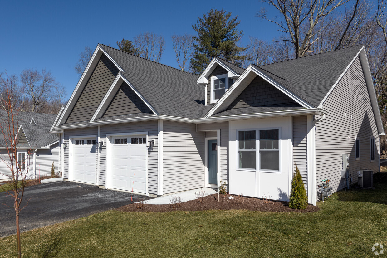
Matteson Ridge is a 55+ community featuring luxury finishes and centers around offering an independent, single-family style living for seniors. Phase One of Matteson Ridge is NOW OPEN with a total of 33 units, which are made up of 15 single-level duplexes and one triplex. The second phase of the project will include 85 additional units, entirely comprised of single-level duplexes, and a clubhouse building complete with a resident gathering area, fitness room, and an extensive activity center. Residents of Matteson Ridge can choose between three-floor plans – a 1478 SF 2-bed, 2-bath plan with a 1 car garage, a 1540 SF plan with 2 beds, 2 baths, and a 2 car garage, and a 1730 SF plan with 2 beds, 2 baths, a den and 1 car garage. Each unit includes upgraded finishes throughout including stainless steel appliances, granite countertops, a fireplace, tile and carpet flooring.
Matteson Ridge is a townhouse community located in Kent County and the 02893 ZIP Code. This area is served by the West Warwick School District attendance zone.
Unique Features
Washer/Dryer
Air Conditioning
Dishwasher
Granite Countertops
West Warwick sits along the Pawtuxet River as Rhode Island's youngest town, incorporated in 1913 after splitting from its larger neighbor, and that industrial heritage still shapes its character today. The town spans just nine square miles in Kent County, placing it within easy reach of Providence to the northeast and the coast to the south via Route 4. Compact and walkable in its core areas, West Warwick carries the feel of a working New England town where longtime residents and newer arrivals share the same tree-lined streets and local gathering spots.
The rental market reflects the town's modest scale, with a mix of converted mill buildings, two- and three-family homes, and smaller apartment communities that offer more space per dollar than many nearby communities. Studios through three-bedroom units are available across the town's distinct village areas, including Riverpoint, Arctic, and Phenix, each with its own pocket of character.
Learn more about living in West Warwick| Colleges & Universities | Distance | ||
|---|---|---|---|
| Colleges & Universities | Distance | ||
| Drive: | 5 min | 2.3 mi | |
| Drive: | 12 min | 4.9 mi | |
| Drive: | 24 min | 13.9 mi | |
| Drive: | 24 min | 14.0 mi |


Scores provided by
Traffic
ActiveAirport
CalmBusinesses
CalmScores provided by
HowLoud What is a Sound Score Rating? A Sound Score Rating aggregates noise caused by vehicle traffic, airplane traffic and local sources. How It WorksWhat Are Walk Score®, Transit Score®, and Bike Score® Ratings?
Walk Score® measures the walkability of any address. Transit Score® measures access to public transit. Bike Score® measures the bikeability of any address.
What is a Sound Score Rating?
A Sound Score Rating aggregates noise caused by vehicle traffic, airplane traffic and local sources.
175 Greenbush Rd
West Warwick, RI 02893


