
Williamsburg
200 W Galbraith Rd,
Cincinnati, OH 45215
$718 - $2,776
Studio - 3 Beds
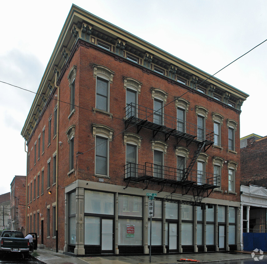
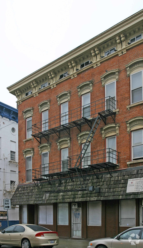
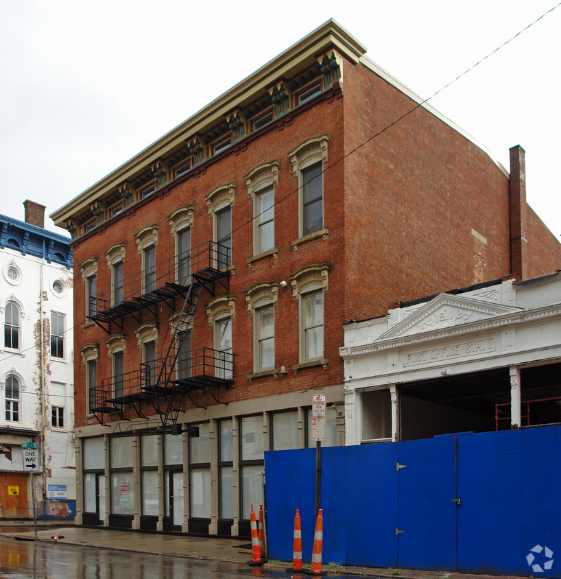
Experience Cincinnati living at Magnolia Heights. Located at 1344 Vine St. in Cincinnati, this community is an ideal place to live. The leasing staff is waiting to show you all that this community has to offer. Come for a visit to see the available floorplan options. Get a head start on moving now. Contact or stop by the Magnolia Heights leasing office to schedule your tour.
Magnolia Heights is an apartment community located in Hamilton County and the 45202 ZIP Code. This area is served by the Cincinnati Public Schools attendance zone.
One of Cincinnati’s most exciting, up-and-coming neighborhoods, Over-the-Rhine has a rich heritage and diverse community. In fact, this neighborhood was one of the most densely populated areas in the country during the turn of the 20th century and is lined with well-preserved 19th-century buildings. Professionals, families, and more flock to Over-the-Rhine for its central location, big-city amenities, and abundant entertainment. This neighborhood is just a few short blocks from Downtown Cincinnati, making it easy for commuters to walk or bike to work. Unique restaurants, hip gastropubs, craft breweries, and boutiques line the streets of Over-the-Rhine’s Gateway District. This lively community has plenty to offer, and is home to Findlay Market, Washington Park, and Cincinnati Music Hall.
Learn more about living in Over-The RhineCompare neighborhood and city base rent averages by bedroom.
| Over-The Rhine | Cincinnati, OH | |
|---|---|---|
| Studio | $1,101 | $1,065 |
| 1 Bedroom | $1,171 | $1,142 |
| 2 Bedrooms | $1,712 | $1,435 |
| 3 Bedrooms | $2,113 | $1,754 |
| Colleges & Universities | Distance | ||
|---|---|---|---|
| Colleges & Universities | Distance | ||
| Drive: | 5 min | 1.9 mi | |
| Drive: | 6 min | 2.3 mi | |
| Drive: | 10 min | 3.8 mi | |
| Drive: | 11 min | 4.6 mi |


Transportation options available in Cincinnati include Washington Park Station - 12Th & Race, located 0.2 mile from Magnolia Heights. Magnolia Heights is near Cincinnati/Northern Kentucky International, located 14.7 miles or 28 minutes away.
| Transit / Subway | Distance | ||
|---|---|---|---|
| Transit / Subway | Distance | ||
| Walk: | 4 min | 0.2 mi | |
| Walk: | 4 min | 0.2 mi | |
| Walk: | 5 min | 0.3 mi | |
| Walk: | 6 min | 0.3 mi | |
| Walk: | 6 min | 0.3 mi |
| Commuter Rail | Distance | ||
|---|---|---|---|
| Commuter Rail | Distance | ||
|
|
Drive: | 5 min | 1.5 mi |
| Airports | Distance | ||
|---|---|---|---|
| Airports | Distance | ||
|
Cincinnati/Northern Kentucky International
|
Drive: | 28 min | 14.7 mi |
Scores provided by
Traffic
-Airport
-Businesses
-Scores provided by
HowLoud What is a Sound Score Rating? A Sound Score Rating aggregates noise caused by vehicle traffic, airplane traffic and local sources. How It WorksTime and distance from Magnolia Heights.
| Shopping Centers | Distance | ||
|---|---|---|---|
| Shopping Centers | Distance | ||
| Walk: | 13 min | 0.7 mi | |
| Walk: | 17 min | 0.9 mi | |
| Drive: | 6 min | 2.7 mi |
| Parks and Recreation | Distance | ||
|---|---|---|---|
| Parks and Recreation | Distance | ||
|
William H. Taft National Historic Site
|
Walk: | 17 min | 0.9 mi |
|
John G. & Phyllis W. Smale Riverfront Park
|
Drive: | 5 min | 1.4 mi |
|
Duke Energy Children's Museum
|
Drive: | 5 min | 1.5 mi |
|
OMNIMAX Theater
|
Drive: | 5 min | 1.5 mi |
|
Museum of Natural History and Science
|
Drive: | 5 min | 1.5 mi |
| Hospitals | Distance | ||
|---|---|---|---|
| Hospitals | Distance | ||
| Walk: | 19 min | 1.0 mi | |
| Drive: | 6 min | 2.3 mi | |
| Drive: | 6 min | 2.4 mi |
| Military Bases | Distance | ||
|---|---|---|---|
| Military Bases | Distance | ||
| Drive: | 72 min | 54.8 mi | |
| Drive: | 78 min | 59.8 mi | |
| Drive: | 81 min | 63.1 mi |
What Are Walk Score®, Transit Score®, and Bike Score® Ratings?
Walk Score® measures the walkability of any address. Transit Score® measures access to public transit. Bike Score® measures the bikeability of any address.
What is a Sound Score Rating?
A Sound Score Rating aggregates noise caused by vehicle traffic, airplane traffic and local sources.


