Median Age
39 Years
Largest Age Group
35-44 Years
Approximately 15% of Residents
Under 20
26%
Over 65
16%


Avg Rent
$1,537
Population
7,322
Renter Mix
20% Rent
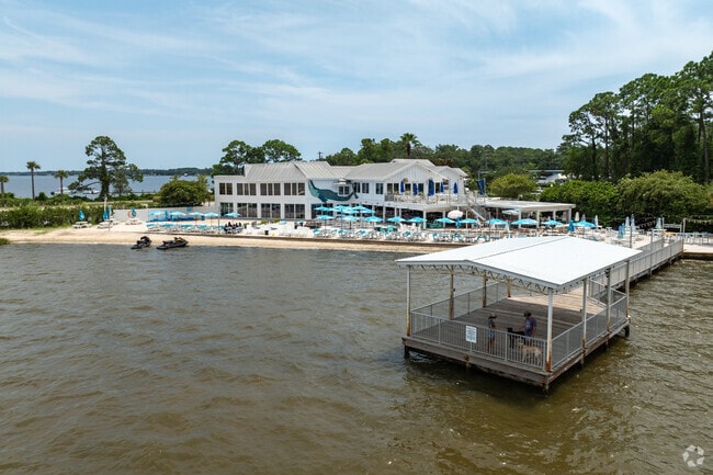
Situated on the Florida Panhandle, Freeport is a tranquil town teeming with natural beauty. Being mostly residential, Freeport touts a secluded atmosphere with an array of houses available for rent along tree-dense streets in scenic residential communities.
Although Freeport feels secluded, the town is just a short drive away from numerous gorgeous Emerald Coast beaches, including Grayton Beach, Miramar Beach, and Destin’s Henderson Beach State Park. Freeport is also within minutes of great shopping at Silver Sands Premium Outlets and many area employers, such as Eglin Air Force Base. Getting around from Freeport is a breeze with convenience to U.S. 331 and Northwest Florida Beaches International Airport.
Proximity to the beach is a big selling point for Hammock Bay residents.
Indoor and outdoor dining is also available at The Bay for Freeport residents.
Freeport residents in Hammock Bay love to be outside biking and running.
Median Household Income
$50,815
Average: $77,535
Education
2,009
Residents Have a Degree
Job Market
3,443
Workers Employed
Median Age
39 Years
Largest Age Group
35-44 Years
Approximately 15% of Residents
Under 20
26%
Over 65
16%
Housing Distribution
Freeport has more homeowners than renters.

Education Distribution
Review this city's overall education levels.

As of July 2026, the average apartment rent in Freeport, FL is $1,537 for one bedroom, $1,806 for two bedrooms, and $1,946 for three bedrooms. Apartment rent in Freeport has decreased by -1.2% in the past year.
Explore how walkable, bikeable, drivable, and transit-friendly Freeport, FL is for everyday living.
Somewhat Walkable
Walkability
Minimal Public Transit
Transit
Exceptionally Drivable
Drivability
Not Bikeable
Bikeability
Public
Grades K-8
881 Students

Public
Grades PK-5
1,137 Students

Public
Grades K-8
881 Students
Public
Grades 9-12
709 Students

† Our analysis of utilities, groceries, transportation, healthcare, home prices, and other goods and services is sourced from the Cost of Living Index, a respected benchmark published by the Council for Community and Economic Research (C2ER) that provides a thorough overview of living expenses across different regions.
Rent data is provided by CoStar Group’s Market Trend reports. As the industry leader in commercial real estate information, analytics, and news, CoStar conducts extensive research to produce and maintain a comprehensive database of commercial real estate information. We combine this data with public record to provide the most up-to-date rental information available.
Consumer goods, services, and home prices are sourced from the Cost of Living Index published by the Council for Community and Economic Research (C2ER). The data on this page is updated quarterly. It was last published in June 2026.
Demographic information comes from Neustar and combines detailed address data with U.S. Census and American Community Survey statistics to produce reliable local estimates.


