
Miami World Tower
710 NE 1st Ave,
Miami, FL 33132
$2,290 - $5,890
Studio - 2 Beds
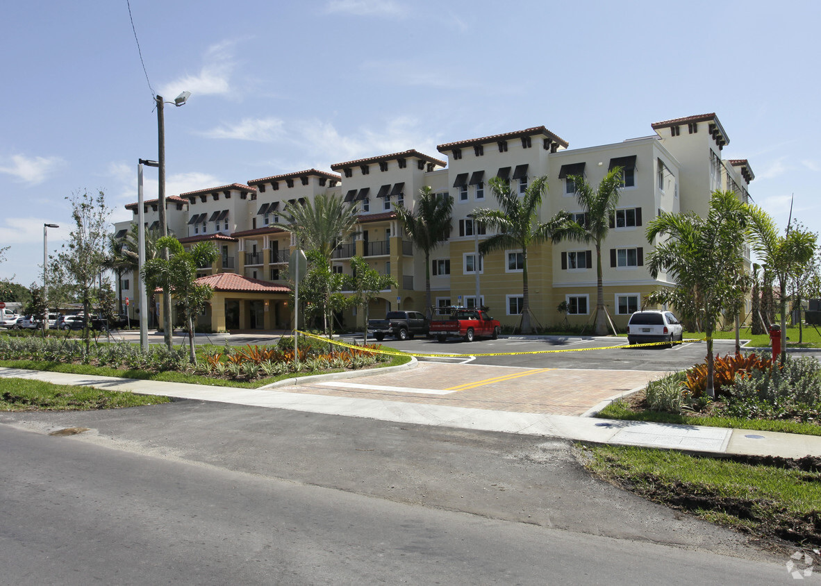

Welcome to Lil’ Abner Apartments I in Miami, FL. The 455 NW 114th Ave location in the Sweetwater Groves neighborhood of Miami has much to offer its residents. The professional leasing team is available to help you find your dream apartment. Drop by the leasing office to see available floor plans and see Lil’ Abner Apartments I.
Lil’ Abner Apartments I is an apartment community located in Miami/Dade County and the 33172 ZIP Code. This area is served by the Miami-Dade County Public Schools attendance zone.
Elevator
Playground
Clubhouse
Basketball Court
Sweetwater Groves, also known as Sweetwater, is a primarily residential area located just north of Florida International University. The community’s convenient locale makes it a top choice for countless students, faculty, and staff seeking a rental within walking distance of FIU’s main campus as well as the FIU College of Engineering and Computing.
Sweetwater Groves offers a broad range of affordable apartments, condos, townhomes, and houses available for rent along quiet streets. World-class shopping options are within close reach of the community at nearby Dolphin Mall. Sweetwater Groves boasts direct access to the Ronald Reagan Turnpike and the Dolphin Expressway, affording many residents short commute times, especially to Doral, Kendall Regional Medical Center, and Miami International Airport.
Learn more about living in Sweetwater GrovesCompare neighborhood and city base rent averages by bedroom.
| Sweetwater Groves | Miami, FL | |
|---|---|---|
| Studio | - | $2,079 |
| 1 Bedroom | $1,535 | $2,200 |
| 2 Bedrooms | $1,210 | $2,766 |
| 3 Bedrooms | - | $3,532 |
| Colleges & Universities | Distance | ||
|---|---|---|---|
| Colleges & Universities | Distance | ||
| Drive: | 7 min | 2.3 mi | |
| Drive: | 10 min | 4.2 mi | |
| Drive: | 17 min | 9.0 mi | |
| Drive: | 18 min | 10.6 mi |


Transportation options available in Miami include Miami Intl Airport Ground Level, located 9.8 miles from Lil’ Abner Apartments I. Lil’ Abner Apartments I is near Miami International, located 7.8 miles or 17 minutes away, and Fort Lauderdale/Hollywood International, located 34.0 miles or 46 minutes away.
| Transit / Subway | Distance | ||
|---|---|---|---|
| Transit / Subway | Distance | ||
|
Miami Intl Airport Ground Level
|
Drive: | 18 min | 9.8 mi |
|
Airport Station
|
Drive: | 20 min | 10.1 mi |
| Commuter Rail | Distance | ||
|---|---|---|---|
| Commuter Rail | Distance | ||
|
|
Drive: | 17 min | 9.2 mi |
|
|
Drive: | 18 min | 10.1 mi |
|
|
Drive: | 17 min | 10.3 mi |
|
|
Drive: | 18 min | 10.6 mi |
|
|
Drive: | 18 min | 10.7 mi |
| Airports | Distance | ||
|---|---|---|---|
| Airports | Distance | ||
|
Miami International
|
Drive: | 17 min | 7.8 mi |
|
Fort Lauderdale/Hollywood International
|
Drive: | 46 min | 34.0 mi |
Time and distance from Lil’ Abner Apartments I.
| Shopping Centers | Distance | ||
|---|---|---|---|
| Shopping Centers | Distance | ||
| Walk: | 6 min | 0.3 mi | |
| Walk: | 7 min | 0.4 mi | |
| Walk: | 8 min | 0.4 mi |
| Parks and Recreation | Distance | ||
|---|---|---|---|
| Parks and Recreation | Distance | ||
|
Sense of Wonder Nature Center and A.D. Barnes Park
|
Drive: | 13 min | 6.9 mi |
|
Gifford Arboretum
|
Drive: | 18 min | 9.7 mi |
|
The Barnacle Historic State Park
|
Drive: | 23 min | 11.8 mi |
|
The Kampong
|
Drive: | 23 min | 12.0 mi |
|
Fairchild Tropical Botanic Garden
|
Drive: | 27 min | 13.9 mi |
| Hospitals | Distance | ||
|---|---|---|---|
| Hospitals | Distance | ||
| Drive: | 11 min | 5.7 mi | |
| Drive: | 14 min | 7.5 mi | |
| Drive: | 17 min | 8.4 mi |
What Are Walk Score®, Transit Score®, and Bike Score® Ratings?
Walk Score® measures the walkability of any address. Transit Score® measures access to public transit. Bike Score® measures the bikeability of any address.
What is a Sound Score Rating?
A Sound Score Rating aggregates noise caused by vehicle traffic, airplane traffic and local sources


