
Bowling Brook Apartments
9000 Stebbing Way,
Laurel, MD 20723
$2,192 - $2,807
1-2 Beds
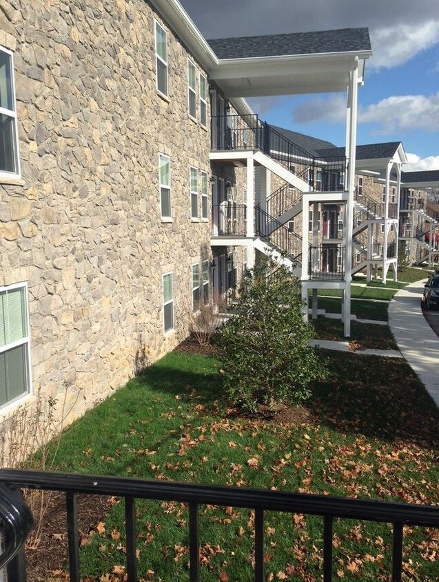

Laurel Gardens is tucked away in a wonderful residential area, the brand new construction community is designed with you in mind. Our BRAND NEW apartments are unique with stylish and convenient features, Washer & Dryers in every apartment home, Vaulted Ceilings on top floors, an excellent staff all tucked away in a gorgeous location. A commuter's dream quick commute to either Baltimore or Washington DC. Easy commute to Fort Meade, NSA and Johns Hopkins Applied Physics Lab as well as being just minutes away to many public amenities! Come home to Laurel Gardens today! ** New to the property, a complete section dedicated exclusively to people 55 and over! Come check out these brand new units!! ** ** Tours are only available Virtually ** To maintain safety during COVID19 please note that the Office is Not Open to the public at this time **
Laurel Garden Apartments LLC is an apartment community located in Prince George's County and the 20707 ZIP Code. This area is served by the Prince George's County Public Schools attendance zone.
Unique Features
Washer/Dryer
Air Conditioning
Dishwasher
Refrigerator
Located between Washington, D.C., and Baltimore, Laurel combines suburban living with easy access to major cities. The historic downtown area features a welcoming Main Street lined with independent businesses, while the Patuxent River winds through numerous parks and green spaces. The Laurel Lakes area offers outdoor recreation opportunities, and the Laurel Museum, housed in an 1840s mill workers' home, preserves the area's rich history. Housing options range from contemporary apartments near Towne Centre at Laurel to historic properties in the Old Town district. Current rental rates average $1,697 for one-bedroom units and $2,035 for two bedrooms, with year-over-year increases of 2.2% and 3.2% respectively.
Originally established as a mill town in the early 19th century, Laurel maintains strong connections to government and technology sectors, with NSA and Fort Meade located nearby.
Learn more about living in Laurel| Colleges & Universities | Distance | ||
|---|---|---|---|
| Colleges & Universities | Distance | ||
| Drive: | 20 min | 10.6 mi | |
| Drive: | 20 min | 10.8 mi | |
| Drive: | 22 min | 12.1 mi | |
| Drive: | 23 min | 14.5 mi |


Transportation options available in Laurel include Greenbelt, Green/Yellow Line Center Platform, located 10.8 miles from Laurel Garden Apartments LLC. Laurel Garden Apartments LLC is near Baltimore/Washington International Thurgood Marshall, located 17.9 miles or 26 minutes away, and Ronald Reagan Washington Ntl, located 24.2 miles or 42 minutes away.
| Transit / Subway | Distance | ||
|---|---|---|---|
| Transit / Subway | Distance | ||
| Drive: | 16 min | 10.8 mi | |
|
|
Drive: | 18 min | 11.7 mi |
| Drive: | 24 min | 12.3 mi |
| Commuter Rail | Distance | ||
|---|---|---|---|
| Commuter Rail | Distance | ||
| Drive: | 5 min | 1.5 mi | |
| Drive: | 9 min | 3.1 mi | |
|
Muirkirk Marc Sb
|
Drive: | 9 min | 4.8 mi |
|
|
Drive: | 13 min | 5.3 mi |
|
|
Drive: | 17 min | 7.6 mi |
| Airports | Distance | ||
|---|---|---|---|
| Airports | Distance | ||
|
Baltimore/Washington International Thurgood Marshall
|
Drive: | 26 min | 17.9 mi |
|
Ronald Reagan Washington Ntl
|
Drive: | 42 min | 24.2 mi |
Time and distance from Laurel Garden Apartments LLC.
| Shopping Centers | Distance | ||
|---|---|---|---|
| Shopping Centers | Distance | ||
| Drive: | 4 min | 1.3 mi | |
| Drive: | 4 min | 1.4 mi | |
| Drive: | 4 min | 1.6 mi |
| Parks and Recreation | Distance | ||
|---|---|---|---|
| Parks and Recreation | Distance | ||
|
Fairland Regional Park
|
Drive: | 9 min | 4.2 mi |
|
Patuxent Research Refuge - North Tract
|
Drive: | 16 min | 6.7 mi |
|
Maydale Conservation Park and Nature Center
|
Drive: | 16 min | 8.5 mi |
|
Patuxent Research Refuge - South Tract
|
Drive: | 18 min | 8.5 mi |
|
Browns Bridge Recreation Area
|
Drive: | 18 min | 8.8 mi |
| Hospitals | Distance | ||
|---|---|---|---|
| Hospitals | Distance | ||
| Drive: | 6 min | 2.2 mi | |
| Drive: | 13 min | 8.3 mi | |
| Drive: | 21 min | 12.0 mi |
| Military Bases | Distance | ||
|---|---|---|---|
| Military Bases | Distance | ||
| Drive: | 17 min | 8.2 mi |

Pets Allowed Fitness Center In Unit Washer & Dryer Balcony Courtyard Concierge EV Charging

Pets Allowed Fitness Center Pool Dishwasher In Unit Washer & Dryer
What Are Walk Score®, Transit Score®, and Bike Score® Ratings?
Walk Score® measures the walkability of any address. Transit Score® measures access to public transit. Bike Score® measures the bikeability of any address.
What is a Sound Score Rating?
A Sound Score Rating aggregates noise caused by vehicle traffic, airplane traffic and local sources

901 Nichols Dr
Laurel, MD 20707


