
52 TEN
5210 N Lamar Blvd,
Austin, TX 78751
Call for Rent
Studio - 3 Beds

Awesome Studio Apartment Close to Downtown - This little jewel is the perfect location for those that want to be close to downtown at a reasonable price! A charming, cozy community... move here and never want to move again!!! We have open, spacious floorplans with walk-in closets and WE PAY THE WATER BILL!!! (512) 443-0000 (RLNE1857105)
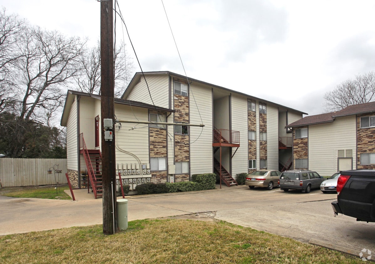
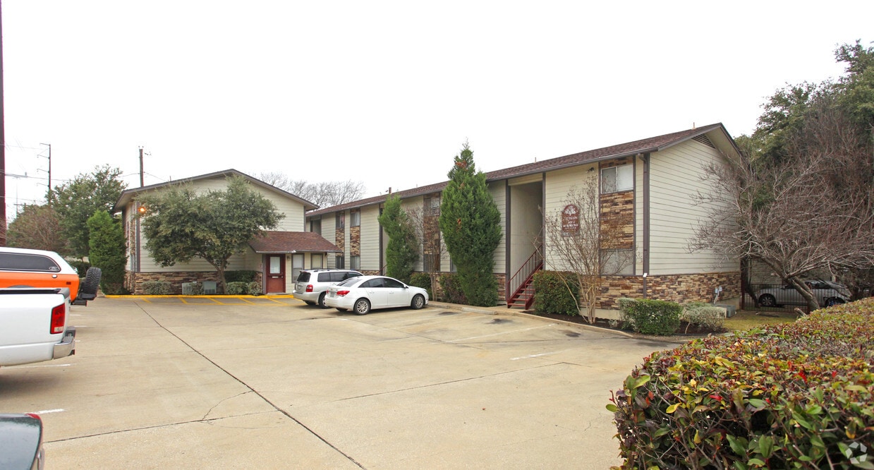
Lanshire Oaks is an apartment community located in Travis County and the 78704 ZIP Code. This area is served by the Austin Independent School District attendance zone.
Galindo developed during the 1950s and its ranches and bungalows reflect the style of the time. The mature trees shade the streets and add to the neighborhood’s established appearance. Galindo extends north from Ben White Boulevard to Oltorf Street, roughly two miles southwest of Downtown Austin. A great option for students, St. Edward’s University is less than a mile east of Galindo and the University of Texas at Austin is about five miles northeast.
Diverse and family-friendly, Galindo is recognized for its good schools and excellent location. The neighborhood has one large park, South Austin Recreation Center, which offers a tennis center and a walkway. In the northeast corner, just outside the boundary along 1st Street, Gillis Neighborhood Park provides a swimming pool, hiking trail, and a playground. While Galindo is mostly residential, you will find a variety of shops and restaurants in the community, especially along 1st Street.
Learn more about living in GalindoCompare neighborhood and city base rent averages by bedroom.
| Galindo | Austin, TX | |
|---|---|---|
| Studio | $1,552 | $1,211 |
| 1 Bedroom | $1,447 | $1,410 |
| 2 Bedrooms | $1,844 | $1,840 |
| 3 Bedrooms | $3,752 | $2,441 |
| Colleges & Universities | Distance | ||
|---|---|---|---|
| Colleges & Universities | Distance | ||
| Drive: | 4 min | 1.4 mi | |
| Drive: | 6 min | 2.5 mi | |
| Drive: | 11 min | 4.3 mi | |
| Drive: | 12 min | 6.0 mi |


Transportation options available in Austin include Downtown Station, located 4.8 miles from Lanshire Oaks. Lanshire Oaks is near Austin-Bergstrom International, located 9.6 miles or 21 minutes away.
| Transit / Subway | Distance | ||
|---|---|---|---|
| Transit / Subway | Distance | ||
| Drive: | 9 min | 4.8 mi | |
| Drive: | 10 min | 5.5 mi | |
| Drive: | 13 min | 7.1 mi | |
| Drive: | 15 min | 9.5 mi | |
| Drive: | 18 min | 10.5 mi |
| Commuter Rail | Distance | ||
|---|---|---|---|
| Commuter Rail | Distance | ||
|
|
Drive: | 9 min | 3.6 mi |
|
|
Drive: | 36 min | 28.7 mi |
|
|
Drive: | 52 min | 40.5 mi |
| Airports | Distance | ||
|---|---|---|---|
| Airports | Distance | ||
|
Austin-Bergstrom International
|
Drive: | 21 min | 9.6 mi |
Scores provided by
Traffic
BusyAirport
CalmBusinesses
ActiveScores provided by
HowLoud What is a Sound Score Rating? A Sound Score Rating aggregates noise caused by vehicle traffic, airplane traffic and local sources. How It WorksTime and distance from Lanshire Oaks.
| Shopping Centers | Distance | ||
|---|---|---|---|
| Shopping Centers | Distance | ||
| Walk: | 10 min | 0.5 mi | |
| Walk: | 13 min | 0.7 mi | |
| Walk: | 16 min | 0.8 mi |
| Parks and Recreation | Distance | ||
|---|---|---|---|
| Parks and Recreation | Distance | ||
|
Blunn Creek Nature Preserve
|
Drive: | 5 min | 1.9 mi |
|
Barton Creek Greenbelt (360 Access)
|
Drive: | 5 min | 2.9 mi |
|
Goat Cave Nature Preserve
|
Drive: | 7 min | 3.2 mi |
|
Umlauf Sculpture Garden and Museum
|
Drive: | 8 min | 3.4 mi |
|
Zilker Botanical Garden
|
Drive: | 9 min | 3.8 mi |
| Hospitals | Distance | ||
|---|---|---|---|
| Hospitals | Distance | ||
| Drive: | 2 min | 1.2 mi | |
| Drive: | 6 min | 2.7 mi | |
| Drive: | 9 min | 5.5 mi |
| Military Bases | Distance | ||
|---|---|---|---|
| Military Bases | Distance | ||
| Drive: | 78 min | 63.7 mi | |
| Drive: | 97 min | 78.4 mi | |
| Drive: | 105 min | 81.9 mi |
Pets Allowed Walk-In Closets Balcony Stainless Steel Appliances Gated EV Charging
What Are Walk Score®, Transit Score®, and Bike Score® Ratings?
Walk Score® measures the walkability of any address. Transit Score® measures access to public transit. Bike Score® measures the bikeability of any address.
What is a Sound Score Rating?
A Sound Score Rating aggregates noise caused by vehicle traffic, airplane traffic and local sources.
3702 S 2nd St
Austin, TX 78704


