
Williamsburg
200 W Galbraith Rd,
Cincinnati, OH 45215
$855 - $2,659
Studio - 3 Beds
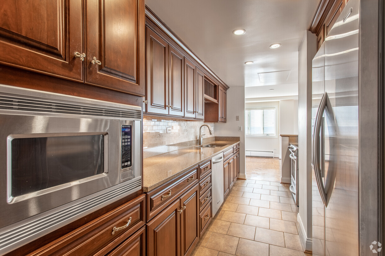

Find your new place at Highland Towers. This community is located at 1071 Celestial St in the Mount Adams area of Cincinnati. The professional leasing team is ready for you to come see our property. At Highland Towers, you'll have access to top amenities and features. Some of these include: convenient on-site parking options and granite countertops. Contact us or stop by today.
Highland Towers is an apartment community located in Hamilton County and the 45202 ZIP Code. This area is served by the Cincinnati Public Schools attendance zone.
Unique Features
Pool
Fitness Center
Laundry Facilities
Elevator
Washer/Dryer
Air Conditioning
Dishwasher
High Speed Internet Access
Hugging the Ohio River just east of the Central Business District, Mount Adams is one of Cincinnati’s hippest and most historic neighborhoods. Vintage architecture is one of the area’s hallmarks, with the abundant brick buildings and townhomes lending a timeless atmosphere to the community. The variety of restaurants and bars is exceptional, with most residents living no more than a few blocks from the finest food and drink in town: from the upscale Celestial Steakhouse and Quincy’s Bar and Lounge to the more relaxed Calle Cantina and Tavern on the Hill, Mount Adams has the perfect spot for any occasion.
The sprawling Eden Park sits on the north end of the neighborhood, home of the popular Krohn Conservatory, Cincinnati Playhouse in the Park, and Cincinnati Art Museum.
Learn more about living in Mount AdamsCompare neighborhood and city base rent averages by bedroom.
| Mount Adams | Cincinnati, OH | |
|---|---|---|
| Studio | $954 | $1,057 |
| 1 Bedroom | $1,476 | $1,127 |
| 2 Bedrooms | $2,092 | $1,404 |
| 3 Bedrooms | $3,046 | $1,703 |
| Colleges & Universities | Distance | ||
|---|---|---|---|
| Colleges & Universities | Distance | ||
| Drive: | 8 min | 2.7 mi | |
| Drive: | 8 min | 2.9 mi | |
| Drive: | 11 min | 4.1 mi | |
| Drive: | 15 min | 6.8 mi |


Transportation options available in Cincinnati include Jack Casino Station, Main & Court, located 1.3 miles from Highland Towers. Highland Towers is near Cincinnati/Northern Kentucky International, located 15.6 miles or 29 minutes away.
| Transit / Subway | Distance | ||
|---|---|---|---|
| Transit / Subway | Distance | ||
| Drive: | 4 min | 1.3 mi | |
| Drive: | 4 min | 1.3 mi | |
| Drive: | 4 min | 1.4 mi | |
| Drive: | 4 min | 1.6 mi | |
| Drive: | 4 min | 1.6 mi |
| Commuter Rail | Distance | ||
|---|---|---|---|
| Commuter Rail | Distance | ||
|
|
Drive: | 8 min | 3.6 mi |
| Airports | Distance | ||
|---|---|---|---|
| Airports | Distance | ||
|
Cincinnati/Northern Kentucky International
|
Drive: | 29 min | 15.6 mi |
Time and distance from Highland Towers.
| Shopping Centers | Distance | ||
|---|---|---|---|
| Shopping Centers | Distance | ||
| Drive: | 5 min | 1.7 mi | |
| Drive: | 5 min | 2.0 mi | |
| Drive: | 8 min | 2.6 mi |
| Parks and Recreation | Distance | ||
|---|---|---|---|
| Parks and Recreation | Distance | ||
|
Krohn Conservatory
|
Walk: | 20 min | 1.0 mi |
|
Theodore M. Berry Friendship Park
|
Drive: | 3 min | 1.2 mi |
|
Eden Park
|
Drive: | 3 min | 1.2 mi |
|
William H. Taft National Historic Site
|
Drive: | 6 min | 1.7 mi |
|
Newport Aquarium
|
Drive: | 6 min | 1.9 mi |
| Hospitals | Distance | ||
|---|---|---|---|
| Hospitals | Distance | ||
| Drive: | 6 min | 1.8 mi | |
| Drive: | 7 min | 2.4 mi | |
| Drive: | 7 min | 2.5 mi |
| Military Bases | Distance | ||
|---|---|---|---|
| Military Bases | Distance | ||
| Drive: | 75 min | 53.4 mi | |
| Drive: | 81 min | 58.5 mi | |
| Drive: | 84 min | 61.8 mi |
What Are Walk Score®, Transit Score®, and Bike Score® Ratings?
Walk Score® measures the walkability of any address. Transit Score® measures access to public transit. Bike Score® measures the bikeability of any address.
What is a Sound Score Rating?
A Sound Score Rating aggregates noise caused by vehicle traffic, airplane traffic and local sources

1071 Celestial St
Cincinnati, OH 45202


