
The Vitagraph
1277 E 14th St,
Brooklyn, NY 11230
$2,627 - $3,884
1-3 Beds
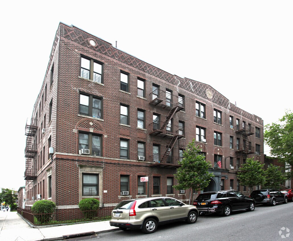
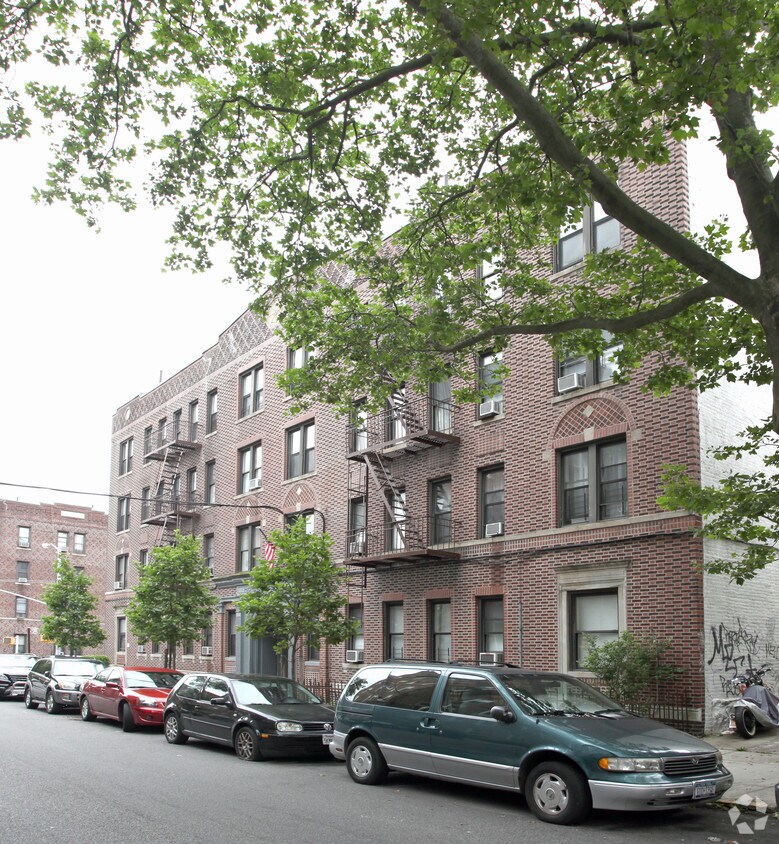

Explore HighLand Circle in Brooklyn. This apartment community is located in Brooklyn on 47th St. in the 11220 area. Be sure to come for a visit to check out the apartment floorplan options. The professional community team is waiting to show you all that this community has in store. Come see HighLand Circle today.
HighLand Circle is an apartment community located in Kings County and the 11220 ZIP Code. This area is served by the New York City Geographic District #20 attendance zone.
Situated on the Upper Bay of the Hudson River, Sunset Park is a vibrant neighborhood in southwestern Brooklyn. The neighborhood is home to a park of the same name, featuring 24.5 acres of space for outdoor recreation as well as stunning views of the Manhattan skyline.
Tucked between Park Slope and Bay Ridge, Sunset Park is known for its diverse restaurants, lively festivals, and numerous supermarkets. Sunset Park also contains Industry City, a complex of towering warehouses on cobblestone streets, which houses a slew of coffee shops, eateries, art galleries, and offices for hundreds of companies. Convenience to the D, N, and R subway lines places Sunset Park within minutes of all that NYC has to offer.
Learn more about living in Sunset Park| Colleges & Universities | Distance | ||
|---|---|---|---|
| Colleges & Universities | Distance | ||
| Drive: | 11 min | 3.9 mi | |
| Drive: | 11 min | 4.0 mi | |
| Drive: | 11 min | 4.4 mi | |
| Drive: | 11 min | 4.4 mi |


Transportation options available in Brooklyn include Fort Hamilton Parkway (D,M Line), located 0.4 mile from HighLand Circle. HighLand Circle is near LaGuardia, located 15.0 miles or 29 minutes away, and Newark Liberty International, located 18.5 miles or 33 minutes away.
| Transit / Subway | Distance | ||
|---|---|---|---|
| Transit / Subway | Distance | ||
|
|
Walk: | 7 min | 0.4 mi |
|
|
Walk: | 9 min | 0.5 mi |
|
|
Walk: | 10 min | 0.5 mi |
|
|
Walk: | 16 min | 0.8 mi |
|
|
Walk: | 17 min | 0.9 mi |
| Commuter Rail | Distance | ||
|---|---|---|---|
| Commuter Rail | Distance | ||
|
|
Drive: | 12 min | 4.0 mi |
|
|
Drive: | 14 min | 5.2 mi |
|
|
Drive: | 15 min | 7.1 mi |
|
|
Drive: | 19 min | 8.4 mi |
|
|
Drive: | 22 min | 9.0 mi |
| Airports | Distance | ||
|---|---|---|---|
| Airports | Distance | ||
|
LaGuardia
|
Drive: | 29 min | 15.0 mi |
|
Newark Liberty International
|
Drive: | 33 min | 18.5 mi |
Time and distance from HighLand Circle.
| Shopping Centers | Distance | ||
|---|---|---|---|
| Shopping Centers | Distance | ||
| Walk: | 14 min | 0.7 mi | |
| Drive: | 4 min | 1.6 mi | |
| Drive: | 5 min | 1.6 mi |
| Parks and Recreation | Distance | ||
|---|---|---|---|
| Parks and Recreation | Distance | ||
|
Sunset Park
|
Walk: | 12 min | 0.6 mi |
|
Owl's Head Park
|
Drive: | 8 min | 2.9 mi |
|
Red Hook Park
|
Drive: | 8 min | 3.4 mi |
|
Prospect Park
|
Drive: | 11 min | 3.6 mi |
|
Narrows Botanical Gardens
|
Drive: | 12 min | 5.5 mi |
| Hospitals | Distance | ||
|---|---|---|---|
| Hospitals | Distance | ||
| Walk: | 5 min | 0.3 mi | |
| Drive: | 9 min | 3.2 mi | |
| Drive: | 10 min | 3.7 mi |
| Military Bases | Distance | ||
|---|---|---|---|
| Military Bases | Distance | ||
| Drive: | 10 min | 3.6 mi | |
| Drive: | 15 min | 7.0 mi | |
| Drive: | 18 min | 7.9 mi |
What Are Walk Score®, Transit Score®, and Bike Score® Ratings?
Walk Score® measures the walkability of any address. Transit Score® measures access to public transit. Bike Score® measures the bikeability of any address.
What is a Sound Score Rating?
A Sound Score Rating aggregates noise caused by vehicle traffic, airplane traffic and local sources


