
1213 Walnut
1213 Walnut St,
Philadelphia, PA 19107
$2,455 - $4,979
Studio - 2 Beds
This building is conveniently located in University City. You are close to public Transportation, restaurants, shopping, Post Office, and Super Market. A hop, skip and a jump to The University of the Sciences in Philadelphia (USP) and University on Pennsylvania (UPENN). Heat, Hot water and cooking Gas are included in rent, set up for internet, cable and phone. Secure you housing for the upcoming year. Please call to set up an appointment!!!!! ALL UNITS INCLUDE HEAT, HOT WATER & COOKING GAS!!!!!!!!!
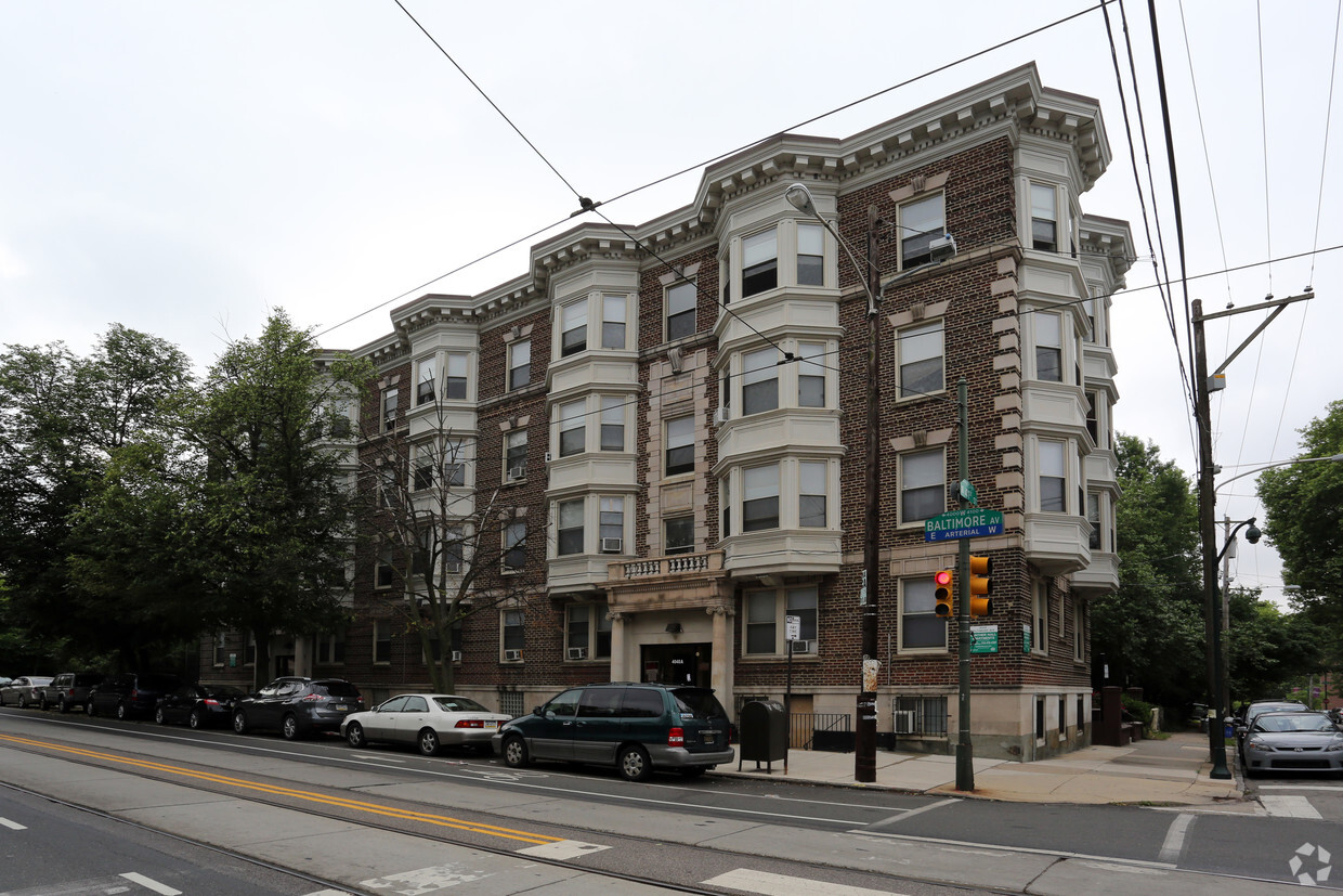
Gunter Hall is an apartment community located in Philadelphia County and the 19104 ZIP Code. This area is served by the The School District of Philadelphia attendance zone.
Situated in West Philadelphia’s University City District, Spruce Hill is a charming neighborhood teeming with historic residences, multicultural eateries, and lush spruce trees. The scenic Clark Park serves as a tranquil reprieve from Spruce Hill’s dynamic urban environment, as well as a host to plenty of popular community events.
Close proximity to numerous hospitals and universities, including the prestigious University of Pennsylvania and Drexel University, makes the neighborhood a top choice for a diverse range of residents. Spruce Hill boasts a walkable environment along with convenient access to SEPTA bus routes and trolley lines. Center City sits just three miles east of the neighborhood, providing residents with a bevy of metropolitan amenities.
Learn more about living in Spruce HillCompare neighborhood and city base rent averages by bedroom.
| Spruce Hill | Philadelphia, PA | |
|---|---|---|
| Studio | $1,600 | $1,407 |
| 1 Bedroom | $1,541 | $1,740 |
| 2 Bedrooms | $2,179 | $2,187 |
| 3 Bedrooms | $2,203 | $2,978 |
| Colleges & Universities | Distance | ||
|---|---|---|---|
| Colleges & Universities | Distance | ||
| Walk: | 4 min | 0.2 mi | |
| Walk: | 11 min | 0.6 mi | |
| Drive: | 4 min | 1.2 mi | |
| Drive: | 4 min | 1.5 mi |


Transportation options available in Philadelphia include Baltimore Ave & 41St St, located 0.0 mile from Gunter Hall. Gunter Hall is near Philadelphia International, located 7.5 miles or 18 minutes away, and Trenton Mercer, located 36.6 miles or 54 minutes away.
| Transit / Subway | Distance | ||
|---|---|---|---|
| Transit / Subway | Distance | ||
|
|
Walk: | 2 min | 0.0 mi |
|
|
Walk: | 1 min | 0.1 mi |
|
|
Walk: | 1 min | 0.1 mi |
|
|
Walk: | 2 min | 0.2 mi |
|
|
Walk: | 3 min | 0.2 mi |
| Commuter Rail | Distance | ||
|---|---|---|---|
| Commuter Rail | Distance | ||
|
|
Walk: | 16 min | 0.8 mi |
| Drive: | 3 min | 1.1 mi | |
|
|
Drive: | 5 min | 2.2 mi |
|
|
Drive: | 6 min | 2.3 mi |
|
|
Drive: | 7 min | 3.4 mi |
| Airports | Distance | ||
|---|---|---|---|
| Airports | Distance | ||
|
Philadelphia International
|
Drive: | 18 min | 7.5 mi |
|
Trenton Mercer
|
Drive: | 54 min | 36.6 mi |
Time and distance from Gunter Hall.
| Shopping Centers | Distance | ||
|---|---|---|---|
| Shopping Centers | Distance | ||
| Drive: | 3 min | 1.2 mi | |
| Drive: | 3 min | 1.4 mi | |
| Drive: | 4 min | 1.5 mi |
| Parks and Recreation | Distance | ||
|---|---|---|---|
| Parks and Recreation | Distance | ||
|
Penn Museum
|
Walk: | 16 min | 0.9 mi |
|
University of Pennsylvania Observatory
|
Walk: | 18 min | 0.9 mi |
|
Bartram's Garden
|
Drive: | 5 min | 1.7 mi |
|
Schuylkill River Park
|
Drive: | 6 min | 2.5 mi |
|
Philadelphia Zoo
|
Drive: | 7 min | 2.7 mi |
| Hospitals | Distance | ||
|---|---|---|---|
| Hospitals | Distance | ||
| Walk: | 14 min | 0.8 mi | |
| Drive: | 3 min | 1.2 mi | |
| Drive: | 9 min | 3.4 mi |
| Military Bases | Distance | ||
|---|---|---|---|
| Military Bases | Distance | ||
| Drive: | 11 min | 5.6 mi |
What Are Walk Score®, Transit Score®, and Bike Score® Ratings?
Walk Score® measures the walkability of any address. Transit Score® measures access to public transit. Bike Score® measures the bikeability of any address.
What is a Sound Score Rating?
A Sound Score Rating aggregates noise caused by vehicle traffic, airplane traffic and local sources

4040-4048 Baltimore Ave
Philadelphia, PA 19104


