
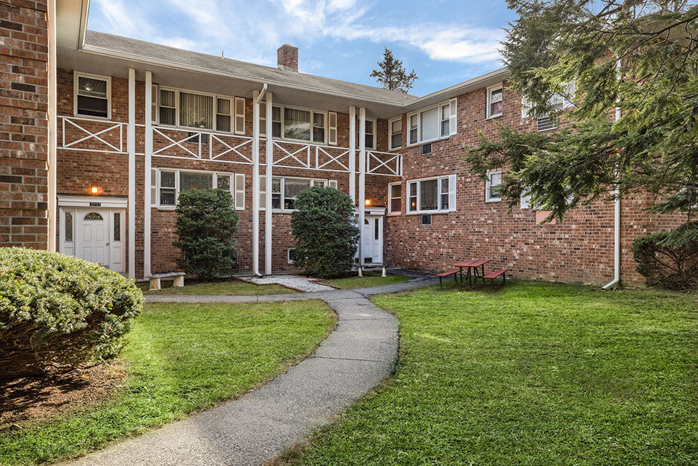
The Landings at Riverwalk
300 Riverfront Blvd,
Elmwood Park, NJ 07407
$2,250 - $4,800
1-2 Beds
Located just off of route-46 in Clifton and close to all major highways, including the Garden State Parkway, Interstate-80 and route-23. Minutes away from downtown Montclair and some of New Jersey's best restaurants, shopping, nightlife and museums. The Willowbrook Mall is moments away and transportation is a breeze. Garret Village is all about lifestyle and location! Call or visit us today for pricing and availability Call Our Leasing Office Today for a Virtual Property Tour!
Garrett Village is an apartment community located in Passaic County and the 07013 ZIP Code. This area is served by the Clifton Public School District attendance zone.
Air Conditioning
Hardwood Floors
Refrigerator
Tub/Shower
Located 15 miles west of Manhattan, Clifton combines suburban living with easy access to New York City. This established New Jersey community offers various housing options, from apartments to single-family homes.
Clifton's landscape features the historic Weasel Brook Park, designed by the Olmsted Brothers landscaping firm. The city maintains its agricultural heritage through active farms, including Ploch's Farm, operating since 1867. Main Avenue serves as the downtown hub, with local shops and dining options. Commuters benefit from access to Routes 3 and 46 and the Garden State Parkway. The city is home to Clifton High School, one of New Jersey's largest single-facility high schools. Residents enjoy seasonal farmers' markets, numerous parks, and convenient public transportation options to Manhattan.
Learn more about living in CliftonCompare neighborhood and city base rent averages by bedroom.
| Montclair Heights | Clifton, NJ | |
|---|---|---|
| Studio | - | $1,742 |
| 1 Bedroom | $1,700 | $2,038 |
| 2 Bedrooms | $1,985 | $2,713 |
| 3 Bedrooms | - | $3,209 |
| Colleges & Universities | Distance | ||
|---|---|---|---|
| Colleges & Universities | Distance | ||
| Walk: | 15 min | 0.8 mi | |
| Drive: | 8 min | 3.6 mi | |
| Drive: | 7 min | 4.2 mi | |
| Drive: | 7 min | 4.6 mi |


Transportation options available in Clifton include Grove Street, located 7.2 miles from Garrett Village. Garrett Village is near Newark Liberty International, located 17.5 miles or 20 minutes away, and LaGuardia, located 27.1 miles or 39 minutes away.
| Transit / Subway | Distance | ||
|---|---|---|---|
| Transit / Subway | Distance | ||
|
|
Drive: | 11 min | 7.2 mi |
|
|
Drive: | 11 min | 7.5 mi |
|
|
Drive: | 12 min | 7.6 mi |
|
|
Drive: | 13 min | 8.0 mi |
|
|
Drive: | 12 min | 8.1 mi |
| Commuter Rail | Distance | ||
|---|---|---|---|
| Commuter Rail | Distance | ||
|
|
Walk: | 16 min | 0.9 mi |
|
|
Drive: | 2 min | 1.2 mi |
|
|
Drive: | 3 min | 1.7 mi |
|
|
Drive: | 4 min | 2.3 mi |
|
|
Drive: | 5 min | 2.7 mi |
| Airports | Distance | ||
|---|---|---|---|
| Airports | Distance | ||
|
Newark Liberty International
|
Drive: | 20 min | 17.5 mi |
|
LaGuardia
|
Drive: | 39 min | 27.1 mi |
Scores provided by
Traffic
-Airport
-Businesses
-Scores provided by
HowLoud What is a Sound Score Rating? A Sound Score Rating aggregates noise caused by vehicle traffic, airplane traffic and local sources. How It WorksTime and distance from Garrett Village.
| Shopping Centers | Distance | ||
|---|---|---|---|
| Shopping Centers | Distance | ||
| Drive: | 3 min | 1.5 mi | |
| Drive: | 3 min | 1.7 mi | |
| Drive: | 3 min | 1.8 mi |
| Parks and Recreation | Distance | ||
|---|---|---|---|
| Parks and Recreation | Distance | ||
|
Presby Memorial Iris Gardens
|
Drive: | 3 min | 1.8 mi |
|
Van Vleck House & Gardens
|
Drive: | 7 min | 3.8 mi |
|
Rifle Camp Park Observatory
|
Drive: | 11 min | 6.9 mi |
|
Edison National Historic Site
|
Drive: | 16 min | 7.2 mi |
|
Fairfield Farm
|
Drive: | 13 min | 8.3 mi |
| Hospitals | Distance | ||
|---|---|---|---|
| Hospitals | Distance | ||
| Drive: | 4 min | 2.7 mi | |
| Drive: | 8 min | 3.6 mi | |
| Drive: | 7 min | 3.9 mi |
| Military Bases | Distance | ||
|---|---|---|---|
| Military Bases | Distance | ||
| Drive: | 29 min | 19.7 mi | |
| Drive: | 28 min | 21.9 mi | |
| Drive: | 44 min | 31.4 mi |
What Are Walk Score®, Transit Score®, and Bike Score® Ratings?
Walk Score® measures the walkability of any address. Transit Score® measures access to public transit. Bike Score® measures the bikeability of any address.
What is a Sound Score Rating?
A Sound Score Rating aggregates noise caused by vehicle traffic, airplane traffic and local sources.

948 Valley Rd
Clifton, NJ 07013


