
The Franklin at Hancock Village
201 Sherman Rd,
Brookline, MA 02467
$3,240 - $8,655 Plus Fees
1-3 Beds 12 Month Lease

Bedrooms
Studio - 2 bd
Bathrooms
1 ba
Square Feet
320 - 825 sq ft
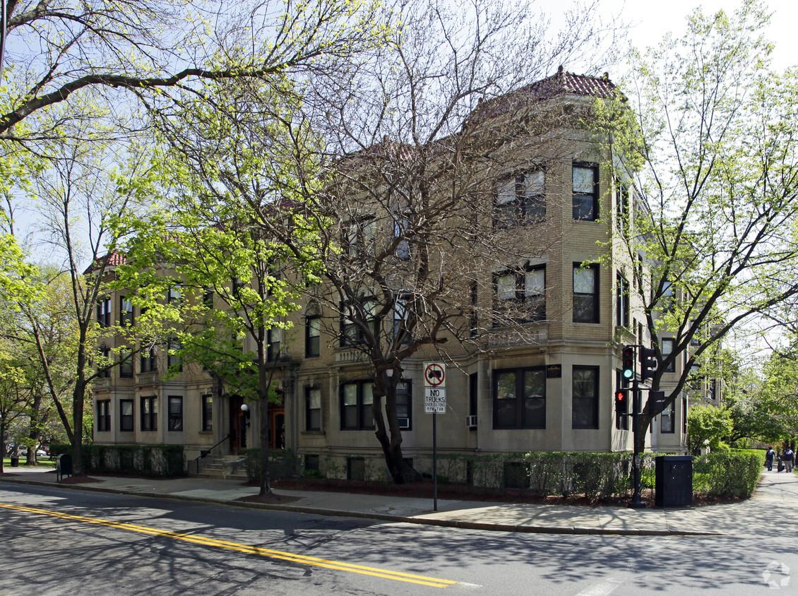
Located along the edge of Knyvet Square Park and just one block from the Armory Woods Sanctuary and playground, it’s easy to forget that the residences at Freeman-St. Paul are situated in the heart of Greater Boston. Commonwealth Avenue, Beacon Street, The MBTA B & C lines, Boston University, Longwood Medical, and the Agganis Arena are all located within a five-block radius.The spacious condominium-quality units are available in a variety of sizes and layouts. Amenities include on-site laundry facilities, 24-hour emergency maintenance, and available on-site parking.
Freeman-St Paul Apartments is an apartment community located in Norfolk County and the 02446 ZIP Code. This area is served by the Brookline School District attendance zone.
Unique Features
Located just four miles west of Downtown Boston, Coolidge Corner is a vibrant commercial hub brimming with activity and gorgeous historical buildings. Residents enjoy a large selection of shops, bookstores, restaurants, and coffee houses in Coolidge Corner as well as access to the landmark Coolidge Theatre, an Art Deco-inspired venue showcasing the best of contemporary art house and independent film.
Coolidge Corner exudes a nostalgic charm, and has attracted shoppers for more than 150 years. There’s a healthy mix of local businesses and familiar chains in Coolidge Corner, offering residents the best of both worlds. Home to its own T stop, Coolidge Corner is an ideal spot for commuters and college students alike.
Learn more about living in Coolidge CornerCompare neighborhood and city base rent averages by bedroom.
| Coolidge Corner | Brookline, MA | |
|---|---|---|
| Studio | $2,774 | $2,674 |
| 1 Bedroom | $2,803 | $2,870 |
| 2 Bedrooms | $3,557 | $3,666 |
| 3 Bedrooms | $4,568 | $5,104 |
| Colleges & Universities | Distance | ||
|---|---|---|---|
| Colleges & Universities | Distance | ||
| Walk: | 10 min | 0.6 mi | |
| Drive: | 2 min | 1.1 mi | |
| Drive: | 3 min | 1.3 mi | |
| Drive: | 3 min | 1.3 mi |


Transportation options available in Brookline include St Paul Street Station, located 0.3 mile from Freeman-St Paul Apartments. Freeman-St Paul Apartments is near General Edward Lawrence Logan International, located 7.2 miles or 16 minutes away.
| Transit / Subway | Distance | ||
|---|---|---|---|
| Transit / Subway | Distance | ||
|
|
Walk: | 5 min | 0.3 mi |
|
|
Walk: | 5 min | 0.3 mi |
|
|
Walk: | 5 min | 0.3 mi |
|
|
Walk: | 6 min | 0.3 mi |
|
|
Walk: | 7 min | 0.4 mi |
| Commuter Rail | Distance | ||
|---|---|---|---|
| Commuter Rail | Distance | ||
|
|
Drive: | 5 min | 2.1 mi |
|
|
Drive: | 9 min | 2.8 mi |
|
|
Drive: | 6 min | 3.2 mi |
|
|
Drive: | 8 min | 3.7 mi |
| Drive: | 13 min | 6.1 mi |
| Airports | Distance | ||
|---|---|---|---|
| Airports | Distance | ||
|
General Edward Lawrence Logan International
|
Drive: | 16 min | 7.2 mi |
Scores provided by
Traffic
-Airport
-Businesses
-Scores provided by
HowLoud What is a Sound Score Rating? A Sound Score Rating aggregates noise caused by vehicle traffic, airplane traffic and local sources. How It WorksTime and distance from Freeman-St Paul Apartments.
| Shopping Centers | Distance | ||
|---|---|---|---|
| Shopping Centers | Distance | ||
| Walk: | 12 min | 0.6 mi | |
| Walk: | 17 min | 0.9 mi | |
| Drive: | 3 min | 1.4 mi |
| Parks and Recreation | Distance | ||
|---|---|---|---|
| Parks and Recreation | Distance | ||
|
Coit Observatory
|
Walk: | 10 min | 0.5 mi |
|
John Fitzgerald Kennedy National Historic Site
|
Walk: | 10 min | 0.6 mi |
|
Frederick Law Olmsted National Historic Site
|
Drive: | 5 min | 1.9 mi |
|
Charles River Reservation
|
Drive: | 5 min | 2.2 mi |
|
Roxbury Heritage State Park
|
Drive: | 6 min | 2.3 mi |
| Hospitals | Distance | ||
|---|---|---|---|
| Hospitals | Distance | ||
| Walk: | 8 min | 0.5 mi | |
| Walk: | 18 min | 1.0 mi | |
| Walk: | 19 min | 1.0 mi |
| Military Bases | Distance | ||
|---|---|---|---|
| Military Bases | Distance | ||
| Drive: | 28 min | 14.5 mi | |
| Drive: | 26 min | 14.8 mi |
Pets Allowed Fitness Center In Unit Washer & Dryer Balcony High-Speed Internet Stainless Steel Appliances
Pets Allowed Fitness Center Pool Dishwasher Refrigerator Kitchen
Fitness Center Pool Dishwasher Kitchen In Unit Washer & Dryer Walk-In Closets
Fitness Center Clubhouse Balcony Granite Countertops Smoke Free Basketball Court
What Are Walk Score®, Transit Score®, and Bike Score® Ratings?
Walk Score® measures the walkability of any address. Transit Score® measures access to public transit. Bike Score® measures the bikeability of any address.
What is a Sound Score Rating?
A Sound Score Rating aggregates noise caused by vehicle traffic, airplane traffic and local sources.
281-283 St Paul St
Brookline, MA 02446


