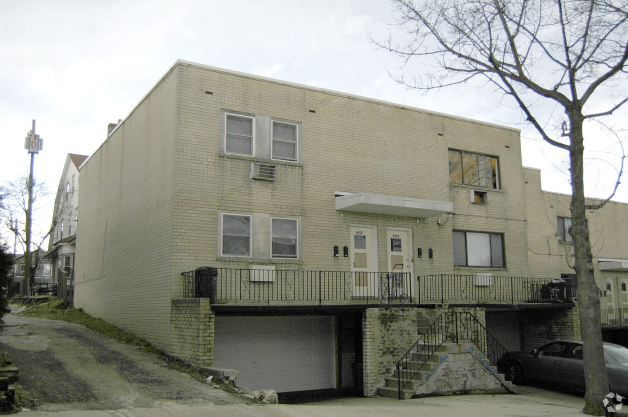
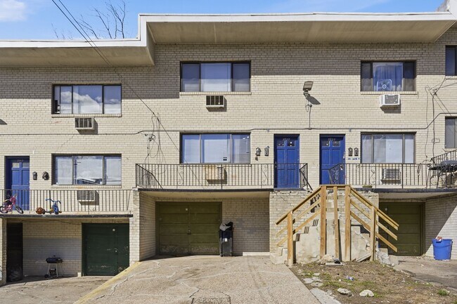
Fernrock Apartments
6022-6038 Warnock Ave,
Philadelphia,
PA
19141
-
Monthly Rent
$1,514
-
Bedrooms
2 bd
-
Bathrooms
1 ba
-
Square Feet
670 sq ft
Highlights
- Walker's Paradise
- Premier Transit Location
- Property Manager on Site
Pricing & Floor Plans
-
Unit 1025Cprice $1,514square feet 670availibility Now
-
Unit 1025Cprice $1,514square feet 670availibility Now
Fees and Policies
The fees listed below are community-provided and may exclude utilities or add-ons. All payments are made directly to the property and are non-refundable unless otherwise specified. Use the Cost Calculator to determine costs based on your needs.
-
One-Time Basics
-
Due at Move-In
-
DepositCharged per unit.$945
-
-
Due at Move-In
-
Dogs
-
Dog FeeMax of 2. Charged per pet.$250
-
Dog RentCharged per pet.$25 / mo
Restrictions:NoneRead More Read LessComments -
-
Cats
-
Cat FeeMax of 2. Charged per pet.$250
-
Cat RentCharged per pet.$25 / mo
Restrictions:Comments -
Property Fee Disclaimer: Based on community-supplied data and independent market research. Subject to change without notice. May exclude fees for mandatory or optional services and usage-based utilities.
Details
Lease Options
-
3 - 13 Month Leases
Property Information
-
Built in 1940
-
20 units/2 stories
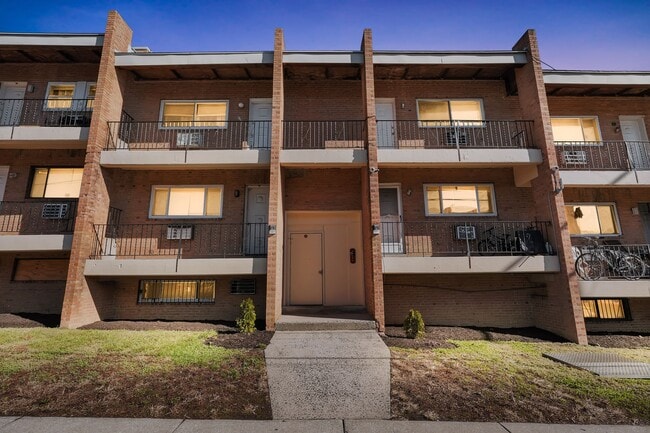
About Fernrock Apartments
Fernrock Apartments offers beautiful, newly renovated rental homes with upgraded kitchens featuring gas stoves, renovated bathrooms, and stylish hardwood or plank flooring. We're just a short walk from the Olney and Fern Rock Transportation Center, as well as the Einstein Medical Center, La Salle University, and Central High School. Looking for a pet-friendly, 1 bedroom apartment home in Fern Rock? Apartments are available now, and you can move in without a security deposit. Contact us for a tour today.
Fernrock Apartments is an apartment community located in Philadelphia County and the 19141 ZIP Code. This area is served by the The School District of Philadelphia attendance zone.
Community Amenities
- Property Manager on Site
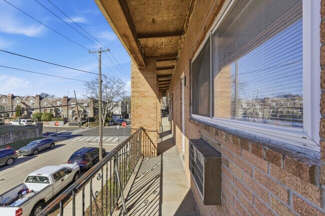
Logan-Ogontz-Fern Rock, located about 10 miles north of the heart of Philadelphia, is a lively urban neighborhood full of residential areas, modern amenities, and exciting attractions. This city is popular for commuters since Route 611 and Highway 1 run through different parts of the neighborhood. Public transportation is also accessible via the Olney Transportation Center, located in the center of Logan-Ogontz-Fern Rock. The area is great for students as well because La Salle University, a small private Catholic university, sits on the western border of town.
Find family-friendly attractions at sprawling parks and historical sites, including the Wister Woods Park and the Stenton Mansion. A variety of local eateries are gathered along North 5th Street and North Broad Street while large shopping plazas with a plethora of stores can be found off these roads as well. Affordable rentals ranging in size and style can be found throughout the neighborhood.
Learn more about living in Logan-Ogontz-Fern RockCompare neighborhood and city base rent averages by bedroom.
| Logan-Ogontz-Fern Rock | Philadelphia, PA | |
|---|---|---|
| Studio | $1,001 | $1,443 |
| 1 Bedroom | $1,039 | $1,790 |
| 2 Bedrooms | $1,184 | $2,223 |
| 3 Bedrooms | $1,359 | $2,909 |
- Property Manager on Site
| Monday | 9am - 5pm |
|---|---|
| Tuesday | 9am - 5pm |
| Wednesday | 9am - 5pm |
| Thursday | 9am - 5pm |
| Friday | 9am - 5pm |
| Saturday | Closed |
| Sunday | Closed |
| Colleges & Universities | Distance | ||
|---|---|---|---|
| Colleges & Universities | Distance | ||
| Walk: | 6 min | 0.4 mi | |
| Drive: | 5 min | 1.6 mi | |
| Drive: | 9 min | 3.2 mi | |
| Drive: | 11 min | 4.4 mi |


View GreatSchools Rating Methodology
Data provided by GreatSchools.org © 2026. All rights reserved.
Transportation options available in Philadelphia include Fern Rock Transit Center, located 0.3 mile from Fernrock Apartments. Fernrock Apartments is near Philadelphia International, located 18.4 miles or 35 minutes away, and Trenton Mercer, located 28.0 miles or 47 minutes away.
| Transit / Subway | Distance | ||
|---|---|---|---|
| Transit / Subway | Distance | ||
| Walk: | 5 min | 0.3 mi | |
| Walk: | 14 min | 0.7 mi | |
|
|
Drive: | 4 min | 1.4 mi |
|
|
Drive: | 5 min | 1.8 mi |
|
|
Drive: | 7 min | 2.9 mi |
| Commuter Rail | Distance | ||
|---|---|---|---|
| Commuter Rail | Distance | ||
| Drive: | 4 min | 1.4 mi | |
|
|
Drive: | 5 min | 1.8 mi |
|
|
Drive: | 6 min | 2.0 mi |
|
|
Drive: | 5 min | 2.1 mi |
|
|
Drive: | 6 min | 2.8 mi |
| Airports | Distance | ||
|---|---|---|---|
| Airports | Distance | ||
|
Philadelphia International
|
Drive: | 35 min | 18.4 mi |
|
Trenton Mercer
|
Drive: | 47 min | 28.0 mi |
Scores provided by
Traffic
-Airport
-Businesses
-Scores provided by
HowLoud What is a Sound Score Rating? A Sound Score Rating aggregates noise caused by vehicle traffic, airplane traffic and local sources. How It WorksTime and distance from Fernrock Apartments.
| Shopping Centers | Distance | ||
|---|---|---|---|
| Shopping Centers | Distance | ||
| Walk: | 10 min | 0.6 mi | |
| Walk: | 12 min | 0.6 mi | |
| Walk: | 20 min | 1.0 mi |
| Parks and Recreation | Distance | ||
|---|---|---|---|
| Parks and Recreation | Distance | ||
|
Awbury Arboretum
|
Drive: | 6 min | 2.6 mi |
|
Tacony Creek Park
|
Drive: | 8 min | 3.8 mi |
|
Wagner Free Institute of Science
|
Drive: | 15 min | 5.2 mi |
|
Lorimer Park
|
Drive: | 14 min | 6.5 mi |
|
Pennypack Park
|
Drive: | 15 min | 7.0 mi |
| Hospitals | Distance | ||
|---|---|---|---|
| Hospitals | Distance | ||
| Walk: | 16 min | 0.9 mi | |
| Drive: | 5 min | 2.8 mi | |
| Drive: | 9 min | 3.0 mi |
| Military Bases | Distance | ||
|---|---|---|---|
| Military Bases | Distance | ||
| Drive: | 28 min | 12.7 mi | |
| Drive: | 26 min | 15.5 mi | |
| Drive: | 30 min | 16.0 mi |
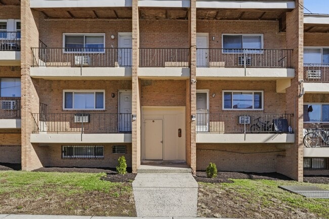
Fernrock Apartments Photos
-
Fernrock Apartments
-
-
-
-
-
-
-
-
Models
-
2 Bedrooms
Nearby Apartments
Within 50 Miles of Fernrock Apartments
-
Kenyon Lofts
40 E Armat St
Philadelphia, PA 19144
Call for Rent
2 Br 2.0 mi
-
Vernon Lofts
5627 Germantown Ave
Philadelphia, PA 19144
$1,724
2-4 Br 2.0 mi
-
Scotts Mills
3510 Scotts Ln
Philadelphia, PA 19129
$2,153
2 Br 3.6 mi
-
Collins Lofts
3475 Collins St
Philadelphia, PA 19134
$1,661 - $1,778
2-3 Br 3.9 mi
-
Hagert Lofts
1821 E Hagert St
Philadelphia, PA 19125
$1,687 - $1,751
2 Br 4.0 mi
-
Girard Court Apartments
2101 N College Ave
Philadelphia, PA 19121
$1,272 - $1,322
2 Br 5.1 mi
Fernrock Apartments does not offer in-unit laundry or shared facilities. Please contact the property to learn about nearby laundry options.
Utilities are not included in rent. Residents should plan to set up and pay for all services separately.
Contact this property for parking details.
Fernrock Apartments has two-bedrooms apartments renting for $1,514/mo.
Yes, Fernrock Apartments welcomes pets. Breed restrictions, weight limits, and additional fees may apply. View this property's pet policy.
A good rule of thumb is to spend no more than 30% of your gross income on rent. Based on the lowest available rent of $1,514 for a two-bedrooms, you would need to earn about $60,560 per year to qualify. Want to double-check your budget? Calculate how much rent you can afford with our Rent Affordability Calculator.
Fernrock Apartments is offering Specials for eligible applicants, with rental rates starting at $1,514.
While Fernrock Apartments does not offer Matterport 3D tours, renters can explore units through In-Person tours. Schedule a tour now.

6022-6038 Warnock Ave
Philadelphia, PA 19141