
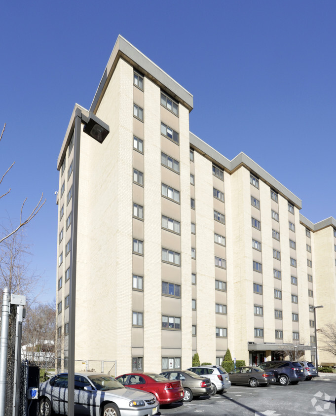
Parkway Lofts
5 Lawrence St,
Bloomfield, NJ 07003
$1,800 - $3,855
Studio - 2 Beds

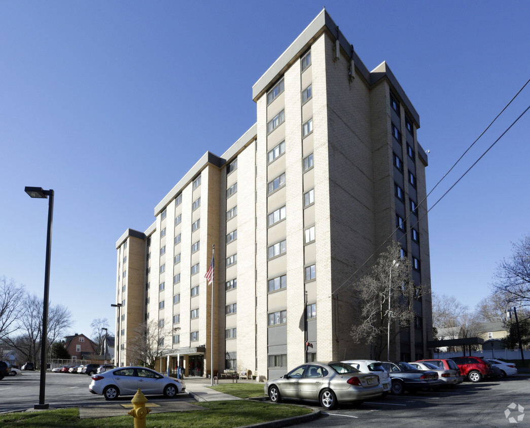
Find your home at Felicity Tower in Bloomfield, NJ. Based in the 07003 area of Bloomfield on Llewellyn Ave, you have easy access to a number of enjoyable points of interest. Here at this community, the team of leasing professionals is ready to help you in finding your new place. Be sure to see the current floorplan options. Stop by the leasing office to schedule a tour.
Felicity Tower is an apartment community located in Essex County and the 07003 ZIP Code. This area is served by the Bloomfield Board Of Education attendance zone.
High Speed Internet Access
Smoke Free
Heating
Oven
Stretched along the Garden State Parkway, the Township of Bloomfield sits in Essex County adjacent to the Township of Montclair. Bloomfield is regarded as an up-and-coming area, boasting convenient access to New York City via major roadways, highways, buses, trains, commuter rail, and light rail. Bloomfield is also close to two major airports, Newark Liberty International and LaGuardia.
In addition to its central locale, Bloomfield offers residents access to a wide range of amenities and services. Quaint shops, cafes, and restaurants line the downtown area on Broad Street in Bloomfield. Large local parks such as Brookdale and Watsessing provide plenty of options for outdoor recreation as well as the behemoth neighbors of South Mountain Reservation and Eagle Rock Reservation. Bloomfield’s appeal is as diverse as its population and offerings, with the township experiencing record growth in residential, retail, and entertainment venues.
Learn more about living in Bloomfield| Colleges & Universities | Distance | ||
|---|---|---|---|
| Colleges & Universities | Distance | ||
| Drive: | 4 min | 1.3 mi | |
| Drive: | 11 min | 4.1 mi | |
| Drive: | 10 min | 4.5 mi | |
| Drive: | 10 min | 4.8 mi |

Transportation options available in Bloomfield include Grove Street, located 2.1 miles from Felicity Tower. Felicity Tower is near Newark Liberty International, located 10.1 miles or 19 minutes away, and LaGuardia, located 26.5 miles or 47 minutes away.
| Transit / Subway | Distance | ||
|---|---|---|---|
| Transit / Subway | Distance | ||
|
|
Drive: | 5 min | 2.1 mi |
|
|
Drive: | 7 min | 2.5 mi |
|
|
Drive: | 7 min | 2.7 mi |
|
|
Drive: | 7 min | 2.7 mi |
|
|
Drive: | 7 min | 3.0 mi |
| Commuter Rail | Distance | ||
|---|---|---|---|
| Commuter Rail | Distance | ||
|
|
Walk: | 18 min | 0.9 mi |
|
|
Walk: | 19 min | 1.0 mi |
|
|
Drive: | 4 min | 1.3 mi |
|
|
Drive: | 5 min | 1.9 mi |
|
|
Drive: | 6 min | 2.1 mi |
| Airports | Distance | ||
|---|---|---|---|
| Airports | Distance | ||
|
Newark Liberty International
|
Drive: | 19 min | 10.1 mi |
|
LaGuardia
|
Drive: | 47 min | 26.5 mi |
Time and distance from Felicity Tower.
| Shopping Centers | Distance | ||
|---|---|---|---|
| Shopping Centers | Distance | ||
| Drive: | 6 min | 2.1 mi | |
| Drive: | 6 min | 2.1 mi | |
| Drive: | 6 min | 2.1 mi |
| Parks and Recreation | Distance | ||
|---|---|---|---|
| Parks and Recreation | Distance | ||
|
Edison National Historic Site
|
Drive: | 8 min | 2.6 mi |
|
Van Vleck House & Gardens
|
Drive: | 8 min | 3.4 mi |
|
Branch Brook Park
|
Drive: | 9 min | 3.7 mi |
|
Newark Museum and Dreyfuss Planetarium
|
Drive: | 10 min | 4.8 mi |
|
Turtle Back Zoo
|
Drive: | 14 min | 5.1 mi |
| Hospitals | Distance | ||
|---|---|---|---|
| Hospitals | Distance | ||
| Drive: | 7 min | 3.1 mi | |
| Drive: | 9 min | 4.2 mi | |
| Drive: | 10 min | 4.6 mi |
| Military Bases | Distance | ||
|---|---|---|---|
| Military Bases | Distance | ||
| Drive: | 24 min | 13.9 mi | |
| Drive: | 31 min | 16.3 mi | |
| Drive: | 35 min | 16.5 mi |
What Are Walk Score®, Transit Score®, and Bike Score® Ratings?
Walk Score® measures the walkability of any address. Transit Score® measures access to public transit. Bike Score® measures the bikeability of any address.
What is a Sound Score Rating?
A Sound Score Rating aggregates noise caused by vehicle traffic, airplane traffic and local sources
100 Llewellyn Ave
Bloomfield, NJ 07003


