
Baxter on Broadway
4901 Broadway,
Oakland, CA 94611
$2,770 - $2,845 Total Monthly Price
Studio - 3 Beds
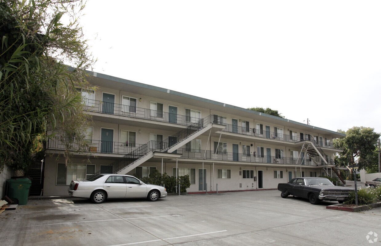
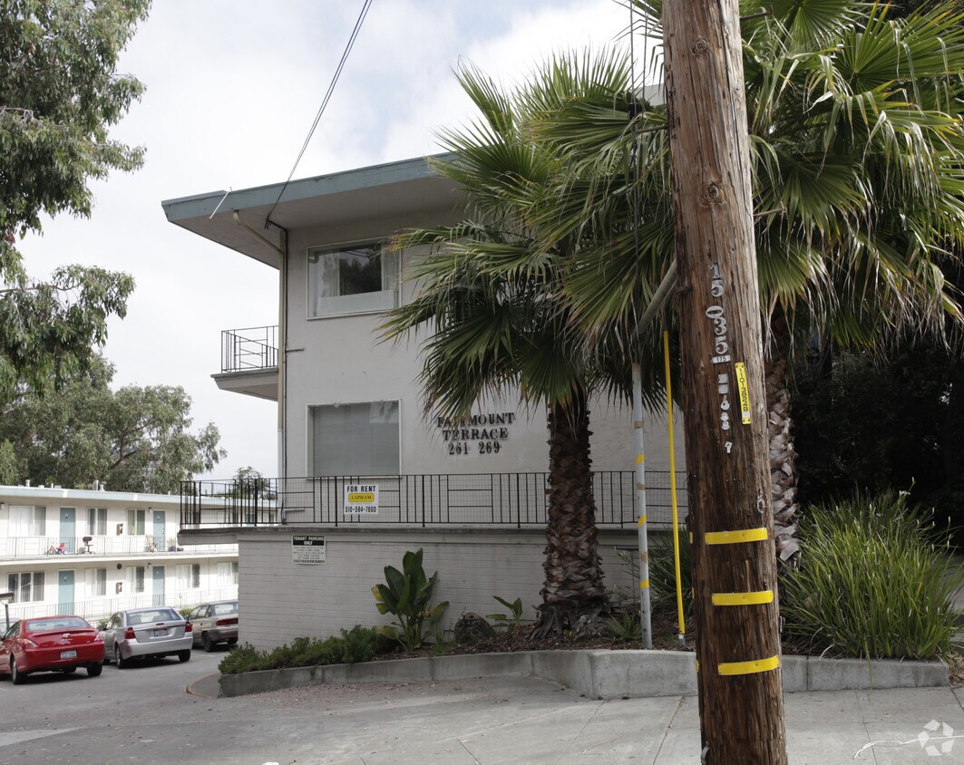
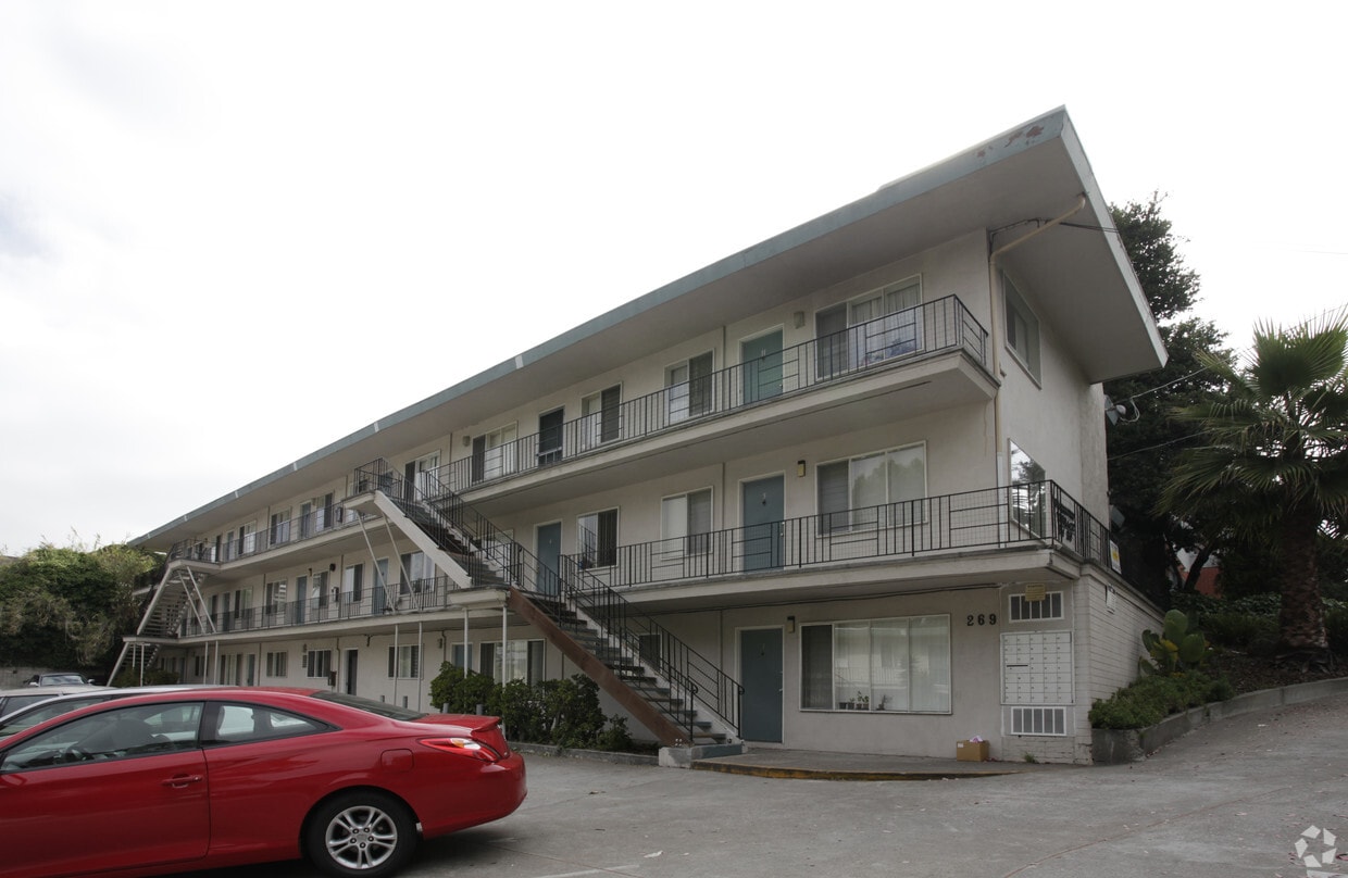
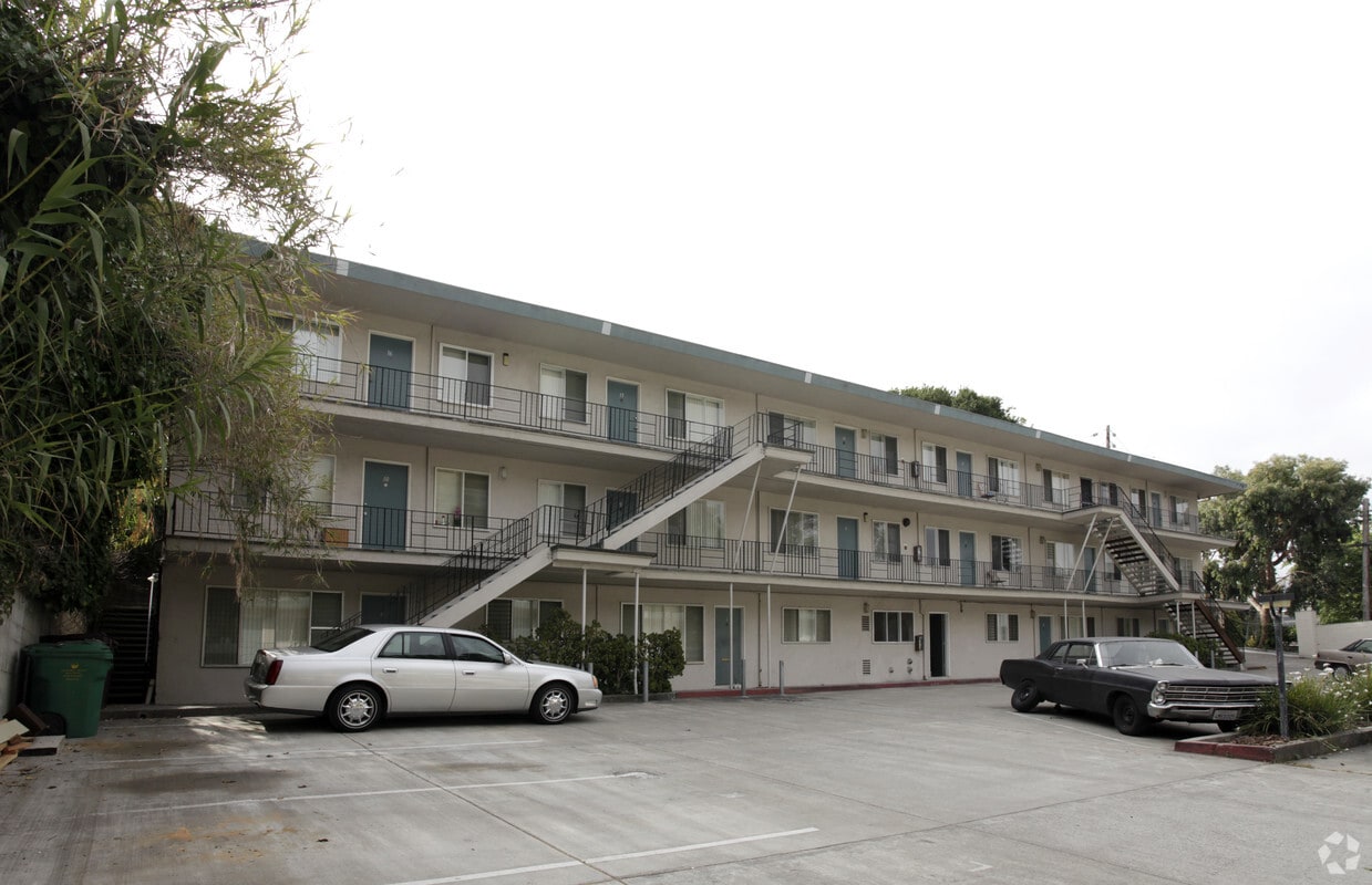
Discover your new apartment at Fairmont Terrace in Oakland, CA. Located at 269 Fairmount Ave in Oakland, this community has much to offer its residents. The professional leasing staff is ready for you to come see our property. It's time to find your new home. Contact or stop by the Fairmont Terrace leasing office to discuss your new apartment.
Fairmont Terrace is an apartment community located in Alameda County and the 94611 ZIP Code. This area is served by the Oakland Unified School District attendance zone.
Settled into the low hills of North Oakland lies the Oakland Avenue-Harrison Street neighborhood, often called HarriOak or Westlake by the locals. With streets lined with established trees and comfortably sized homes, HarriOak serves as a popular choice with young professionals and families. A decidedly residential neighborhood, this area sits just moments away from a strong business corridors along Broadway while remaining tucked away from the bustle.
This close-knit neighborhood runs an active block watch to keep the area safer. Many streets host block parties and homeowners share produce from their home gardens with neighbors. Residents enjoy close proximity to major employer Kaiser Permanente and an easy 2-mile commute to Downtown Oakland and a 4-mile commute north to the UC Berkeley campus.
Learn more about living in WestlakeCompare neighborhood and city base rent averages by bedroom.
| Westlake | Oakland, CA | |
|---|---|---|
| Studio | $2,107 | $1,764 |
| 1 Bedroom | $2,615 | $2,132 |
| 2 Bedrooms | $3,596 | $2,774 |
| 3 Bedrooms | $4,776 | $3,330 |
| Colleges & Universities | Distance | ||
|---|---|---|---|
| Colleges & Universities | Distance | ||
| Walk: | 9 min | 0.5 mi | |
| Drive: | 4 min | 1.5 mi | |
| Drive: | 6 min | 2.5 mi | |
| Drive: | 9 min | 3.4 mi |


Transportation options available in Oakland include 19Th Street Oakland, located 1.0 miles from Fairmont Terrace. Fairmont Terrace is near Metro Oakland International, located 10.3 miles or 18 minutes away, and San Francisco International, located 23.1 miles or 35 minutes away.
| Transit / Subway | Distance | ||
|---|---|---|---|
| Transit / Subway | Distance | ||
|
|
Walk: | 19 min | 1.0 mi |
|
|
Drive: | 3 min | 1.3 mi |
|
|
Drive: | 5 min | 1.8 mi |
|
|
Drive: | 7 min | 2.4 mi |
|
|
Drive: | 8 min | 4.0 mi |
| Commuter Rail | Distance | ||
|---|---|---|---|
| Commuter Rail | Distance | ||
|
|
Drive: | 6 min | 2.2 mi |
| Drive: | 7 min | 4.1 mi | |
|
|
Drive: | 8 min | 5.7 mi |
| Drive: | 17 min | 10.7 mi | |
| Drive: | 18 min | 11.9 mi |
| Airports | Distance | ||
|---|---|---|---|
| Airports | Distance | ||
|
Metro Oakland International
|
Drive: | 18 min | 10.3 mi |
|
San Francisco International
|
Drive: | 35 min | 23.1 mi |
Scores provided by
Traffic
-Airport
-Businesses
-Scores provided by
HowLoud What is a Sound Score Rating? A Sound Score Rating aggregates noise caused by vehicle traffic, airplane traffic and local sources. How It WorksTime and distance from Fairmont Terrace.
| Shopping Centers | Distance | ||
|---|---|---|---|
| Shopping Centers | Distance | ||
| Walk: | 5 min | 0.3 mi | |
| Walk: | 12 min | 0.6 mi | |
| Drive: | 4 min | 1.3 mi |
| Parks and Recreation | Distance | ||
|---|---|---|---|
| Parks and Recreation | Distance | ||
|
Lakeside Park Garden Center
|
Walk: | 17 min | 0.9 mi |
|
Morcom Rose Garden
|
Walk: | 18 min | 1.0 mi |
|
Lakeside Park
|
Drive: | 3 min | 1.1 mi |
|
Rotary Nature Center
|
Drive: | 4 min | 1.2 mi |
|
Juan Bautista de Anza National Historic Trail
|
Drive: | 4 min | 1.6 mi |
| Hospitals | Distance | ||
|---|---|---|---|
| Hospitals | Distance | ||
| Walk: | 8 min | 0.4 mi | |
| Walk: | 12 min | 0.6 mi | |
| Drive: | 5 min | 2.4 mi |
| Military Bases | Distance | ||
|---|---|---|---|
| Military Bases | Distance | ||
| Drive: | 14 min | 4.9 mi | |
| Drive: | 13 min | 4.9 mi | |
| Drive: | 13 min | 5.2 mi |
Pets Allowed Fitness Center In Unit Washer & Dryer Stainless Steel Appliances Business Center Package Service Elevator
What Are Walk Score®, Transit Score®, and Bike Score® Ratings?
Walk Score® measures the walkability of any address. Transit Score® measures access to public transit. Bike Score® measures the bikeability of any address.
What is a Sound Score Rating?
A Sound Score Rating aggregates noise caused by vehicle traffic, airplane traffic and local sources.
269 Fairmount Ave
Oakland, CA 94611


