
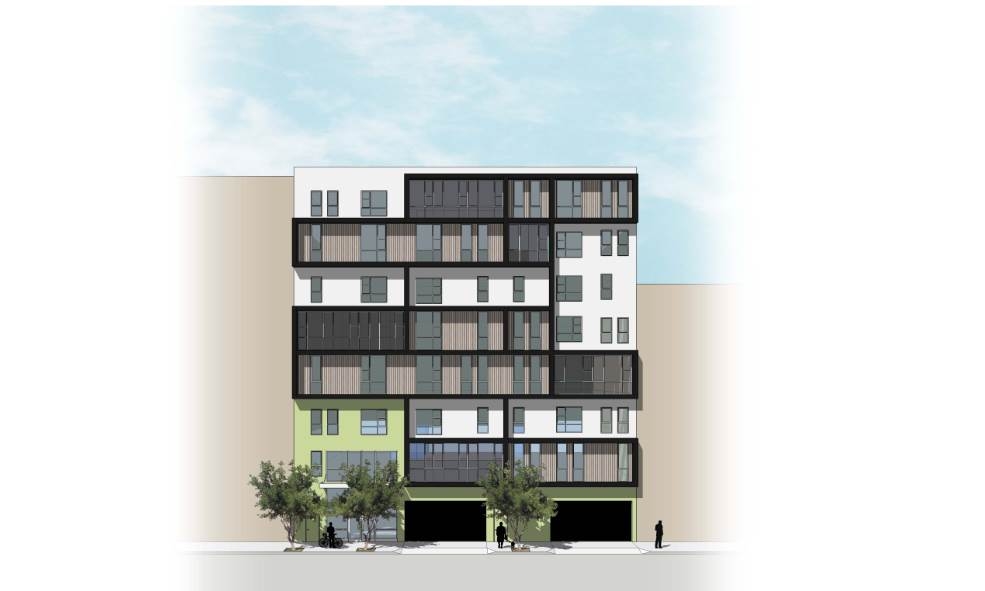
Isle House
39 Bruton St,
San Francisco, CA 94130
$3,035 - $6,998
Studio - 3 Beds
Explore your new apartment at Civic Center 14 TOD in Oakland. A convenient 14th St. setting in the 94612 area of Oakland is a great place for those looking for their new place. The community staff is ready and waiting for you to come for a visit. Schedule a time to check out the current floorplan options. Drop by to schedule a tour.
Civic Center 14 TOD is an apartment community located in Alameda County and the 94612 ZIP Code. This area is served by the Oakland Unified attendance zone.
Air Conditioning
Heating
Oven
Range
Located directly across the bay from San Francisco, Downtown Oakland extends from 12th Street north to Grand Avenue. It includes Lincoln University, several bank headquarters, a variety of restaurants, shops, and theaters. The historic Fox Theater and the art deco Paramount Theatre both offer live performances. Sports fans head to the Oakland-Alameda County Coliseum to cheer on the NFL's Oakland Raiders and to the Oracle Arena to cheer the NBA's Golden State Warriors.
Oakland's "main street" is Broadway, which extends from 8th Street to 17th Street. The neighborhood's history dates back to the 1850s, and the downtown area is home to some of the nation's finest Art Deco architecture. Some places to visit include the Pardee Home (built in1868), the Rotunda Building, and the African American Museum and Library.
Learn more about living in Uptown Oakland| Colleges & Universities | Distance | ||
|---|---|---|---|
| Colleges & Universities | Distance | ||
| Walk: | 7 min | 0.4 mi | |
| Drive: | 4 min | 1.6 mi | |
| Drive: | 4 min | 1.9 mi | |
| Drive: | 6 min | 2.4 mi |


Transportation options available in Oakland include 12Th Street / Oakland City Center, located 0.3 mile from Civic Center 14 TOD. Civic Center 14 TOD is near Metro Oakland International, located 9.6 miles or 15 minutes away, and San Francisco International, located 22.0 miles or 35 minutes away.
| Transit / Subway | Distance | ||
|---|---|---|---|
| Transit / Subway | Distance | ||
|
|
Walk: | 6 min | 0.3 mi |
|
|
Walk: | 6 min | 0.3 mi |
|
|
Walk: | 9 min | 0.5 mi |
|
|
Drive: | 3 min | 1.1 mi |
|
|
Drive: | 3 min | 1.4 mi |
| Commuter Rail | Distance | ||
|---|---|---|---|
| Commuter Rail | Distance | ||
|
|
Drive: | 3 min | 1.2 mi |
|
|
Drive: | 7 min | 4.1 mi |
|
|
Drive: | 10 min | 6.2 mi |
| Drive: | 16 min | 9.5 mi | |
| Drive: | 16 min | 9.6 mi |
| Airports | Distance | ||
|---|---|---|---|
| Airports | Distance | ||
|
Metro Oakland International
|
Drive: | 15 min | 9.6 mi |
|
San Francisco International
|
Drive: | 35 min | 22.0 mi |
Time and distance from Civic Center 14 TOD.
| Shopping Centers | Distance | ||
|---|---|---|---|
| Shopping Centers | Distance | ||
| Walk: | 8 min | 0.4 mi | |
| Walk: | 10 min | 0.5 mi | |
| Walk: | 10 min | 0.5 mi |
| Parks and Recreation | Distance | ||
|---|---|---|---|
| Parks and Recreation | Distance | ||
|
Juan Bautista de Anza National Historic Trail
|
Walk: | 15 min | 0.8 mi |
|
Jack London Square
|
Walk: | 19 min | 1.0 mi |
|
Oakland Museum of California
|
Walk: | 20 min | 1.1 mi |
|
Lakeside Park Garden Center
|
Drive: | 3 min | 1.4 mi |
|
Rotary Nature Center
|
Drive: | 4 min | 1.7 mi |
| Hospitals | Distance | ||
|---|---|---|---|
| Hospitals | Distance | ||
| Drive: | 4 min | 1.6 mi | |
| Drive: | 4 min | 2.2 mi | |
| Drive: | 4 min | 2.4 mi |
| Military Bases | Distance | ||
|---|---|---|---|
| Military Bases | Distance | ||
| Drive: | 10 min | 3.3 mi | |
| Drive: | 10 min | 3.9 mi |
What Are Walk Score®, Transit Score®, and Bike Score® Ratings?
Walk Score® measures the walkability of any address. Transit Score® measures access to public transit. Bike Score® measures the bikeability of any address.
What is a Sound Score Rating?
A Sound Score Rating aggregates noise caused by vehicle traffic, airplane traffic and local sources

632 14th St
Oakland, CA 94612


