Aeon
1119 C St,
Vancouver, WA 98660
$1,629 - $2,977
Studio - 2 Beds

Bedrooms
1 - 3 bd
Bathrooms
1 ba
Square Feet
600 - 1,100 sq ft

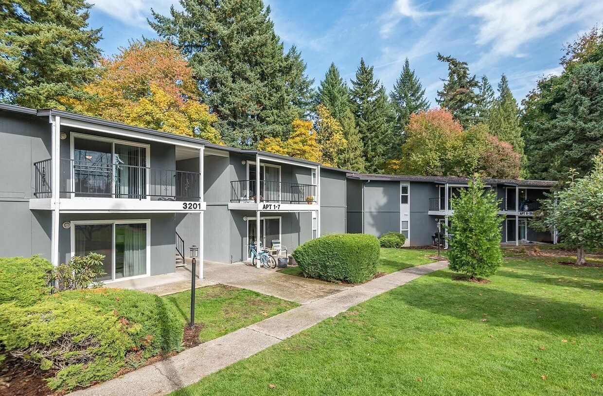
Each apartment comes equipped range, refrigerator, kitchen faucet with sprayer, dishwasher, and electric water heater. Park easy in your included assigned space. Enjoy the fresh air as all homes at Cedar Lane have a private balcony/patio. Cedar Lane is set on 10 acres of serene beauty, surrounded by natural forest with views of Burnt Bridge Creek and plenty of acreage for outdoor activities and relaxation. Cedar Lane offers spacious 1-, 2-, or 3-bedroom floor plans ready for you. Just steps away from Bagley Community Park, Evergreen Park and the Burnt Bridge Creek Trail, Cedar Lane is a nature lovers’ dream. Our community also boasts easy access to Hwy 99, SR 500, and I-5 South, to make for a short and easy 8-minute drive to the Vancouver Mall and Downtown Vancouver Waterfront. Close to all local schools, Harney Elementary, Discovery Middle School, Hudson’s Bay High School and Clark College. Say goodbye to stress and come home to a 24/7 Maintenance Call Center ready to help with all your maintenance needs! Utilities are based upon current occupancy and square footage of your unit. We now offer high speed internet through Xfinity! For only $45/month you'll get 800 Mbps speeds for unlimited devices! Modem included. Set up is one call away once you move in! We are now offering virtual and in-person tours via scheduled appointments only. Contact us today and start your story at Cedar Lane! *Pricing and availability are subject to change daily. Photos may not be of the exact advertised unit. Please contact us today for the most up to date information! This property is professionally managed by Equity Management and is compliant with Fair Housing laws.
Cedar Lane is an apartment community located in Clark County and the 98661 ZIP Code. This area is served by the Vancouver attendance zone.
Unique Features
Laundry Facilities
Playground
Clubhouse
Controlled Access
Washer/Dryer
Dishwasher
High Speed Internet Access
Refrigerator
Fourth Plain Village is a tranquil residential neighborhood in north-central Vancouver. East 4th Plain Boulevard runs along the south end of the neighborhood, serving as a major commercial hub for this part of town. This is where you’ll find many of the most popular low-key local hangouts, including Black Rock Coffee Bar, Don Taco, and Pho Hong Phat.
The campus of Clark College sits just a few blocks away, making Fourth Plain Village a great spot for students, faculty, and staff members who want to live within walking or biking distance. Vancouver Mall is just a short drive down WA-500, and close access to I-5 makes it a breeze to hop down to Portland and beyond.
Learn more about living in Fourth Plain VillageCompare neighborhood and city base rent averages by bedroom.
| Fourth Plain Village | Vancouver, WA | |
|---|---|---|
| Studio | - | $1,374 |
| 1 Bedroom | $1,220 | $1,518 |
| 2 Bedrooms | $1,291 | $1,702 |
| 3 Bedrooms | $1,911 | $2,100 |
| Colleges & Universities | Distance | ||
|---|---|---|---|
| Colleges & Universities | Distance | ||
| Drive: | 5 min | 1.5 mi | |
| Drive: | 8 min | 2.6 mi | |
| Drive: | 14 min | 8.1 mi | |
| Drive: | 16 min | 8.9 mi |
 The GreatSchools Rating helps parents compare schools within a state based on a variety of school quality indicators and provides a helpful picture of how effectively each school serves all of its students. Ratings are on a scale of 1 (below average) to 10 (above average) and can include test scores, college readiness, academic progress, advanced courses, equity, discipline and attendance data. We also advise parents to visit schools, consider other information on school performance and programs, and consider family needs as part of the school selection process.
Transportation options available in Vancouver include Delta Park/Vanport, located 5.5 miles from Cedar Lane. Cedar Lane is near Portland International, located 12.7 miles or 21 minutes away.
| Transit / Subway | Distance | ||
|---|---|---|---|
| Transit / Subway | Distance | ||
|
|
Drive: | 9 min | 5.5 mi |
|
|
Drive: | 12 min | 6.5 mi |
|
|
Drive: | 12 min | 6.7 mi |
|
|
Drive: | 13 min | 7.0 mi |
|
|
Drive: | 21 min | 12.8 mi |
| Commuter Rail | Distance | ||
|---|---|---|---|
| Commuter Rail | Distance | ||
|
|
Drive: | 10 min | 4.1 mi |
|
|
Drive: | 18 min | 10.8 mi |
|
|
Drive: | 30 min | 18.5 mi |
|
|
Drive: | 31 min | 20.3 mi |
|
|
Drive: | 34 min | 20.8 mi |
| Airports | Distance | ||
|---|---|---|---|
| Airports | Distance | ||
|
Portland International
|
Drive: | 21 min | 12.7 mi |
Time and distance from Cedar Lane.
| Shopping Centers | Distance | ||
|---|---|---|---|
| Shopping Centers | Distance | ||
| Walk: | 14 min | 0.8 mi | |
| Walk: | 16 min | 0.8 mi | |
| Walk: | 17 min | 0.9 mi |
| Parks and Recreation | Distance | ||
|---|---|---|---|
| Parks and Recreation | Distance | ||
|
Evergreen Park - Vancouver
|
Drive: | 4 min | 1.1 mi |
|
Water Works Park
|
Drive: | 5 min | 1.3 mi |
|
St. Helens Park
|
Drive: | 6 min | 1.7 mi |
|
West Minnehaha Neighborhood Park
|
Drive: | 5 min | 1.8 mi |
|
Bagley Community Park
|
Drive: | 5 min | 1.9 mi |
| Hospitals | Distance | ||
|---|---|---|---|
| Hospitals | Distance | ||
| Drive: | 12 min | 5.2 mi | |
| Drive: | 12 min | 7.0 mi | |
| Drive: | 19 min | 9.8 mi |
| Military Bases | Distance | ||
|---|---|---|---|
| Military Bases | Distance | ||
| Drive: | 22 min | 11.6 mi | |
| Drive: | 29 min | 14.7 mi |
What Are Walk Score®, Transit Score®, and Bike Score® Ratings?
Walk Score® measures the walkability of any address. Transit Score® measures access to public transit. Bike Score® measures the bikeability of any address.
What is a Sound Score Rating?
A Sound Score Rating aggregates noise caused by vehicle traffic, airplane traffic and local sources