
Venue Residences
3688 Overland Ave,
Los Angeles, CA 90034
$3,250 - $5,895
1-2 Beds
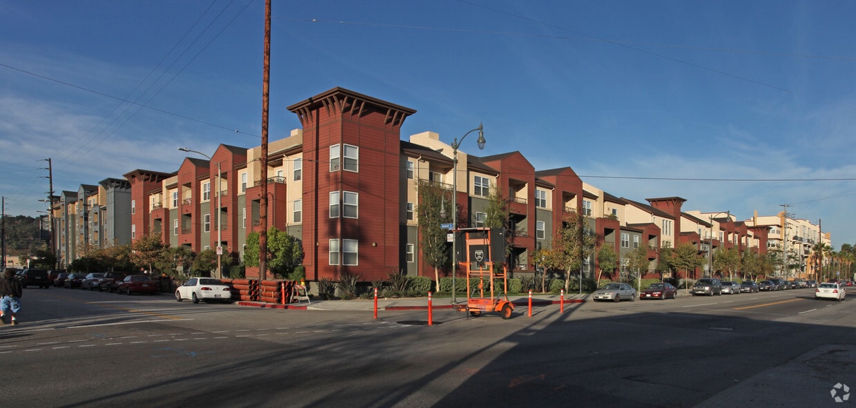
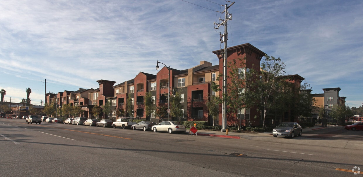
At Camino al Oro in Los Angeles, CA, experience fine living. This community is located on W. Avenue 26 in the 90031 area of Los Angeles. Come for a visit to see the available floorplan options. The leasing team is ready to help you find your perfect floorplan. Life is great at Camino al Oro. Stop by the leasing office to schedule a tour today.
Camino al Oro is an apartment community located in Los Angeles County and the 90031 ZIP Code. This area is served by the Los Angeles Unified attendance zone.
Situated in northeast Los Angeles, just four miles from downtown, Montecito Heights sits atop a hilly landscape separating LA from the San Gabriel Valley. From the neighborhood’s steep hills, you can catch stunning views of downtown and the San Gabriel Valley in addition to the Arroyo Seco and even the Pacific Ocean (on a clear day).
Montecito Heights is known for its secluded feel despite being minutes away from Downtown LA. Natural beauty and lush parks abound in Montecito Heights. Ernest E. Debs Regional Park is one of the neighborhood’s defining features, touting 300 acres of scenic hiking trails, biking paths, picnic tables, a peaceful pond, and the striking panoramic views the neighborhood is revered for.
Montecito Heights is also home to the Heritage Square Museum, a living history museum that details life in 19th-century Southern California.
Learn more about living in Montecito Heights| Colleges & Universities | Distance | ||
|---|---|---|---|
| Colleges & Universities | Distance | ||
| Drive: | 4 min | 1.8 mi | |
| Drive: | 6 min | 3.8 mi | |
| Drive: | 9 min | 4.8 mi | |
| Drive: | 10 min | 4.9 mi |


Transportation options available in Los Angeles include Lincoln Heights/Cypress Park Station, located 0.2 mile from Camino al Oro. Camino al Oro is near Bob Hope, located 15.3 miles or 21 minutes away, and Los Angeles International, located 17.9 miles or 28 minutes away.
| Transit / Subway | Distance | ||
|---|---|---|---|
| Transit / Subway | Distance | ||
|
|
Walk: | 3 min | 0.2 mi |
|
|
Walk: | 16 min | 0.9 mi |
|
|
Drive: | 3 min | 1.8 mi |
|
|
Drive: | 3 min | 2.2 mi |
|
|
Drive: | 7 min | 3.0 mi |
| Commuter Rail | Distance | ||
|---|---|---|---|
| Commuter Rail | Distance | ||
|
|
Drive: | 6 min | 2.8 mi |
|
|
Drive: | 7 min | 3.0 mi |
|
|
Drive: | 7 min | 4.1 mi |
| Drive: | 9 min | 7.0 mi | |
|
|
Drive: | 16 min | 10.5 mi |
| Airports | Distance | ||
|---|---|---|---|
| Airports | Distance | ||
|
Bob Hope
|
Drive: | 21 min | 15.3 mi |
|
Los Angeles International
|
Drive: | 28 min | 17.9 mi |
Time and distance from Camino al Oro.
| Shopping Centers | Distance | ||
|---|---|---|---|
| Shopping Centers | Distance | ||
| Walk: | 5 min | 0.3 mi | |
| Walk: | 5 min | 0.3 mi | |
| Walk: | 7 min | 0.4 mi |
| Parks and Recreation | Distance | ||
|---|---|---|---|
| Parks and Recreation | Distance | ||
|
Audubon Center at Debs Park
|
Drive: | 3 min | 2.0 mi |
|
Chavez Ravine Arboretum
|
Drive: | 4 min | 2.6 mi |
|
Elysian Park
|
Drive: | 7 min | 2.6 mi |
|
Elyria Canyon Park
|
Drive: | 6 min | 2.8 mi |
|
Echo Park Lake
|
Drive: | 5 min | 3.4 mi |
| Hospitals | Distance | ||
|---|---|---|---|
| Hospitals | Distance | ||
| Drive: | 3 min | 1.9 mi | |
| Drive: | 4 min | 2.0 mi | |
| Drive: | 7 min | 3.3 mi |
| Military Bases | Distance | ||
|---|---|---|---|
| Military Bases | Distance | ||
| Drive: | 25 min | 19.5 mi |
What Are Walk Score®, Transit Score®, and Bike Score® Ratings?
Walk Score® measures the walkability of any address. Transit Score® measures access to public transit. Bike Score® measures the bikeability of any address.
What is a Sound Score Rating?
A Sound Score Rating aggregates noise caused by vehicle traffic, airplane traffic and local sources

330 W Avenue 26
Los Angeles, CA 90031


 - Violet on Virgil")

 - AVA Burbank")
