
Williamsburg
200 W Galbraith Rd,
Cincinnati, OH 45215
$850 - $2,554
Studio - 3 Beds

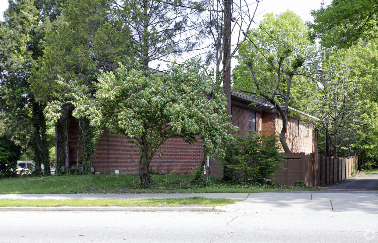

Find your new apartment at Brandywine Way. You'll find this community on Corbly Rd. in Cincinnati. The professional leasing staff will assist you in finding your new home. Stop by the leasing office to schedule your tour.
Brandywine Way is an apartment community located in Hamilton County and the 45230 ZIP Code. This area is served by the Cincinnati Public Schools attendance zone.
As one of the oldest cities in the United States west of the Appalachians, Cincinnati offers residents contemporary urban living in a historic, distinctive setting. One of the oldest cities in the US houses an influential youth culture. Students, professionals, artists, and musicians of all walks of life come to the southwest corner of Ohio to live and work. College and professional sports are wildly popular, with the Bearcats of the University of Cincinnati, the Reds, and the Bengals enjoying huge fan bases in their hometown.
Renters and visitors alike will delight in attractions like the Cincinnati Art Museum, the Newport Aquarium, and the city’s iconic zoo. The annual Oktoberfest is one of the biggest celebrations of its kind outside of Munich, drawing thousands to the streets to celebrate the city’s German heritage.
Learn more about living in Cincinnati| Colleges & Universities | Distance | ||
|---|---|---|---|
| Colleges & Universities | Distance | ||
| Drive: | 18 min | 7.5 mi | |
| Drive: | 16 min | 8.1 mi | |
| Drive: | 20 min | 9.4 mi | |
| Drive: | 20 min | 9.5 mi |


Transportation options available in Cincinnati include Richter & Phillips Station, 6Th & Main, located 9.8 miles from Brandywine Way. Brandywine Way is near Cincinnati/Northern Kentucky International, located 20.5 miles or 36 minutes away.
| Transit / Subway | Distance | ||
|---|---|---|---|
| Transit / Subway | Distance | ||
| Drive: | 19 min | 9.8 mi | |
| Drive: | 18 min | 9.9 mi | |
| Drive: | 19 min | 9.9 mi | |
| Drive: | 19 min | 10.0 mi | |
| Drive: | 19 min | 10.0 mi |
| Commuter Rail | Distance | ||
|---|---|---|---|
| Commuter Rail | Distance | ||
|
|
Drive: | 23 min | 11.8 mi |
| Airports | Distance | ||
|---|---|---|---|
| Airports | Distance | ||
|
Cincinnati/Northern Kentucky International
|
Drive: | 36 min | 20.5 mi |
Time and distance from Brandywine Way.
| Shopping Centers | Distance | ||
|---|---|---|---|
| Shopping Centers | Distance | ||
| Walk: | 9 min | 0.5 mi | |
| Walk: | 9 min | 0.5 mi | |
| Drive: | 6 min | 2.5 mi |
| Parks and Recreation | Distance | ||
|---|---|---|---|
| Parks and Recreation | Distance | ||
|
Stanbery Park
|
Walk: | 6 min | 0.3 mi |
|
Otto Armleder Park
|
Drive: | 8 min | 3.5 mi |
|
Withrow Nature Preserve
|
Drive: | 9 min | 4.0 mi |
|
California Woods Nature Preserve
|
Drive: | 10 min | 4.2 mi |
|
Ault Park
|
Drive: | 11 min | 4.7 mi |
| Hospitals | Distance | ||
|---|---|---|---|
| Hospitals | Distance | ||
| Drive: | 5 min | 2.5 mi | |
| Drive: | 19 min | 9.1 mi | |
| Drive: | 20 min | 9.5 mi |
| Military Bases | Distance | ||
|---|---|---|---|
| Military Bases | Distance | ||
| Drive: | 80 min | 59.2 mi | |
| Drive: | 86 min | 64.2 mi | |
| Drive: | 89 min | 67.5 mi |
What Are Walk Score®, Transit Score®, and Bike Score® Ratings?
Walk Score® measures the walkability of any address. Transit Score® measures access to public transit. Bike Score® measures the bikeability of any address.
What is a Sound Score Rating?
A Sound Score Rating aggregates noise caused by vehicle traffic, airplane traffic and local sources
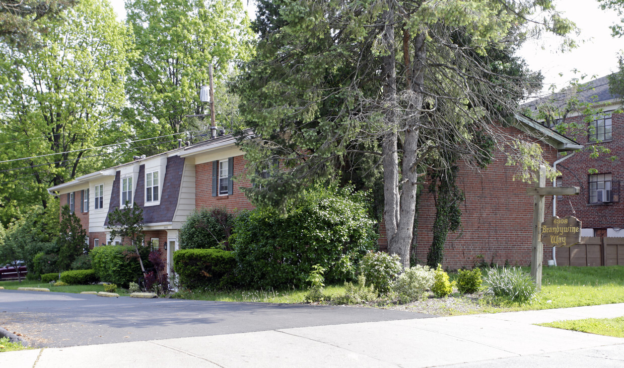
6308 Corbly Rd
Cincinnati, OH 45230


