
Adara
888 N 4th St,
Phoenix, AZ 85004
$773 - $3,400
Studio - 4 Beds
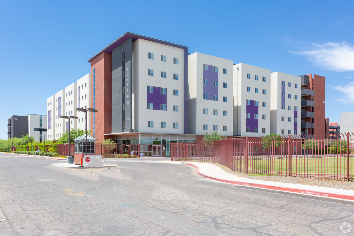

Discover your new apartment at Agave Apartments in Phoenix, AZ. The 5302 N. 30th Dr. location in the Westside neighborhood of Phoenix is perfectly situated for work or play. The professional leasing staff is ready for you to come see our property. Come see Agave Apartments today.
Agave Apartments is an apartment community located in Maricopa County and the 85017 ZIP Code. This area is served by the Alhambra Elementary District attendance zone.
Refrigerator
Oven
Range
Kitchen
Westside is a neighborhood within Glendale, which was voted “Arizona’s Antique Capital” by Sunset magazine and USA Today. Many higher education schools are located near Westside, including Glendale Community College, Carrington College, and Arizona State University West campus. You’ll discover numerous pocket parks in the area, plus larger ones like Glendale Heroes Regional Park and Grand Canal Linear Park. Shopping and dining destinations are plentiful, especially at Arrowhead Towne Center Mall.
Learn more about living in Westside| Colleges & Universities | Distance | ||
|---|---|---|---|
| Colleges & Universities | Distance | ||
| Walk: | 13 min | 0.7 mi | |
| Drive: | 11 min | 4.4 mi | |
| Drive: | 10 min | 5.1 mi | |
| Drive: | 10 min | 5.2 mi |


Transportation options available in Phoenix include Montebello/19Th Ave, located 2.2 miles from Agave Apartments. Agave Apartments is near Phoenix Sky Harbor International, located 12.6 miles or 20 minutes away, and Phoenix-Mesa Gateway, located 39.4 miles or 53 minutes away.
| Transit / Subway | Distance | ||
|---|---|---|---|
| Transit / Subway | Distance | ||
|
|
Drive: | 5 min | 2.2 mi |
|
|
Drive: | 6 min | 2.3 mi |
|
|
Drive: | 7 min | 2.9 mi |
|
|
Drive: | 7 min | 3.1 mi |
|
|
Drive: | 8 min | 3.3 mi |
| Commuter Rail | Distance | ||
|---|---|---|---|
| Commuter Rail | Distance | ||
|
|
Drive: | 53 min | 40.5 mi |
| Airports | Distance | ||
|---|---|---|---|
| Airports | Distance | ||
|
Phoenix Sky Harbor International
|
Drive: | 20 min | 12.6 mi |
|
Phoenix-Mesa Gateway
|
Drive: | 53 min | 39.4 mi |
Time and distance from Agave Apartments.
| Shopping Centers | Distance | ||
|---|---|---|---|
| Shopping Centers | Distance | ||
| Walk: | 14 min | 0.8 mi | |
| Walk: | 16 min | 0.8 mi | |
| Drive: | 3 min | 1.3 mi |
| Parks and Recreation | Distance | ||
|---|---|---|---|
| Parks and Recreation | Distance | ||
|
Maryvale Park
|
Drive: | 9 min | 4.0 mi |
|
Steele Indian School Park
|
Drive: | 11 min | 4.7 mi |
|
Desert Storm Park
|
Drive: | 12 min | 6.0 mi |
|
Japanese Friendship Garden
|
Drive: | 12 min | 6.5 mi |
|
Margaret T. Hance Park
|
Drive: | 13 min | 8.1 mi |
| Hospitals | Distance | ||
|---|---|---|---|
| Hospitals | Distance | ||
| Drive: | 4 min | 1.9 mi | |
| Drive: | 6 min | 2.6 mi | |
| Drive: | 11 min | 5.1 mi |
| Military Bases | Distance | ||
|---|---|---|---|
| Military Bases | Distance | ||
| Drive: | 21 min | 12.5 mi | |
| Drive: | 28 min | 14.6 mi | |
| Drive: | 101 min | 75.9 mi |
What Are Walk Score®, Transit Score®, and Bike Score® Ratings?
Walk Score® measures the walkability of any address. Transit Score® measures access to public transit. Bike Score® measures the bikeability of any address.
What is a Sound Score Rating?
A Sound Score Rating aggregates noise caused by vehicle traffic, airplane traffic and local sources

5302 N 30th Dr
Phoenix, AZ 85017


