
Baxter on Broadway
4901 Broadway,
Oakland, CA 94611
$2,770 - $2,785 Total Monthly Price
Studio - 3 Beds
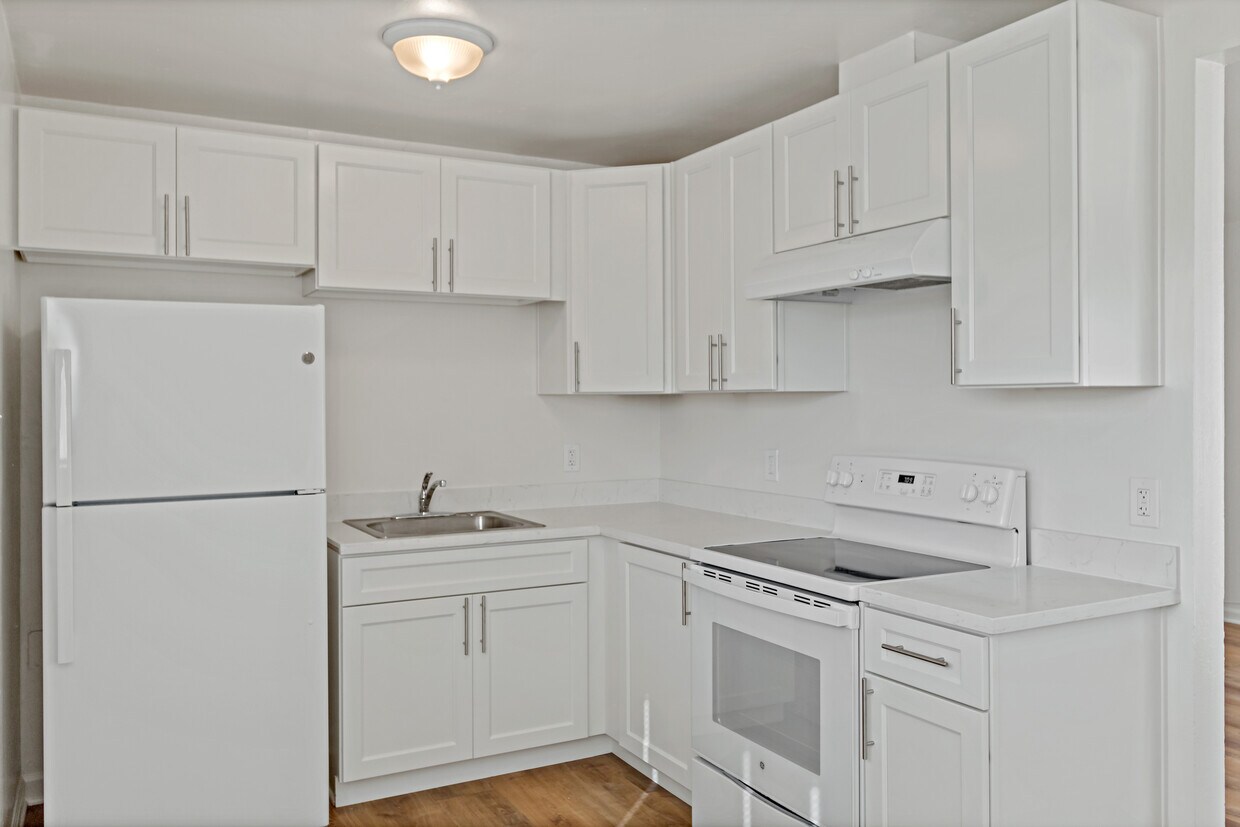

Beautiful freshly painted 2 bedroom apartment and 1 bathroom. This lovely newly remodeled home offers great updates such as new renovated kitchen, new appliances, new flooring, new doors and trims and more!
9833 Walnut St is an apartment community located in Alameda County and the 94603 ZIP Code. This area is served by the Oakland Unified School District attendance zone.
Hardwood Floors
Refrigerator
Range
Kitchen
Oakland sits on the eastern shore of San Francisco Bay, anchored by Lake Merritt—the nation's first official wildlife refuge—and backed by redwood-covered hills that stretch toward the horizon. As the county seat of Alameda County and a major port city, Oakland carries real economic weight in the Bay Area, drawing employers in technology, healthcare, logistics, and the arts. California College of the Arts and Mills College contribute to a strong creative and academic presence that shapes the city's character.
Neighborhoods here cover a wide range of personalities. Rockridge offers tree-lined streets and walkable retail along College Avenue, while Temescal draws those who want a lively, arts-forward atmosphere. Uptown sits close to the historic Fox Theater and Paramount Theatre, and Jack London Square puts residents at the waterfront with ferry access to San Francisco. The Oakland Hills neighborhoods like Montclair offer sweeping Bay views and proximity to regional parks.
Learn more about living in OaklandCompare neighborhood and city base rent averages by bedroom.
| Iveywood | Oakland, CA | |
|---|---|---|
| Studio | $773 | $1,788 |
| 1 Bedroom | $1,248 | $2,166 |
| 2 Bedrooms | $1,436 | $2,784 |
| 3 Bedrooms | $2,496 | $3,321 |
| Colleges & Universities | Distance | ||
|---|---|---|---|
| Colleges & Universities | Distance | ||
| Drive: | 10 min | 3.9 mi | |
| Drive: | 11 min | 7.8 mi | |
| Drive: | 12 min | 8.7 mi | |
| Drive: | 15 min | 9.9 mi |


Transportation options available in Oakland include San Leandro, located 2.2 miles from 9833 Walnut St. 9833 Walnut St is near Metro Oakland International, located 4.0 miles or 7 minutes away, and San Francisco International, located 30.7 miles or 39 minutes away.
| Transit / Subway | Distance | ||
|---|---|---|---|
| Transit / Subway | Distance | ||
|
|
Drive: | 4 min | 2.2 mi |
|
|
Drive: | 4 min | 2.2 mi |
|
|
Drive: | 7 min | 3.7 mi |
|
|
Drive: | 7 min | 4.0 mi |
|
|
Drive: | 9 min | 4.6 mi |
| Commuter Rail | Distance | ||
|---|---|---|---|
| Commuter Rail | Distance | ||
|
|
Drive: | 11 min | 8.1 mi |
|
|
Drive: | 13 min | 9.0 mi |
| Drive: | 13 min | 9.0 mi | |
| Drive: | 18 min | 11.6 mi | |
|
|
Drive: | 19 min | 13.2 mi |
| Airports | Distance | ||
|---|---|---|---|
| Airports | Distance | ||
|
Metro Oakland International
|
Drive: | 7 min | 4.0 mi |
|
San Francisco International
|
Drive: | 39 min | 30.7 mi |
Scores provided by
Traffic
-Airport
-Businesses
-Scores provided by
HowLoud What is a Sound Score Rating? A Sound Score Rating aggregates noise caused by vehicle traffic, airplane traffic and local sources. How It WorksTime and distance from 9833 Walnut St.
| Shopping Centers | Distance | ||
|---|---|---|---|
| Shopping Centers | Distance | ||
| Walk: | 15 min | 0.8 mi | |
| Drive: | 3 min | 1.4 mi |
| Parks and Recreation | Distance | ||
|---|---|---|---|
| Parks and Recreation | Distance | ||
|
Arroyo Viejo Creek at the Oakland Zoo
|
Drive: | 5 min | 1.6 mi |
|
Oakland Zoo
|
Drive: | 6 min | 1.7 mi |
|
Dunsmuir Hellman Historic Estate
|
Drive: | 4 min | 1.8 mi |
|
Martin Luther King Jr. Regional Shoreline
|
Drive: | 7 min | 3.3 mi |
|
Leona Canyon Regional Open Space Preserve
|
Drive: | 11 min | 4.8 mi |
| Hospitals | Distance | ||
|---|---|---|---|
| Hospitals | Distance | ||
| Drive: | 7 min | 4.1 mi | |
| Drive: | 7 min | 4.6 mi | |
| Drive: | 9 min | 5.1 mi |
| Military Bases | Distance | ||
|---|---|---|---|
| Military Bases | Distance | ||
| Drive: | 19 min | 11.5 mi | |
| Drive: | 20 min | 11.7 mi | |
| Drive: | 20 min | 11.7 mi |
Pets Allowed Fitness Center In Unit Washer & Dryer Stainless Steel Appliances Business Center Package Service Elevator
What Are Walk Score®, Transit Score®, and Bike Score® Ratings?
Walk Score® measures the walkability of any address. Transit Score® measures access to public transit. Bike Score® measures the bikeability of any address.
What is a Sound Score Rating?
A Sound Score Rating aggregates noise caused by vehicle traffic, airplane traffic and local sources.

9833 Walnut St
Oakland, CA 94603


