
Venue Residences
3688 Overland Ave,
Los Angeles, CA 90034
$3,550 - $4,795
1-2 Beds
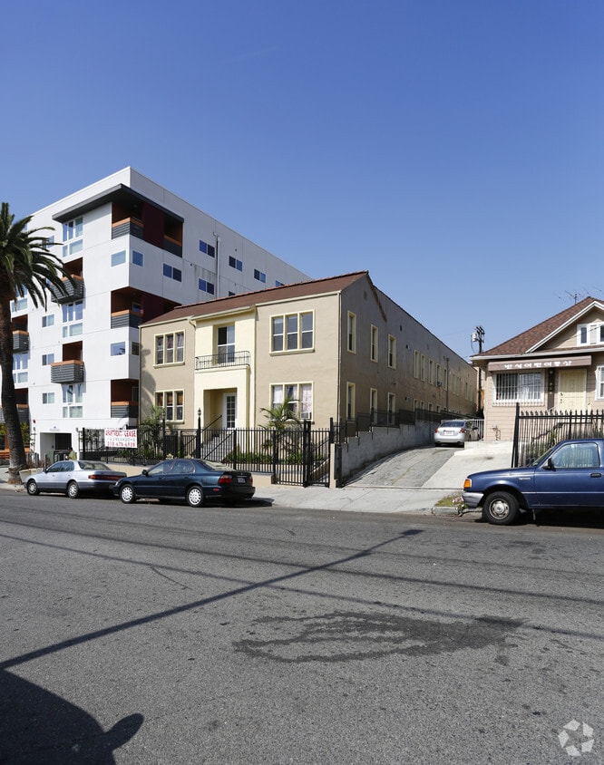
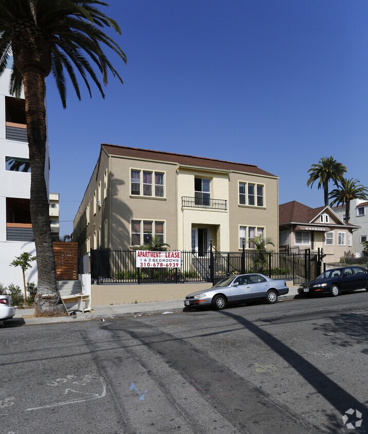


Discover your new apartment at 969 S Serrano Ave. This community is located in the 90006 area of Los Angeles. Choose from 0 to 2 bedroom apartments. The leasing team is eager for you to come see our property. Give us a call now to check the current floor plan availability.
969 S Serrano Ave is an apartment community located in Los Angeles County and the 90006 ZIP Code. This area is served by the Los Angeles Unified Rocp School District attendance zone.
Koreatown is a vibrant LA neighborhood fille with hidden gems, bars, eateries, and a collision of cultures. As the name suggests, the atmosphere in Koreatown is heavily influenced by Korean culture. The neighborhood is a favorite destination among foodies city-wide for its endless selection of authentic Korean restaurants, but the community has a much more diverse character than that: the broad range of cultural influences is exemplified in landmarks like the synagogue and contemporary art gallery of the Wilshire Boulevard Temple, the Latin fusion cuisine of Roy Choi’s restaurants, and the popular German/Korean/Hawaiian tinged gastropub, Biergarten.
Although the area is a hot spot for LA residents’ day trips, Koreatown is known as one of the best places to live in LA. Most locals rent their homes and enjoy parks, coffee shops, and stores within walking distance of their apartments.
Learn more about living in KoreatownCompare neighborhood and city base rent averages by bedroom.
| Koreatown | Los Angeles, CA | |
|---|---|---|
| Studio | $2,007 | $1,712 |
| 1 Bedroom | $2,242 | $2,178 |
| 2 Bedrooms | $2,933 | $3,017 |
| 3 Bedrooms | $3,879 | $4,255 |
| Colleges & Universities | Distance | ||
|---|---|---|---|
| Colleges & Universities | Distance | ||
| Drive: | 3 min | 1.7 mi | |
| Drive: | 6 min | 3.1 mi | |
| Drive: | 6 min | 3.2 mi | |
| Drive: | 6 min | 3.3 mi |


Transportation options available in Los Angeles include Wilshire/Western Station, located 0.7 mile from 969 S Serrano Ave. 969 S Serrano Ave is near Los Angeles International, located 11.8 miles or 22 minutes away, and Bob Hope, located 12.8 miles or 22 minutes away.
| Transit / Subway | Distance | ||
|---|---|---|---|
| Transit / Subway | Distance | ||
|
|
Walk: | 13 min | 0.7 mi |
|
|
Drive: | 2 min | 1.1 mi |
|
|
Drive: | 3 min | 1.8 mi |
|
|
Drive: | 3 min | 2.0 mi |
|
|
Drive: | 4 min | 2.5 mi |
| Commuter Rail | Distance | ||
|---|---|---|---|
| Commuter Rail | Distance | ||
|
|
Drive: | 10 min | 4.8 mi |
|
|
Drive: | 12 min | 5.1 mi |
|
|
Drive: | 14 min | 7.8 mi |
| Drive: | 14 min | 8.9 mi | |
|
|
Drive: | 19 min | 11.5 mi |
| Airports | Distance | ||
|---|---|---|---|
| Airports | Distance | ||
|
Los Angeles International
|
Drive: | 22 min | 11.8 mi |
|
Bob Hope
|
Drive: | 22 min | 12.8 mi |
Scores provided by
Traffic
-Airport
-Businesses
-Scores provided by
HowLoud What is a Sound Score Rating? A Sound Score Rating aggregates noise caused by vehicle traffic, airplane traffic and local sources. How It WorksTime and distance from 969 S Serrano Ave.
| Shopping Centers | Distance | ||
|---|---|---|---|
| Shopping Centers | Distance | ||
| Walk: | 1 min | 0.1 mi | |
| Walk: | 3 min | 0.2 mi | |
| Walk: | 5 min | 0.3 mi |
| Parks and Recreation | Distance | ||
|---|---|---|---|
| Parks and Recreation | Distance | ||
|
MacArthur Park Lake
|
Drive: | 4 min | 2.2 mi |
|
La Brea Tar Pits
|
Drive: | 6 min | 3.4 mi |
|
Natural History Museum of LA County
|
Drive: | 7 min | 3.5 mi |
|
Exposition Park Rose Garden
|
Drive: | 7 min | 3.6 mi |
|
Vista Hermosa Natural Park
|
Drive: | 7 min | 3.8 mi |
| Hospitals | Distance | ||
|---|---|---|---|
| Hospitals | Distance | ||
| Drive: | 4 min | 2.2 mi | |
| Drive: | 4 min | 2.5 mi | |
| Drive: | 5 min | 2.8 mi |
| Military Bases | Distance | ||
|---|---|---|---|
| Military Bases | Distance | ||
| Drive: | 22 min | 13.5 mi |
What Are Walk Score®, Transit Score®, and Bike Score® Ratings?
Walk Score® measures the walkability of any address. Transit Score® measures access to public transit. Bike Score® measures the bikeability of any address.
What is a Sound Score Rating?
A Sound Score Rating aggregates noise caused by vehicle traffic, airplane traffic and local sources.

969 S Serrano Ave
Los Angeles, CA 90006


