
Albion Oak Park
1000 Lake St,
Oak Park, IL 60301
$1,871 - $4,631 Total Monthly Price
Studio - 3 Beds
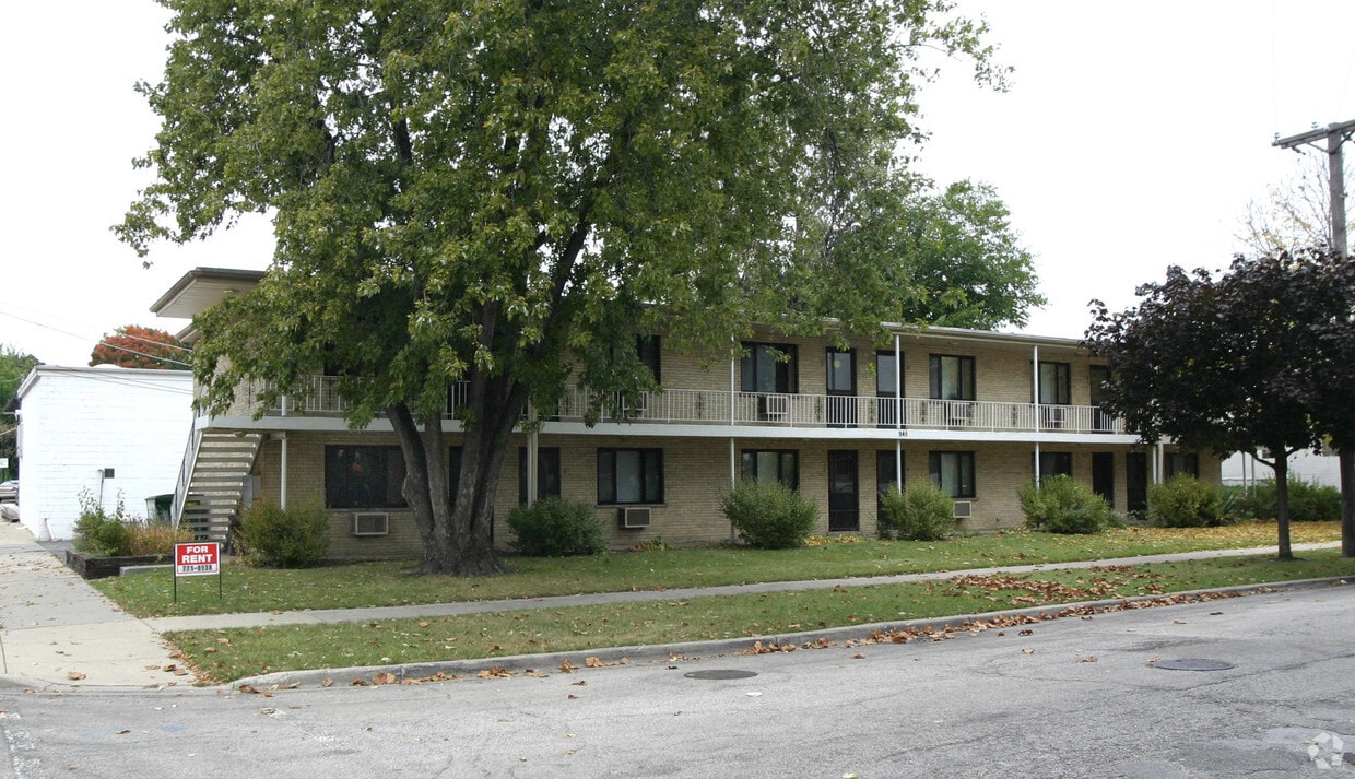
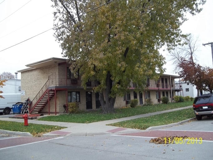

At 945 Troost Ave, you've discovered your new place. This community can be found in Forest Park on Troost Ave in the 60130 area. Here at this community, the professional leasing staff is ready and waiting to help you find your perfect new apartment. Be sure to come for a visit to see the available floorplan options. Stop by the leasing office to find out the current floorplan availability.
945 Troost Ave is an apartment community located in Cook County and the 60130 ZIP Code. This area is served by the Forest Park School District 91 attendance zone.
West Cook is a multicultural neighborhood south of O’Hare International Airport. Golfers in the community enjoy its numerous golf greens, including Oak Park Country Club and Edgewood Valley Country Club.
Public transit abounds in West Cook, attracting renters who wish to live outside the cities in which they work. Residents appreciate the shopping opportunities at Fashion Outlets of Chicago and North Riverside Park Mall.
The Brookfield Zoo is a fun-filled attraction in West Cook which houses hundreds of animals. Locals adore the neighborhood’s lush green spaces – many of which are in walking distance of affordable West Cook apartments. Direct access to Interstate 55 and Interstate 294 makes commuting easy, whether you’re traveling into Chicago or a neighboring state.
Learn more about living in West CookCompare neighborhood and city base rent averages by bedroom.
| West Cook | Forest Park, IL | |
|---|---|---|
| Studio | $922 | $983 |
| 1 Bedroom | $1,124 | $1,237 |
| 2 Bedrooms | $1,403 | $1,708 |
| 3 Bedrooms | $1,586 | $1,277 |
| Colleges & Universities | Distance | ||
|---|---|---|---|
| Colleges & Universities | Distance | ||
| Drive: | 8 min | 2.6 mi | |
| Drive: | 8 min | 3.0 mi | |
| Drive: | 8 min | 3.1 mi | |
| Drive: | 11 min | 4.7 mi |


Transportation options available in Forest Park include Forest Park Station, located 0.5 mile from 945 Troost Ave. 945 Troost Ave is near Chicago Midway International, located 8.8 miles or 17 minutes away, and Chicago O'Hare International, located 13.6 miles or 24 minutes away.
| Transit / Subway | Distance | ||
|---|---|---|---|
| Transit / Subway | Distance | ||
|
|
Walk: | 9 min | 0.5 mi |
|
|
Drive: | 4 min | 1.9 mi |
|
|
Drive: | 4 min | 1.9 mi |
|
|
Drive: | 6 min | 2.3 mi |
|
|
Drive: | 5 min | 2.8 mi |
| Commuter Rail | Distance | ||
|---|---|---|---|
| Commuter Rail | Distance | ||
|
|
Drive: | 5 min | 1.9 mi |
|
|
Drive: | 5 min | 2.0 mi |
|
|
Drive: | 6 min | 2.8 mi |
|
|
Drive: | 8 min | 3.6 mi |
|
|
Drive: | 8 min | 3.7 mi |
| Airports | Distance | ||
|---|---|---|---|
| Airports | Distance | ||
|
Chicago Midway International
|
Drive: | 17 min | 8.8 mi |
|
Chicago O'Hare International
|
Drive: | 24 min | 13.6 mi |
Scores provided by
Traffic
-Airport
-Businesses
-Scores provided by
HowLoud What is a Sound Score Rating? A Sound Score Rating aggregates noise caused by vehicle traffic, airplane traffic and local sources. How It WorksTime and distance from 945 Troost Ave.
| Shopping Centers | Distance | ||
|---|---|---|---|
| Shopping Centers | Distance | ||
| Walk: | 10 min | 0.5 mi | |
| Walk: | 17 min | 0.9 mi | |
| Walk: | 18 min | 1.0 mi |
| Parks and Recreation | Distance | ||
|---|---|---|---|
| Parks and Recreation | Distance | ||
|
Schuth's Grove / Callahan Grove
|
Drive: | 4 min | 1.6 mi |
|
Oak Park Conservatory
|
Drive: | 5 min | 1.7 mi |
|
Andrew Toman Grove
|
Drive: | 6 min | 2.3 mi |
|
Tyrell Trailside Museum / Thatcher Woods
|
Drive: | 6 min | 2.3 mi |
|
Brookfield Zoo
|
Drive: | 8 min | 3.2 mi |
| Hospitals | Distance | ||
|---|---|---|---|
| Hospitals | Distance | ||
| Walk: | 16 min | 0.8 mi | |
| Drive: | 3 min | 1.3 mi | |
| Drive: | 3 min | 1.6 mi |
| Military Bases | Distance | ||
|---|---|---|---|
| Military Bases | Distance | ||
| Drive: | 29 min | 20.3 mi | |
| Drive: | 32 min | 23.7 mi | |
| Drive: | 40 min | 25.3 mi |
What Are Walk Score®, Transit Score®, and Bike Score® Ratings?
Walk Score® measures the walkability of any address. Transit Score® measures access to public transit. Bike Score® measures the bikeability of any address.
What is a Sound Score Rating?
A Sound Score Rating aggregates noise caused by vehicle traffic, airplane traffic and local sources.

945 Troost Ave
Forest Park, IL 60130


