$700
Total Monthly Price
933 Hollytree Dr Unit 4
Cincinnati, OH 45231
Favorites
933 Hollytree Dr Unit 4

Favorites
Check Back Soon for Upcoming Availability
| Beds | Baths | Average SF |
|---|---|---|
| 2 Bedrooms 2 Bedrooms 2 Br | 1 Bath 1 Bath 1 Ba | 750 SF |
Fees and Policies
The fees listed below are community-provided and may exclude utilities or add-ons. All payments are made directly to the property and are non-refundable unless otherwise specified.
- Parking
-
Garage--
Details
Utilities Included
-
Water
-
Heat
-
Trash Removal
-
Sewer
Property Information
-
4 units
About This Property
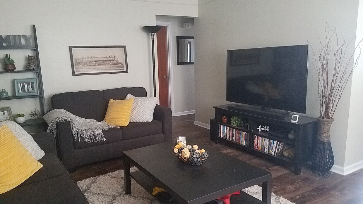
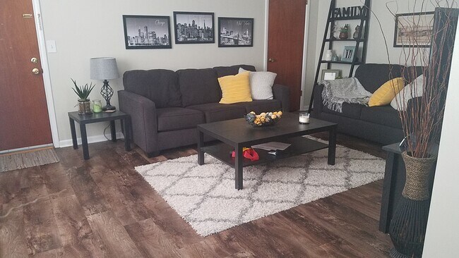
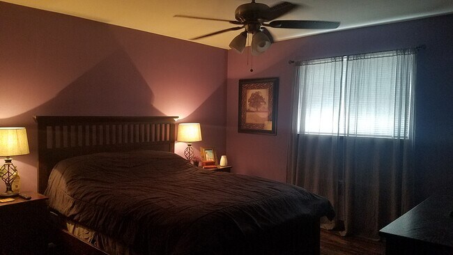
Newly updated apartment with garage (garage opener). Very quiet, pleasant neighbors.
933 Hollytree Dr is an apartment community located in Hamilton County and the 45231 ZIP Code.
Apartment Features
Washer/Dryer
Air Conditioning
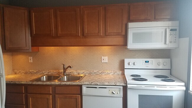
Dishwasher
Microwave
- Washer/Dryer
- Air Conditioning
- Heating
- Smoke Free
- Storage Space
- Dishwasher
- Disposal
- Kitchen
- Microwave
- Oven
- Range
- Refrigerator
- Tile Floors
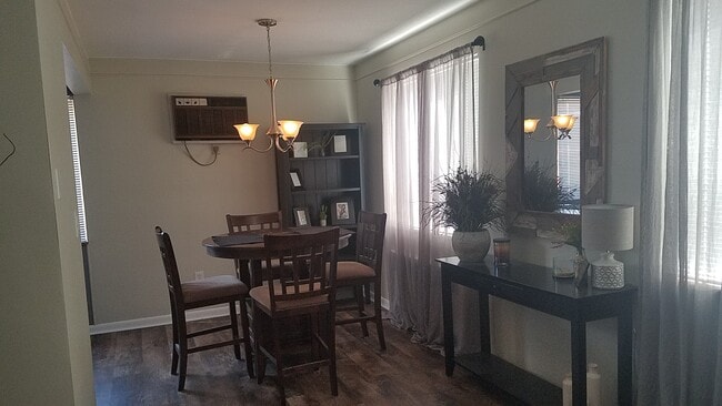
- Dining Room
- Large Bedrooms
- Laundry Facilities
933 Hollytree Dr,
Cincinnati,
OH
45231
Brentwood, a small community located in the northwestern portion of Springfield Township’s Finneytown neighborhood, sits in Hamilton County approximately 16 miles northeast of Downtown Cincinnati. Modest homes from the late 1940s line the tidy streets of the neighborhood, some with attached garages, fenced-in backyards, and private driveways.
Residents appreciate the neighborhood’s homey atmosphere, affordable housing options, and good school system. Also, State Route 126 runs through the southern portion of Brentwood, making it easy for residents to commute to and from Cincinnati.
Learn more about living in BrentwoodBelow are rent ranges for similar nearby apartments
Amenities
- Washer/Dryer
- Air Conditioning
- Heating
- Smoke Free
- Storage Space
- Dishwasher
- Disposal
- Kitchen
- Microwave
- Oven
- Range
- Refrigerator
- Tile Floors
- Dining Room
- Large Bedrooms
- Laundry Facilities
Expenses
Utilities Included
Water, Heat, Trash Removal, Sewer
Included
Education
| Colleges & Universities | Distance | ||
|---|---|---|---|
| Colleges & Universities | Distance | ||
| Drive: | 16 min | 6.6 mi | |
| Drive: | 17 min | 7.3 mi | |
| Drive: | 15 min | 7.7 mi | |
| Drive: | 16 min | 8.6 mi |
933 Hollytree Dr Unit 4 is within 16 minutes or 6.6 miles from Cincinnati State. It is also near Cincinnati State, WDC and Univ. of Cincinnati, Medical.
Transportation options available in Cincinnati include Findlay Market-Race Station - Race & Elder, located 8.2 miles from 933 Hollytree Dr Unit 4. 933 Hollytree Dr Unit 4 is near Cincinnati/Northern Kentucky International, located 24.3 miles or 44 minutes away.
| Transit / Subway | Distance | ||
|---|---|---|---|
| Transit / Subway | Distance | ||
| Drive: | 19 min | 8.2 mi | |
| Drive: | 19 min | 8.3 mi | |
| Drive: | 19 min | 8.3 mi | |
| Drive: | 19 min | 8.4 mi | |
| Drive: | 20 min | 8.7 mi |
| Commuter Rail | Distance | ||
|---|---|---|---|
| Commuter Rail | Distance | ||
|
|
Drive: | 19 min | 10.2 mi |
| Airports | Distance | ||
|---|---|---|---|
| Airports | Distance | ||
|
Cincinnati/Northern Kentucky International
|
Drive: | 44 min | 24.3 mi |
Walkability Near 933 Hollytree Dr Cincinnati, OH 45231
Getting Around
 What do Walkability, Transit, Drivability, and Bikeability mean?
Walkability measures the walking distance to day-to-day needs.
Transit measures access to public transportation.
Drivability measures congestion, parking availability, and access to major roads.
Bikeability measures the suitability for cycling.
How It Works
What do Walkability, Transit, Drivability, and Bikeability mean?
Walkability measures the walking distance to day-to-day needs.
Transit measures access to public transportation.
Drivability measures congestion, parking availability, and access to major roads.
Bikeability measures the suitability for cycling.
How It Works
Moderately Walkable
Walkability
60
/ 100
Limited Public Transit
Transit
30
/ 100
Very Drivable
Drivability
80
/ 100
Fairly Bikeable
Bikeability
40
/ 100
Scores provided by
-
Soundscore™
-
/ 100
Traffic
-Airport
-Businesses
-Scores provided by
HowLoud What is a Sound Score Rating? A Sound Score Rating aggregates noise caused by vehicle traffic, airplane traffic and local sources. How It WorksTime and distance from 933 Hollytree Dr Unit 4.
| Shopping Centers | Distance | ||
|---|---|---|---|
| Shopping Centers | Distance | ||
| Walk: | 1 min | 0.1 mi | |
| Walk: | 3 min | 0.2 mi | |
| Walk: | 3 min | 0.2 mi |
933 Hollytree Dr Unit 4 has 3 shopping centers within 0.2 mile, which is about a 3-minute walk. The miles and minutes will be for the farthest away property.
| Parks and Recreation | Distance | ||
|---|---|---|---|
| Parks and Recreation | Distance | ||
|
Winton Woods Park
|
Drive: | 7 min | 2.6 mi |
|
Caldwell Preserve
|
Drive: | 8 min | 3.6 mi |
|
LaBoiteaux Woods
|
Drive: | 10 min | 4.2 mi |
|
Glenwood Gardens
|
Drive: | 13 min | 5.2 mi |
|
Buttercup Valley
|
Drive: | 13 min | 5.2 mi |
933 Hollytree Dr Unit 4 has 5 parks within 5.2 miles, including Winton Woods Park, Caldwell Preserve, and LaBoiteaux Woods.
| Hospitals | Distance | ||
|---|---|---|---|
| Hospitals | Distance | ||
| Drive: | 8 min | 4.6 mi | |
| Drive: | 14 min | 6.4 mi | |
| Drive: | 16 min | 7.0 mi |
933 Hollytree Dr Unit 4 has 3 hospitals within 7.0 miles, the nearest is Summit Behavioral Healthcare which is 4.6 miles away and a 8 minute drive.
| Military Bases | Distance | ||
|---|---|---|---|
| Military Bases | Distance | ||
| Drive: | 63 min | 48.9 mi | |
| Drive: | 70 min | 53.9 mi | |
| Drive: | 72 min | 57.2 mi |
933 Hollytree Dr Unit 4 has 3 military bases within 57.2 miles, the nearest is Gentile Air Force Station which is 48.9 miles away and a 63 minute drive.
You May Also Like
-
The Farm at Taylor Mill
5142 Old Taylor Mill Rd
Taylor Mill, KY 41015
$1,555 - $1,610
2 Br 14.4 mi
-
Arbors of Anderson
4037 Mt Carmel Tobasco Rd
Cincinnati, OH 45255
$1,395 - $2,295
2-3 Br 15.6 mi
-
Water's Bend
350 Sycamore Ln
South Lebanon, OH 45065
$1,727 - $1,902 Total Monthly Price
2 Br 12 Month Lease 19.2 mi
Similar Rentals Nearby
-
-
-
-
-
-
-
-
-
-
2 Beds$2,039+Total Monthly PriceTotal Monthly Price NewPrices include all required monthly fees.1 Month Free
Pets Allowed Pool In Unit Washer & Dryer Clubhouse Maintenance on site Stainless Steel Appliances


What Are Walk Score®, Transit Score®, and Bike Score® Ratings?
Walk Score® measures the walkability of any address. Transit Score® measures access to public transit. Bike Score® measures the bikeability of any address.
What is a Sound Score Rating?
A Sound Score Rating aggregates noise caused by vehicle traffic, airplane traffic and local sources.

933 Hollytree Dr
Cincinnati, OH 45231