$1,400 Total Monthly Price

930 E 1250 S

,

Ogden, UT 84404

Share Listing
Favorites
  • Bedrooms

    2

  • Bathrooms

    1.5

  • Square Feet

    1,080 sq ft

  • Available

    Available Jul 1

930 E 1250 S
Share Listing
Favorites

Contact

  • Contact
| Edit

Under 30 minutes

Commute Time is calculated at rush hour.
Neighborhood

Canyon Road is a small residential city between Highway 89 and the rugged mountain terrain. The area is largely residential with parks, schools, and convenient amenities dotting the town, and a variety of eateries ranging from fast-food spots to locally owned restaurants are gathered along the highway. Residents enjoy peaceful neighborhoods as well as low-rise apartments with views of the mountains. Thrill seekers have plenty of options for adventure in Canyon Road like hiking through the eastbound mountains at Sardine Peak, Mount Ogden, and De Moisy Peak. Laid-back outdoor activities are provided a few miles east at the Great Salt Lake. Apart from the great outdoors, residents enjoy staying in town to visit community parks, theme parks, and the attractions in Downtown Ogden, located a few minutes south of town.

Learn more about living in Canyon Road 
Education
Colleges & Universities Distance
Drive: 10 min 4.9 mi
Drive: 57 min 43.1 mi
Drive: 58 min 43.7 mi
930 E 1250 S is within 10 minutes or 4.9 miles from Weber State University. It is also near The University of Utah and The Univ. of Utah, Ft Douglas.
Transportation

930 E 1250 S is near Salt Lake City International, located 41.8 miles or 53 minutes away.

Commuter Rail Distance
Drive: 6 min 2.8 mi
Roy
Drive: 15 min 8.3 mi
Drive: 22 min 13.6 mi
Drive: 24 min 16.9 mi
Drive: 29 min 22.3 mi
Airports Distance
Airports Distance
Salt Lake City International
Drive: 53 min 41.8 mi
Getting Around
Fairly Walkable
Walkability
50 / 100
Limited Public Transit
Transit
30 / 100
Very Drivable
Drivability
80 / 100
Fairly Bikeable
Bikeability
40 / 100

Scores provided by

What do Walkability, Transit, Drivability, and Bikeability mean? Walkability measures the walking distance to day-to-day needs. Transit measures access to public transportation. Drivability measures congestion, parking availability, and access to major roads. Bikeability measures the suitability for cycling. How It Works
-
Soundscore
- / 100

Traffic

-

Airport

-

Businesses

-

Scores provided by

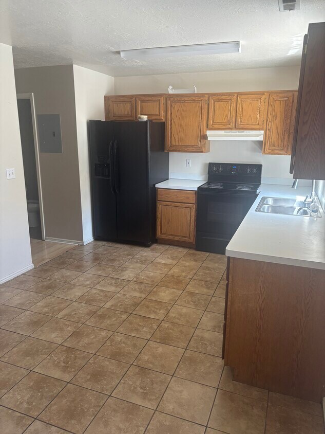
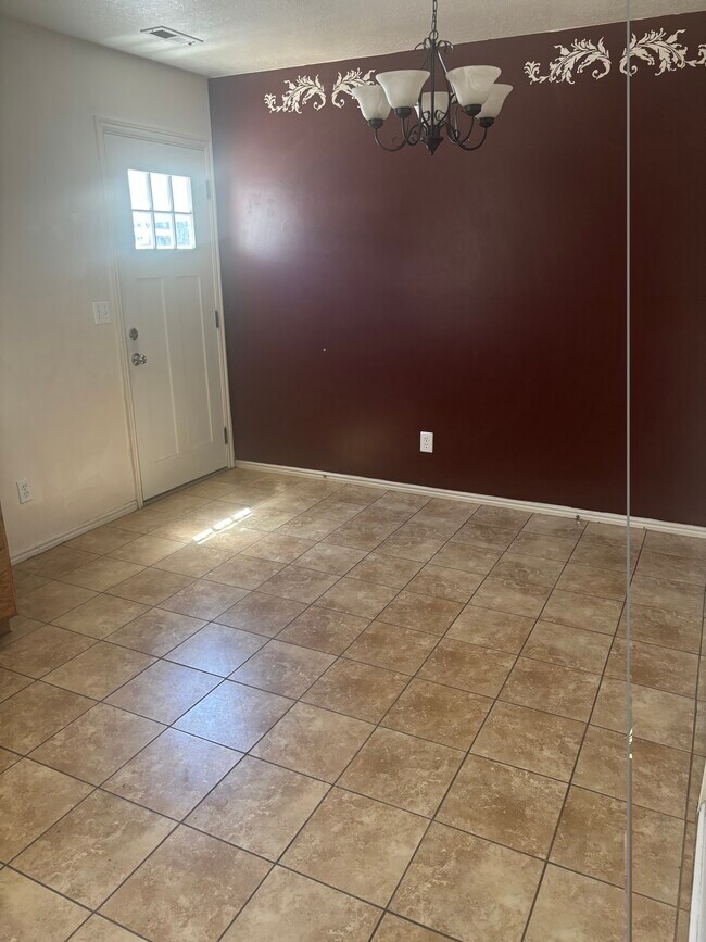
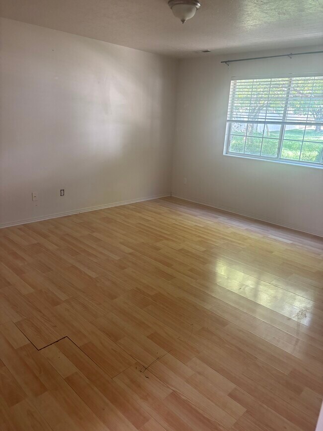
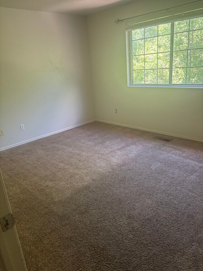
HowLoud What is a Sound Score Rating? A Sound Score Rating aggregates noise caused by vehicle traffic, airplane traffic and local sources. How It Works
Points of Interest

Time and distance from 930 E 1250 S.

Shopping Centers Distance
Walk: 17 min 0.9 mi
Drive: 3 min 1.5 mi
Drive: 3 min 1.5 mi
930 E 1250 S has 3 shopping centers within 1.5 miles, which is about a 3-minute drive. The miles and minutes will be for the farthest away property.
Parks and Recreation Distance
Ogden Nature Center
Drive: 4 min 2.6 mi
Museum of Natural Science
Drive: 9 min 4.5 mi
Ott Planetarium
Drive: 9 min 4.6 mi
Nordic Valley Resort
Drive: 25 min 14.3 mi
Snowbasin
Drive: 29 min 17.6 mi
930 E 1250 S has 5 parks within 17.6 miles, including Ogden Nature Center, Ott Planetarium, and Museum of Natural Science.
Hospitals Distance
Hospitals Distance
Drive: 9 min 4.7 mi
Drive: 12 min 6.5 mi
930 E 1250 S is 4.7 miles from Mckay Dee Hospital, and is convenient to other hospitals, including Ogden Regional Medical Center.
Military Bases Distance
Drive: 8 min 3.7 mi
Drive: 20 min 9.8 mi
Drive: 32 min 15.6 mi
930 E 1250 S has 3 military bases within 15.6 miles, the nearest is Ogden Defence Depot which is 3.7 miles away and a 8 minute drive.