
The Vitagraph
1277 E 14th St,
Brooklyn, NY 11230
$3,389 - $3,802
2-3 Beds
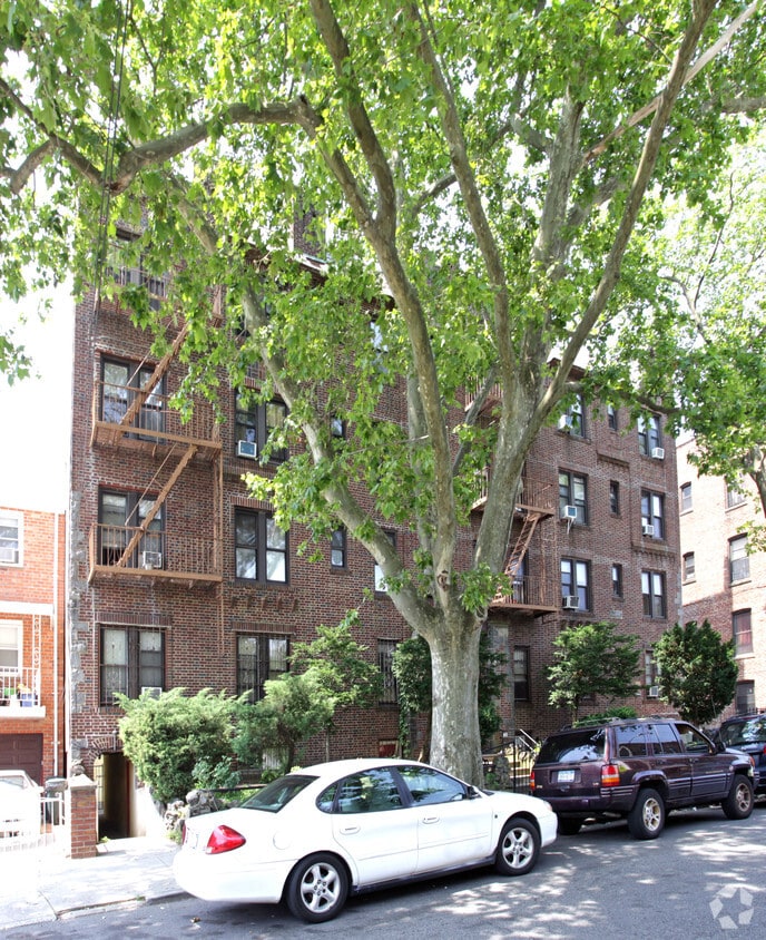
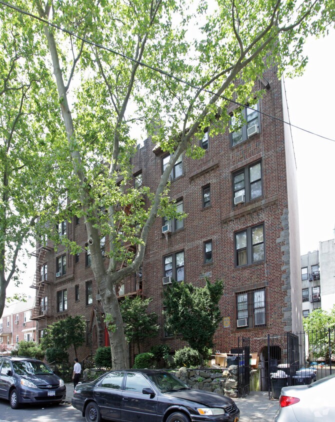

920 72nd St in Brooklyn is ready to be your home. In Brooklyn's 11228 area, moving to this community gives you a variety of nearby experiences to enjoy. Here at this community, the team of leasing professionals is ready to help you find your new home. Be sure to view the available floorplans. Drop by to talk about your next apartment.
920 72nd St is an apartment community located in Kings County and the 11228 ZIP Code. This area is served by the New York City Geographic District #20 attendance zone.
Refrigerator
Tub/Shower
Heating
Oven
Situated in the southwest corner of the bustling borough of Brooklyn in New York City, Dyker Heights is an affluent urban neighborhood that stands out from the rest. Though it’s considered an urban neighborhood, Dyker Heights’ variety of apartments, townhomes, and detached houses for rent give it a somewhat suburban feel, considering more urban neighborhoods in NYC lack detached homes.
Mature trees, community parks, and a family-friendly atmosphere add to the laid-back culture of this neighborhood. As a community-focused area, residents feel safe in their homes and appreciate the walkability of the neighborhood.
With nearby subway and bus stations, as well as proximity to major interstates, Dyker Heights is a great place to live for convenience and commuting purposes. Enjoy athletic fields, tennis courts, open green space, and walking trails at McKinley Park, or visit the popular Dyker Beach Golf Course to practice your swing.
Learn more about living in Dyker Heights| Colleges & Universities | Distance | ||
|---|---|---|---|
| Colleges & Universities | Distance | ||
| Drive: | 12 min | 4.6 mi | |
| Drive: | 12 min | 4.7 mi | |
| Drive: | 12 min | 5.7 mi | |
| Drive: | 11 min | 6.0 mi |


Transportation options available in Brooklyn include Fort Hamilton Parkway (N Line), located 0.6 mile from 920 72nd St. 920 72nd St is near John F Kennedy International, located 15.2 miles or 28 minutes away, and Newark Liberty International, located 20.0 miles or 31 minutes away.
| Transit / Subway | Distance | ||
|---|---|---|---|
| Transit / Subway | Distance | ||
|
|
Walk: | 12 min | 0.6 mi |
|
|
Walk: | 13 min | 0.7 mi |
|
|
Walk: | 16 min | 0.8 mi |
|
|
Walk: | 17 min | 0.9 mi |
|
|
Drive: | 2 min | 1.1 mi |
| Commuter Rail | Distance | ||
|---|---|---|---|
| Commuter Rail | Distance | ||
|
|
Drive: | 10 min | 5.0 mi |
|
|
Drive: | 10 min | 5.4 mi |
|
|
Drive: | 12 min | 6.0 mi |
|
|
Drive: | 14 min | 6.6 mi |
|
|
Drive: | 17 min | 7.2 mi |
| Airports | Distance | ||
|---|---|---|---|
| Airports | Distance | ||
|
John F Kennedy International
|
Drive: | 28 min | 15.2 mi |
|
Newark Liberty International
|
Drive: | 31 min | 20.0 mi |
Time and distance from 920 72nd St.
| Shopping Centers | Distance | ||
|---|---|---|---|
| Shopping Centers | Distance | ||
| Walk: | 5 min | 0.3 mi | |
| Walk: | 18 min | 0.9 mi | |
| Drive: | 3 min | 1.2 mi |
| Parks and Recreation | Distance | ||
|---|---|---|---|
| Parks and Recreation | Distance | ||
|
Dyker Beach Park
|
Drive: | 3 min | 1.3 mi |
|
Owl's Head Park
|
Drive: | 5 min | 1.8 mi |
|
Sunset Park
|
Drive: | 6 min | 2.6 mi |
|
Narrows Botanical Gardens
|
Drive: | 8 min | 3.8 mi |
|
Alice Austen Park
|
Drive: | 9 min | 5.0 mi |
| Hospitals | Distance | ||
|---|---|---|---|
| Hospitals | Distance | ||
| Drive: | 3 min | 1.3 mi | |
| Drive: | 9 min | 4.4 mi | |
| Drive: | 11 min | 4.4 mi |
| Military Bases | Distance | ||
|---|---|---|---|
| Military Bases | Distance | ||
| Drive: | 5 min | 1.9 mi | |
| Drive: | 13 min | 6.2 mi |
What Are Walk Score®, Transit Score®, and Bike Score® Ratings?
Walk Score® measures the walkability of any address. Transit Score® measures access to public transit. Bike Score® measures the bikeability of any address.
What is a Sound Score Rating?
A Sound Score Rating aggregates noise caused by vehicle traffic, airplane traffic and local sources


