
Harbor Point
24 Oyster Bay Rd,
Boston, MA 02125
$2,427 - $4,468 Total Monthly Price
1-3 Beds


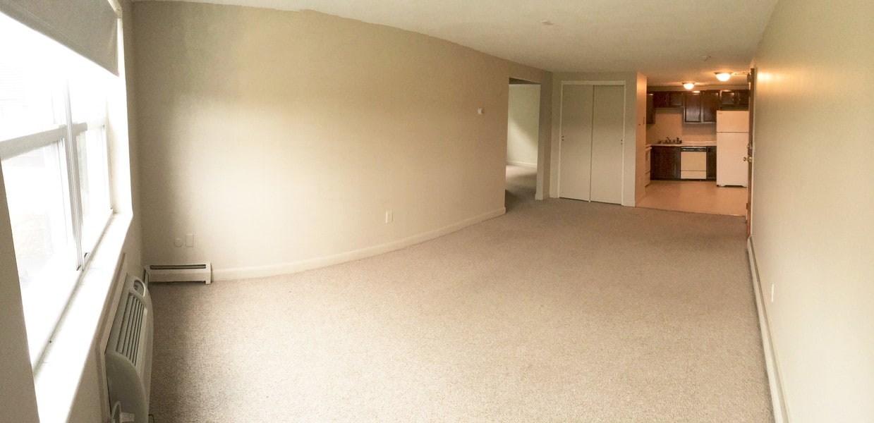
2 bedroom -- 1 Bathroom apartment in quite building walking distance to the North Quincy Redline T-station and the North Quincy High School. Easy access to the highway, Quincy Bay Marina, Boston and Downtown Quincy. Apartments feature: -Heat, Hot Water, and Water & Sewer INCLUDED! -AC in unit -FREE OFF street parking (1 per unit) -Professional management staff -Snow Removal -On-site trash removal -Laundry in Building -Free Storage Units -No Broker FEE
89 E. Squantum Street is an apartment community located in Norfolk County and the 02171 ZIP Code. This area is served by the Quincy School District attendance zone.
Unique Features
Washer/Dryer
Air Conditioning
Dishwasher
Refrigerator
Welcome to Quincy, Massachusetts, a historic coastal city eight miles south of Boston. As the "City of Presidents," Quincy combines centuries of American history with contemporary city living. The rental market remains competitive, with current average rents ranging from $2,252 for studios to $4,758 for four-bedroom units, reflecting modest year-over-year changes between -2.9% and 2% depending on unit size.
Each Quincy neighborhood offers its own distinctive appeal. Marina Bay features waterfront living with a scenic harbor and walking paths, while Wollaston encompasses residential streets alongside international markets and restaurants. The Blue Hills Reservation provides 2,485 acres of protected space for hiking, mountain biking, and seasonal skiing. For commuters, four Red Line T stations offer convenient access to downtown Boston. History enthusiasts can explore significant landmarks including the Adams National Historical Park, home to the birthplaces of two U.S. presidents.
Learn more about living in Quincy| Colleges & Universities | Distance | ||
|---|---|---|---|
| Colleges & Universities | Distance | ||
| Drive: | 9 min | 3.8 mi | |
| Drive: | 11 min | 6.3 mi | |
| Drive: | 12 min | 6.3 mi | |
| Drive: | 12 min | 6.5 mi |


Transportation options available in Quincy include North Quincy Station, located 0.4 mile from 89 E. Squantum Street. 89 E. Squantum Street is near General Edward Lawrence Logan International, located 9.2 miles or 17 minutes away.
| Transit / Subway | Distance | ||
|---|---|---|---|
| Transit / Subway | Distance | ||
|
|
Walk: | 8 min | 0.4 mi |
|
|
Drive: | 3 min | 1.1 mi |
|
|
Drive: | 5 min | 2.5 mi |
|
|
Drive: | 7 min | 3.0 mi |
|
|
Drive: | 7 min | 3.0 mi |
| Commuter Rail | Distance | ||
|---|---|---|---|
| Commuter Rail | Distance | ||
|
|
Drive: | 6 min | 2.3 mi |
|
|
Drive: | 7 min | 3.7 mi |
| Drive: | 10 min | 3.7 mi | |
| Drive: | 8 min | 3.9 mi | |
|
|
Drive: | 8 min | 4.2 mi |
| Airports | Distance | ||
|---|---|---|---|
| Airports | Distance | ||
|
General Edward Lawrence Logan International
|
Drive: | 17 min | 9.2 mi |
Scores provided by
Traffic
-Airport
-Businesses
-Scores provided by
HowLoud What is a Sound Score Rating? A Sound Score Rating aggregates noise caused by vehicle traffic, airplane traffic and local sources. How It WorksTime and distance from 89 E. Squantum Street.
| Shopping Centers | Distance | ||
|---|---|---|---|
| Shopping Centers | Distance | ||
| Walk: | 14 min | 0.7 mi | |
| Walk: | 15 min | 0.8 mi | |
| Drive: | 4 min | 1.8 mi |
| Parks and Recreation | Distance | ||
|---|---|---|---|
| Parks and Recreation | Distance | ||
|
Squantum Point Park
|
Drive: | 6 min | 2.0 mi |
|
Adams National Historical Park
|
Drive: | 6 min | 2.3 mi |
|
Dorchester Shores Reservation
|
Drive: | 8 min | 3.8 mi |
|
Franklin Park Zoo
|
Drive: | 10 min | 5.5 mi |
|
Lower Neponset River Trail
|
Drive: | 10 min | 5.7 mi |
| Hospitals | Distance | ||
|---|---|---|---|
| Hospitals | Distance | ||
| Drive: | 5 min | 2.7 mi | |
| Drive: | 8 min | 3.7 mi | |
| Drive: | 9 min | 5.3 mi |
| Military Bases | Distance | ||
|---|---|---|---|
| Military Bases | Distance | ||
| Drive: | 40 min | 21.5 mi | |
| Drive: | 38 min | 21.7 mi | |
| Drive: | 42 min | 23.9 mi |
Pets Allowed Fitness Center Pool Dishwasher Kitchen In Unit Washer & Dryer
Pets Allowed Fitness Center Dishwasher Refrigerator Kitchen In Unit Washer & Dryer Walk-In Closets
Pets Allowed Fitness Center Pool Dishwasher Refrigerator Kitchen
Pets Allowed Fitness Center Dishwasher Refrigerator Kitchen In Unit Washer & Dryer
Pets Allowed Fitness Center Pool Dishwasher Refrigerator In Unit Washer & Dryer
Fitness Center Pool Clubhouse Balcony Stainless Steel Appliances Granite Countertops Smoke Free
What Are Walk Score®, Transit Score®, and Bike Score® Ratings?
Walk Score® measures the walkability of any address. Transit Score® measures access to public transit. Bike Score® measures the bikeability of any address.
What is a Sound Score Rating?
A Sound Score Rating aggregates noise caused by vehicle traffic, airplane traffic and local sources.
89 E Squantum St
Quincy, MA 02171


