$2,000
Total Monthly Price
88 Red Top Dr
West Hartford, CT 06110
Favorites
301-689-8717
-
Bedrooms
3
-
Bathrooms
1.5
-
Square Feet
1,292 sq ft
-
Available
Available Now
88 Red Top Dr

Favorites
About This Home
Available Now
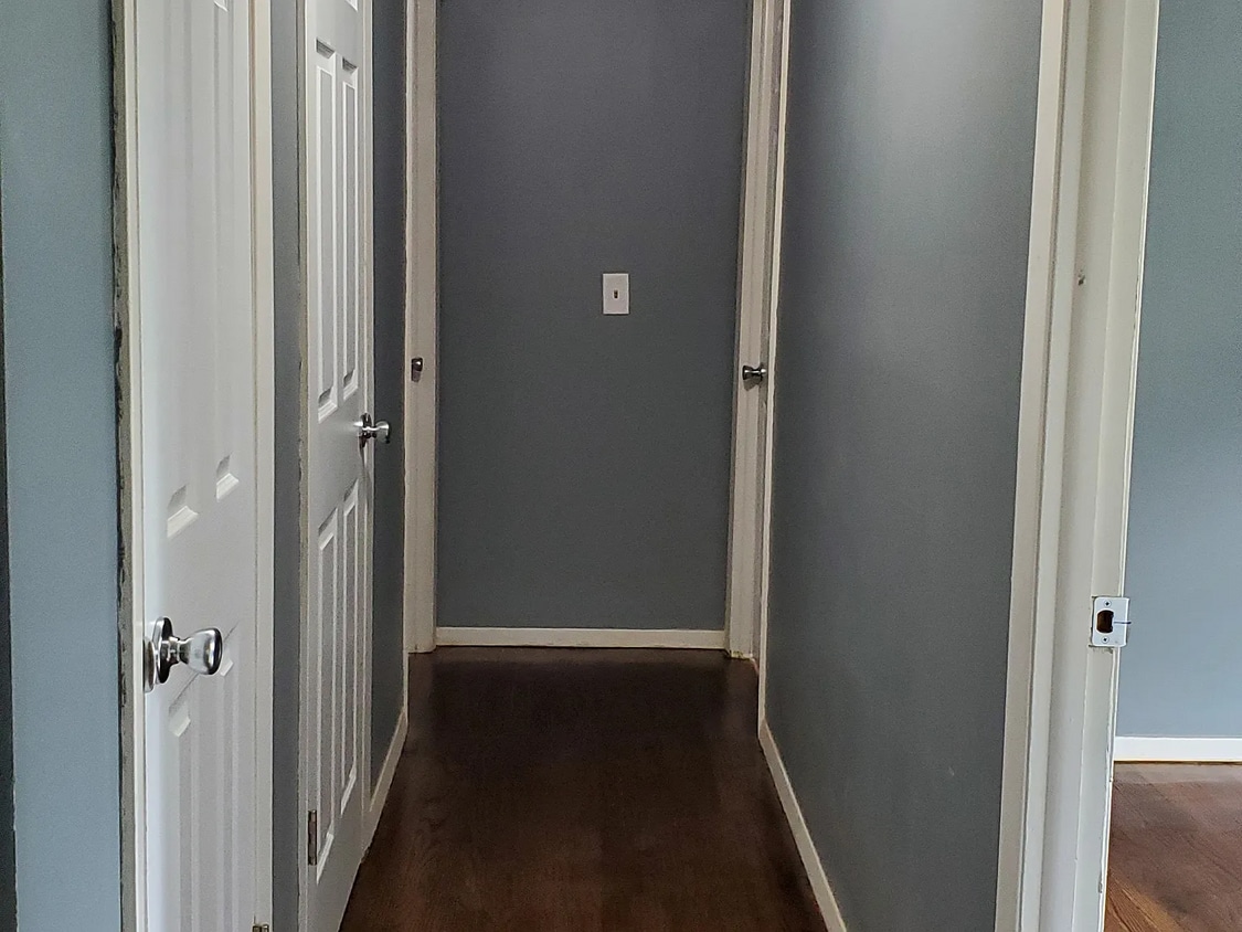
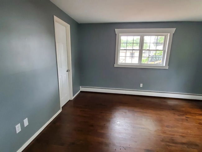
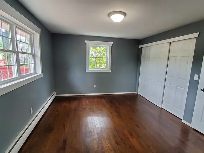
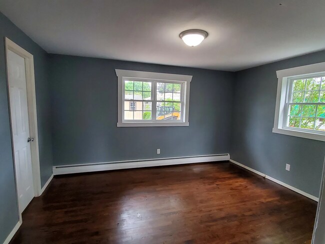
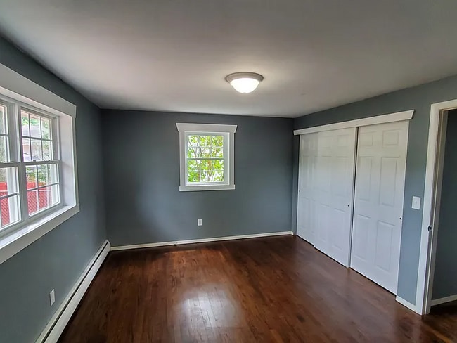
Now available to rent is a charming single-family home, offering two comfortable bedrooms upstairs plus a versatile main level bonus room. This can easily serve as a third bedroom, dining room, or home office. The home includes one and a half baths, making it ideal and comfortable for families. The spacious kitchen provides ample room for cooking and preparing meals, with plenty of storage and counter space. Conveniently, the laundry is located on the main level. Washer and dryer are included for tenant use. Enjoy the ease of off-street parking for one vehicle. Situated in a convenient neighborhood, this home offers both ease and practicality-schedule your tour today!
88 Red Top Dr is an apartment community located in Hartford County and the 06110 ZIP Code.
* Price shown is total price based on community-supplied monthly required fees. Excludes user-selected optional fees and variable or usage-based fees and required charges due at or prior to move-in or at move-out. Price, availability, fees, and any applicable rent special are subject to change without notice.
* Square footage definitions vary. Displayed square footage is approximate.
Features
Air Conditioning
Microwave
Refrigerator
Disposal
- Air Conditioning
- Ceiling Fans
- Fireplace
- Disposal
- Microwave
- Refrigerator
- Carpet
- Patio
- Lawn
Fees and Policies
The fees listed below are community-provided and may exclude utilities or add-ons. All payments are made directly to the property and are non-refundable unless otherwise specified.
Contact
- Listed by S&D Real Estate Services, LLC | S&D Real Estate Services, LLC
- Phone Number
- Contact
Location
Get Directions
Set five miles west of Connecticut's state capital, West Hartford carries the ease of a walkable town with the economic pull of a major metro close by. The University of Hartford and the University of Saint Joseph both anchor the town, lending it a steady academic presence alongside the government, insurance, and healthcare sectors concentrated in Hartford. West Hartford Center, built around Farmington Avenue and Main Street, has served as the commercial core since the late 17th century and still draws people with its mix of independent shops, theaters, and outdoor dining. Neighborhoods like Elmwood, Bishops Corner, and the Asylum Avenue corridor each have their own character, from tree-lined residential streets to areas with quick highway and transit access. Elizabeth Park, home to the oldest public rose garden in the country, sits on the town's northeastern edge and anchors an active outdoor scene year-round.
Learn more about living in West Hartford
Amenities
- Air Conditioning
- Ceiling Fans
- Fireplace
- Disposal
- Microwave
- Refrigerator
- Carpet
- Patio
- Lawn
Education
| Colleges & Universities | Distance | ||
|---|---|---|---|
| Colleges & Universities | Distance | ||
| Drive: | 8 min | 3.1 mi | |
| Drive: | 9 min | 4.1 mi | |
| Drive: | 11 min | 4.7 mi | |
| Drive: | 11 min | 5.0 mi |
88 Red Top Dr is within 8 minutes or 3.1 miles from Central Connecticut. It is also near Charter Oak College and Trinity College.
Getting Around
 What do Walkability, Transit, Drivability, and Bikeability mean?
Walkability measures the walking distance to day-to-day needs.
Transit measures access to public transportation.
Drivability measures congestion, parking availability, and access to major roads.
Bikeability measures the suitability for cycling.
How It Works
What do Walkability, Transit, Drivability, and Bikeability mean?
Walkability measures the walking distance to day-to-day needs.
Transit measures access to public transportation.
Drivability measures congestion, parking availability, and access to major roads.
Bikeability measures the suitability for cycling.
How It Works
Somewhat Walkable
Walkability
30
/ 100
Limited Public Transit
Transit
20
/ 100
Exceptionally Drivable
Drivability
100
/ 100
Fairly Bikeable
Bikeability
50
/ 100
Scores provided by
-
Soundscore™
-
/ 100
Traffic
-Airport
-Businesses
-Scores provided by
HowLoud What is a Sound Score Rating? A Sound Score Rating aggregates noise caused by vehicle traffic, airplane traffic and local sources. How It WorksYou May Also Like
-
The Preserve at Great Pond
100 Lexington St
Windsor, CT 06095
$3,470 Total Monthly Price
3 Br 12 Month Lease 11.0 mi
-
Springside Middletown
1100 Springside Ln
Middletown, CT 06457
Call for Rent
3 Br 12 Month Lease 11.3 mi
-
The Pavilions
345 Buckland Hills Dr
Manchester, CT 06042
$2,526 - $2,766 Total Monthly Price
3 Br 12.5 mi
Similar Rentals Nearby
-
-
1 / 6
 3 Beds$6,045Total Monthly Price12 Month LeaseTotal Monthly Price NewPrices include required monthly fees of $25.Base Rent:3 Beds$6,020Specials
Pets Allowed Fitness Center Pool Dishwasher Refrigerator Kitchen
-
-
1 / 25
 3 Beds$2,724+Total Monthly Price12 Month LeaseTotal Monthly Price NewPrices include base rent and required monthly fees of $30. Variable costs based on usage may apply.Base Rent:3 Beds$2,694+1 Month Free
Pets Allowed Fitness Center In Unit Washer & Dryer Clubhouse Stainless Steel Appliances Elevator EV Charging
-
3 Beds$3,164Total Monthly Price12 Month LeaseTotal Monthly Price NewPrices include base rent and required monthly fees. Variable costs based on usage may apply.
Pets Allowed In Unit Washer & Dryer Heat Tub / Shower
-
-
3 Beds$4,550+Total Monthly Price12 Month LeaseTotal Monthly Price NewPrices include required monthly fees of $75.Base Rent:3 Beds$4,475+Specials
Pets Allowed Fitness Center Pool In Unit Washer & Dryer Elevator
-
-
3 Beds$3,700+Total Monthly PriceTotal Monthly Price NewPrices include base rent and required monthly fees. Variable costs based on usage may apply.
Pets Allowed Fitness Center Pool Dishwasher Refrigerator Kitchen
-


What Are Walk Score®, Transit Score®, and Bike Score® Ratings?
Walk Score® measures the walkability of any address. Transit Score® measures access to public transit. Bike Score® measures the bikeability of any address.
What is a Sound Score Rating?
A Sound Score Rating aggregates noise caused by vehicle traffic, airplane traffic and local sources.

88 Red Top Dr
West Hartford, CT 06110