

$1,755
/ Month
8619 Running Bird Ln
Missouri City, TX 77489
2 Weeks Ago
|
Edit
Favorites
8619 Running Bird Ln

Favorites
Check Back Soon for Upcoming Availability
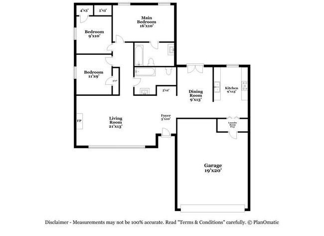
| Beds | Baths | Average SF |
|---|---|---|
| 3 Bedrooms 3 Bedrooms 3 Br | 2 Baths 2 Baths 2 Ba | — |
Fees and Policies
The fees below are based on community-supplied data and may exclude additional fees and utilities.
- Parking
-
Garage--
Details
Lease Options
-
12 Months
About This Property
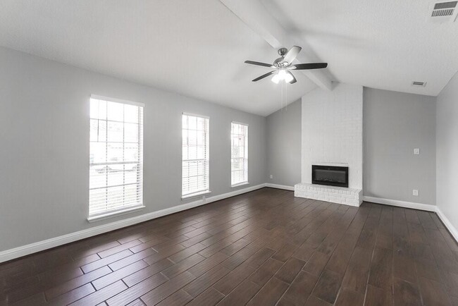
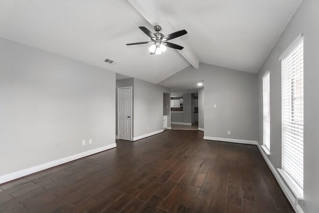
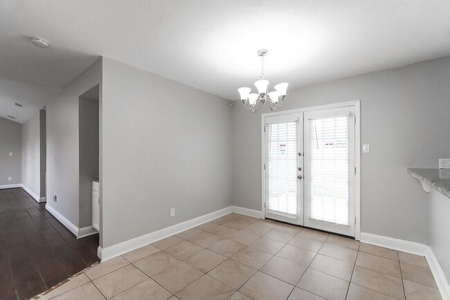
This home features a smart home app, which allows you to control the home securely from any of your devices. Like all our homes, this one features: a great location, a comfortable layout with good-sized bedrooms and bathrooms, a great kitchen with plenty of counter and cabinet space, many updated and upgraded features, central HVAC and programmable thermostat, and a spacious yard, and it's pet friendly.
8619 Running Bird Ln is a house located in Fort Bend County and the 77489 ZIP Code. This area is served by the Fort Bend Independent attendance zone.
House Features
- Smoke Free
- Dishwasher
- Disposal
Location
Get Directions
A tight-knit residential community in Missouri City, Quail Valley is known for its expansive golf courses, recreation centers, and welcoming neighbors. The well-maintained streets of Quail Valley are filled with a variety of upscale apartments, condos, houses, and townhomes that will fit any renter’s needs. Quail Valley’s community park offers a scenic outdoor reprieve with ponds, playgrounds, piers, sports fields, and an outdoor amphitheater.
This safe neighborhood sits near both Missouri City and Sugar Land, and is located about 22 miles southwest of Houston. Residents who play to commute can hop onto Highway 90, Interstate 610, and Highway 288 to get to downtown. This golf course community offers a laidback vibe with plenty of outdoor recreational opportunities.
Learn more about living in Quail ValleyBelow are rent ranges for similar nearby apartments
Amenities
- Smoke Free
- Dishwasher
- Disposal
Education
| Colleges & Universities | Distance | ||
|---|---|---|---|
| Colleges & Universities | Distance | ||
| Drive: | 18 min | 9.3 mi | |
| Drive: | 19 min | 9.5 mi | |
| Drive: | 18 min | 12.3 mi | |
| Drive: | 20 min | 13.5 mi |
8619 Running Bird Ln is within 18 minutes or 9.3 miles from Houston Christian University. It is also near Houston Baptist University and UT Health Houston.
Schools


Public Elementary School
Grades K-5
263 Students
Attendance Zone
Public Middle School
Grades 6-8
835 Students
Attendance Zone
Public Middle & High School
Grades 8-12
1,319 Students
Attendance Zone
Private Elementary & Middle School
Grades PK-7
232 Students
Nearby
Private Elementary & Middle School
Grades PK-8
31 Students
Nearby
Private High School
Grades 9-12
Nearby
School data provided by
 The GreatSchools Rating helps parents compare schools within a state based on a variety of school quality indicators and provides a helpful picture of how effectively each school serves all of its students. Ratings are on a scale of 1 (below average) to 10 (above average) and can include test scores, college readiness, academic progress, advanced courses, equity, discipline and attendance data. We also advise parents to visit schools, consider other information on school performance and programs, and consider family needs as part of the school selection process.
View GreatSchools Rating Methodology
Data provided by GreatSchools.org © 2025. All rights reserved.
View GreatSchools Rating Methodology
Data provided by GreatSchools.org © 2025. All rights reserved.
Transportation options available in Missouri City include Fannin South, located 11.2 miles from 8619 Running Bird Ln. 8619 Running Bird Ln is near William P Hobby, located 19.6 miles or 31 minutes away, and George Bush Intcntl/Houston, located 35.7 miles or 50 minutes away.
| Transit / Subway | Distance | ||
|---|---|---|---|
| Transit / Subway | Distance | ||
|
|
Drive: | 16 min | 11.2 mi |
| Commuter Rail | Distance | ||
|---|---|---|---|
| Commuter Rail | Distance | ||
|
|
Drive: | 29 min | 19.6 mi |
| Airports | Distance | ||
|---|---|---|---|
| Airports | Distance | ||
|
William P Hobby
|
Drive: | 31 min | 19.6 mi |
|
George Bush Intcntl/Houston
|
Drive: | 50 min | 35.7 mi |
Time and distance from 8619 Running Bird Ln.
| Shopping Centers | Distance | ||
|---|---|---|---|
| Shopping Centers | Distance | ||
| Walk: | 13 min | 0.7 mi | |
| Walk: | 18 min | 0.9 mi | |
| Drive: | 2 min | 1.3 mi |
8619 Running Bird Ln has 3 shopping centers within 1.3 miles, which is about a 2-minute drive. The miles and minutes will be for the farthest away property.
| Parks and Recreation | Distance | ||
|---|---|---|---|
| Parks and Recreation | Distance | ||
|
Galveston Island State Park
|
Drive: | 15 min | 9.2 mi |
|
Nature Discovery Center
|
Drive: | 17 min | 10.8 mi |
|
Club Creek Park and Vietnam Veterans Memorial
|
Drive: | 16 min | 11.0 mi |
|
Arthur Storey Park
|
Drive: | 18 min | 12.1 mi |
8619 Running Bird Ln has 4 parks within 12.1 miles, including Galveston Island State Park, Club Creek Park and Vietnam Veterans Memorial, and Arthur Storey Park.
| Hospitals | Distance | ||
|---|---|---|---|
| Hospitals | Distance | ||
| Drive: | 15 min | 8.0 mi | |
| Drive: | 13 min | 8.1 mi | |
| Drive: | 15 min | 8.2 mi |
8619 Running Bird Ln has 3 hospitals within 8.2 miles, the nearest is St Luke's Sugar Land Hospital which is 8.0 miles away and a 15 minute drive.
| Military Bases | Distance | ||
|---|---|---|---|
| Military Bases | Distance | ||
| Drive: | 44 min | 31.7 mi | |
| Drive: | 72 min | 57.3 mi |
8619 Running Bird Ln is 31.7 miles from Lyndon B Johnson Space Center, and is convenient to other military bases, including Pelican Spit Military Reservation.
You May Also Like
Similar Rentals Nearby
-
-

-

-

-
-
-
-
-
-
1 / 37


What Are Walk Score®, Transit Score®, and Bike Score® Ratings?
Walk Score® measures the walkability of any address. Transit Score® measures access to public transit. Bike Score® measures the bikeability of any address.
What is a Sound Score Rating?
A Sound Score Rating aggregates noise caused by vehicle traffic, airplane traffic and local sources
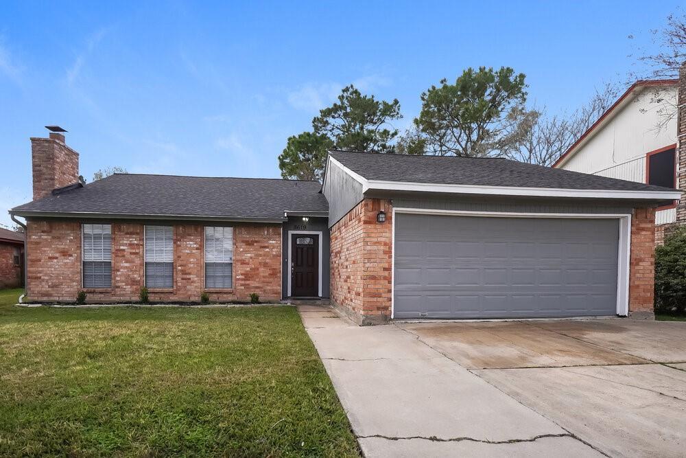
8619 Running Bird Ln
Missouri City, TX 77489