
$1,095
/ Month
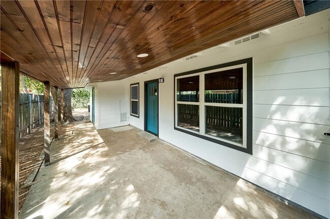
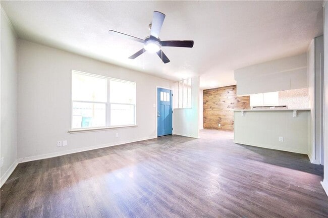
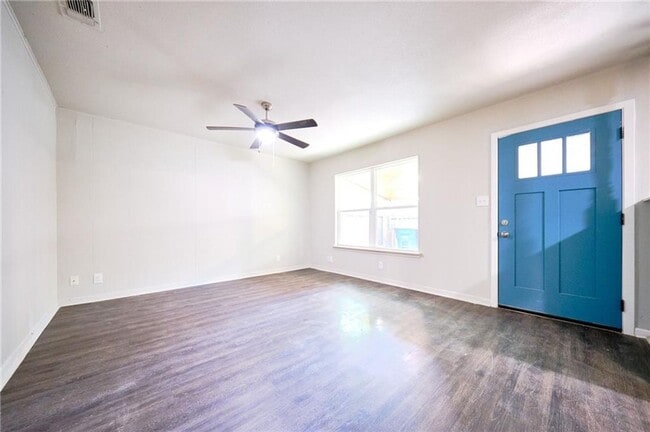
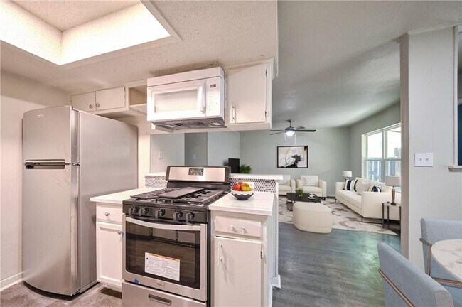
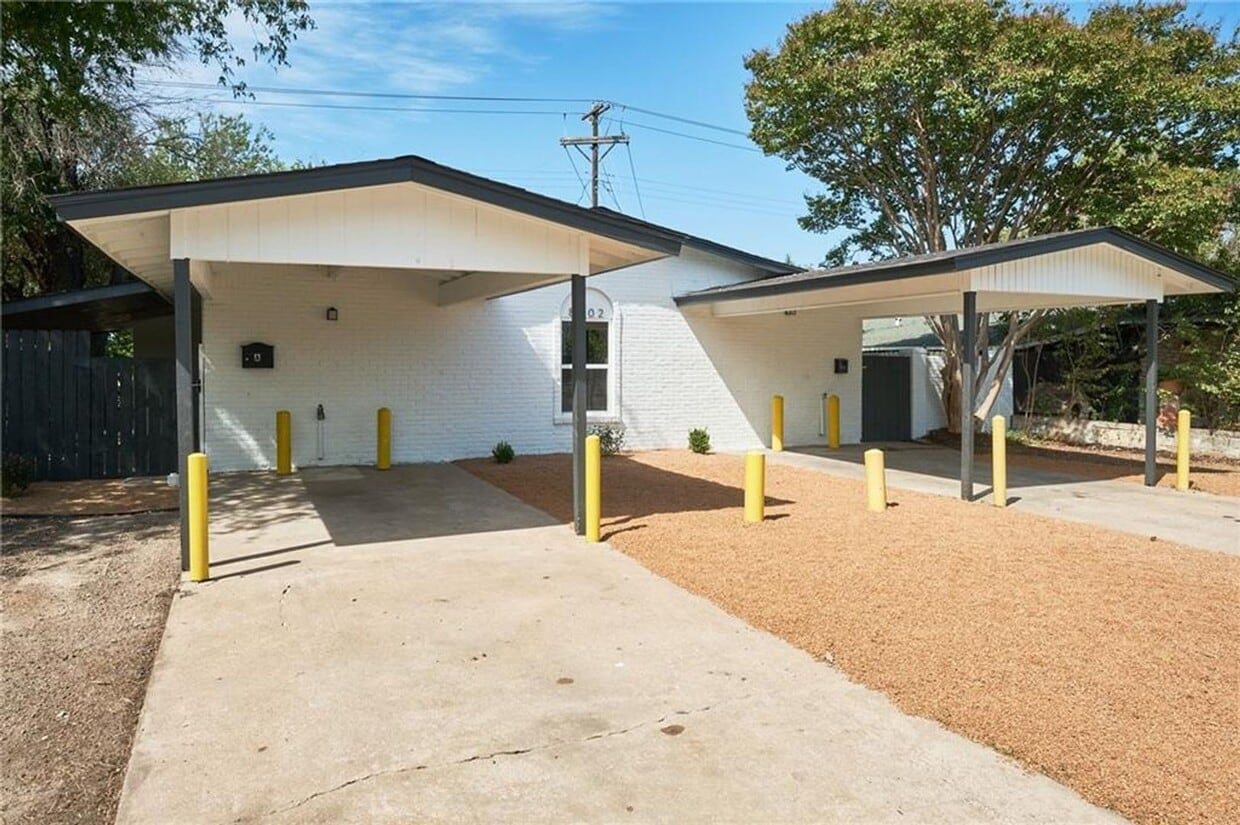
8602 Fireside Dr Unit -A
Austin, TX 78757
Today
|
Edit
Favorites
512-504-7414
-
Bedrooms
3
-
Bathrooms
1
-
Square Feet
875 sq ft
-
Available
Available Now
8602 Fireside Dr Unit -A

Favorites
Fees and Policies
The fees below are based on community-supplied data and may exclude additional fees and utilities.
-
One-Time Basics
-
Due at Move-In
-
Security Deposit - RefundableCharged per unit.$1,095
-
-
Due at Move-In
Property Fee Disclaimer: Based on community-supplied data and independent market research. Subject to change without notice. May exclude fees for mandatory or optional services and usage-based utilities.
Contact
- Listed by Treaty | Treaty Oak Property Management, LLC
- Phone Number
- Contact
Location
Get Directions
The northern Austin neighborhood of Wooten is bordered on its east side by Highway 183. It is a compact, suburban neighborhood with plenty of shops and restaurants along the highway as well as along Burnet Road. Wooten has one small park, Wooten Neighborhood Park, next to Wooten Elementary School. Wooten is east of North Shoal Creek and north of Crestview, roughly seven miles north of Downtown Austin and six miles north of the University of Texas at Austin.
A cozy, family-friendly neighborhood with good schools and a strong sense of community, many choose Wooten apartments because they are relatively close to downtown but offer a much more residential, peaceful atmosphere. Wooten is fast-growing, diverse, and still relatively affordable. Favorite neighborhood restaurants include Mi Tradicion, P. Terry’s Burger Stand, and Shu Shu’s Asian Cuisine.
Learn more about living in Wooten
Education
| Colleges & Universities | Distance | ||
|---|---|---|---|
| Colleges & Universities | Distance | ||
| Drive: | 8 min | 3.6 mi | |
| Drive: | 12 min | 7.1 mi | |
| Drive: | 14 min | 8.6 mi | |
| Drive: | 16 min | 8.6 mi |
8602 Fireside Dr Unit -A is within 8 minutes or 3.6 miles from Austin C.C., Northridge Campus. It is also near University of Texas at Austin and Austin C.C., Rio Grande Campus.
Transportation options available in Austin include Crestview Station, located 2.5 miles from 8602 Fireside Dr Unit -A. 8602 Fireside Dr Unit -A is near Austin-Bergstrom International, located 18.6 miles or 30 minutes away.
| Transit / Subway | Distance | ||
|---|---|---|---|
| Transit / Subway | Distance | ||
| Drive: | 6 min | 2.5 mi | |
| Drive: | 6 min | 2.5 mi | |
| Drive: | 7 min | 2.9 mi | |
| Drive: | 7 min | 3.2 mi | |
| Drive: | 12 min | 7.4 mi |
| Commuter Rail | Distance | ||
|---|---|---|---|
| Commuter Rail | Distance | ||
|
|
Drive: | 17 min | 9.8 mi |
|
|
Drive: | 41 min | 31.5 mi |
| Airports | Distance | ||
|---|---|---|---|
| Airports | Distance | ||
|
Austin-Bergstrom International
|
Drive: | 30 min | 18.6 mi |
Time and distance from 8602 Fireside Dr Unit -A.
| Shopping Centers | Distance | ||
|---|---|---|---|
| Shopping Centers | Distance | ||
| Walk: | 7 min | 0.4 mi | |
| Walk: | 7 min | 0.4 mi | |
| Drive: | 4 min | 1.5 mi |
8602 Fireside Dr Unit -A has 3 shopping centers within 1.5 miles, which is about a 4-minute drive. The miles and minutes will be for the farthest away property.
| Parks and Recreation | Distance | ||
|---|---|---|---|
| Parks and Recreation | Distance | ||
|
Beverly S. Sheffield Northwest District Park
|
Drive: | 7 min | 2.6 mi |
|
The Stephen F. Austin Planetarium
|
Drive: | 8 min | 3.5 mi |
|
Balcones District Park
|
Drive: | 9 min | 4.4 mi |
|
Bull Creek Greenbelt
|
Drive: | 9 min | 4.7 mi |
|
Walnut Creek Park
|
Drive: | 9 min | 4.9 mi |
8602 Fireside Dr Unit -A has 5 parks within 4.9 miles, including Beverly S. Sheffield Northwest District Park, The Stephen F. Austin Planetarium, and Balcones District Park.
| Hospitals | Distance | ||
|---|---|---|---|
| Hospitals | Distance | ||
| Drive: | 8 min | 3.3 mi | |
| Drive: | 7 min | 4.0 mi | |
| Drive: | 8 min | 4.2 mi |
8602 Fireside Dr Unit -A has 3 hospitals within 4.2 miles, the nearest is Northwest Hills Surgical Hospital which is 3.3 miles away and a 8 minute drive.
| Military Bases | Distance | ||
|---|---|---|---|
| Military Bases | Distance | ||
| Drive: | 87 min | 69.6 mi | |
| Drive: | 91 min | 73.9 mi |
8602 Fireside Dr Unit -A is 69.6 miles from Fort Hood, and is convenient to other military bases, including Randolph Air Force Base.
You May Also Like
Similar Rentals Nearby


What Are Walk Score®, Transit Score®, and Bike Score® Ratings?
Walk Score® measures the walkability of any address. Transit Score® measures access to public transit. Bike Score® measures the bikeability of any address.
What is a Sound Score Rating?
A Sound Score Rating aggregates noise caused by vehicle traffic, airplane traffic and local sources
8602 Fireside Dr
Austin, TX 78757