
$2,200
/ Month
8519 Church Light Ln
Houston, TX 77064
1 Day Ago
|
Edit
Favorites
713-340-6860
-
Bedrooms
3
-
Bathrooms
3
-
Square Feet
1,878 sq ft
-
Available
Available Now
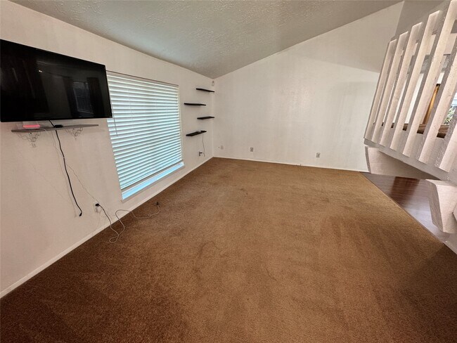
Highlights
- 1 Fireplace
- 2 Car Attached Garage
- Central Heating and Cooling System
- Patio Home
8519 Church Light Ln

Favorites
About This Home
Available Now
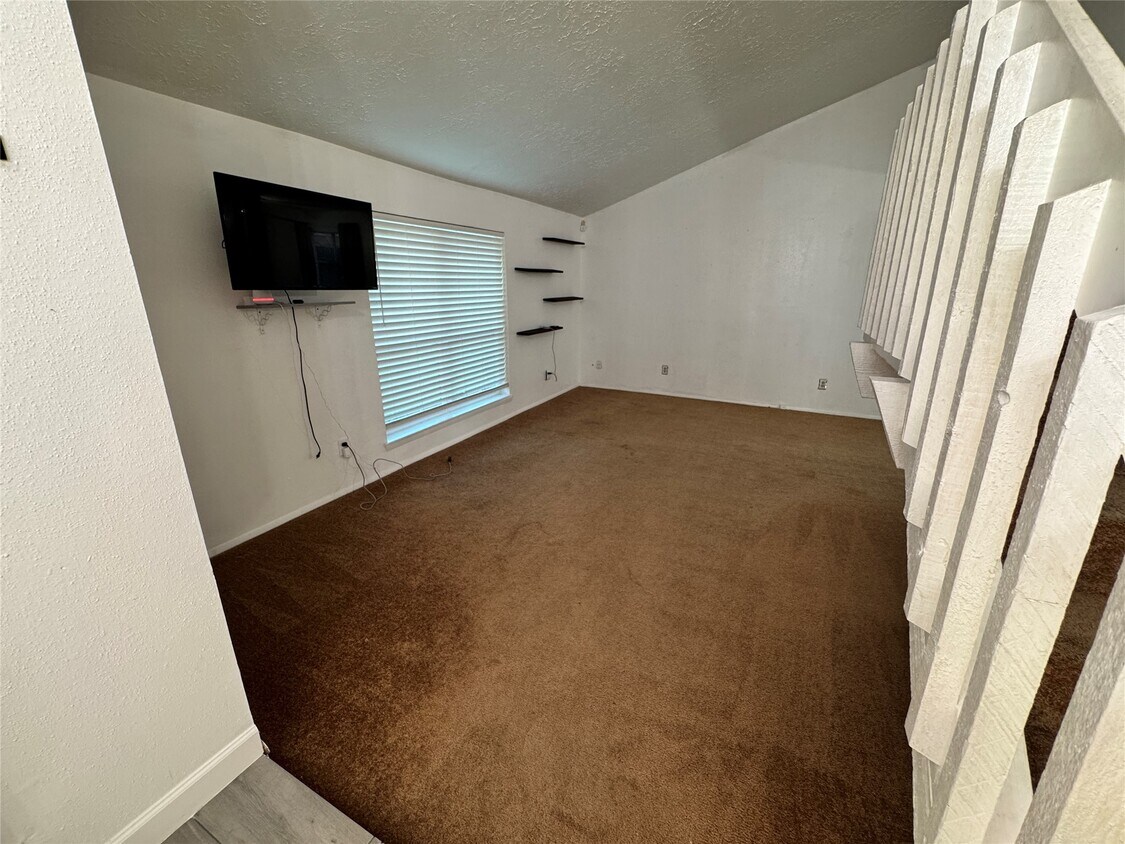
This well maintained,two story home is located in the well sought out area of Westbank in Northwest Houston. Highway 290,Highway 249 and Beltway 8 are all a short drive away to get to your destinations quickly. Zoned to Cy-Fair ISD and has Frazier Elementary School inside of the neighborhood for convenience. MLS# 93620497
8519 Church Light Ln is a house located in Harris County and the 77064 ZIP Code. This area is served by the Aldine Independent School District attendance zone.
* Price shown is base rent. Excludes user-selected optional fees and variable or usage-based fees and required charges due at or prior to move-in or at move-out. Price, availability, fees, and any applicable rent special are subject to change without notice.
* Square footage definitions vary. Displayed square footage is approximate.
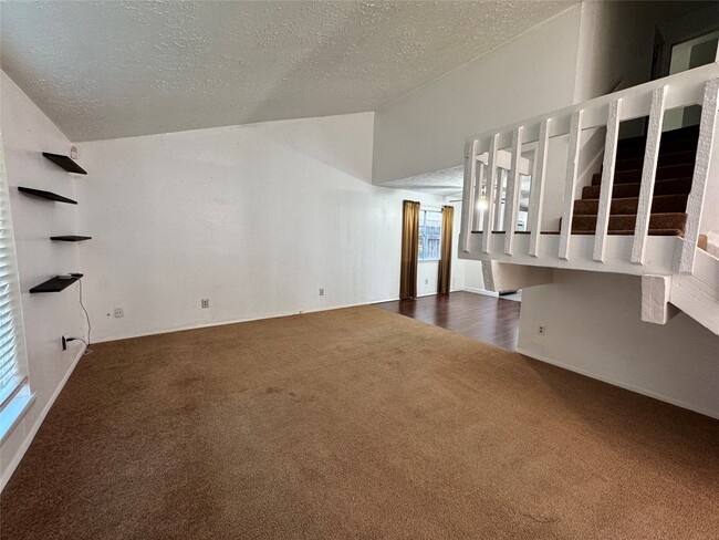
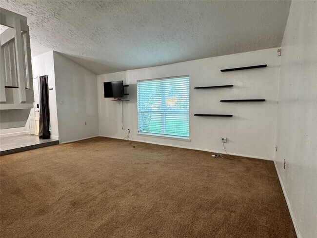
Home Details
Home Type
Single Family Detached Home
Year Built
Built in 1977
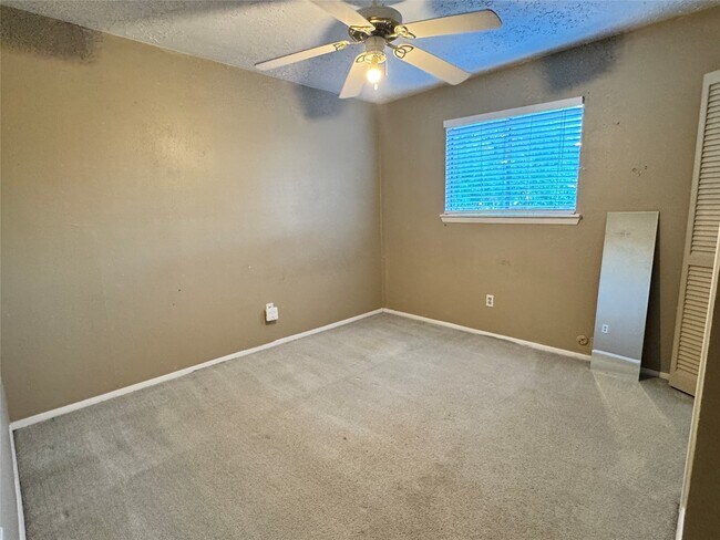
Bedrooms and Bathrooms
2.5 Bathrooms
3 Bedrooms
Home Design
Patio Home
Interior Spaces
1 Fireplace
1,878 Sq Ft Home
2-Story Property
Listing and Financial Details
Property Available on 3/31/26
12 Month Lease Term
Lot Details
6,295 Sq Ft Lot
Parking
2 Car Attached Garage
Schools
Frazier Elementary School
Cook Middle School
Jersey Village High School
Utilities
Central Heating and Cooling System
Community Details
Overview
Franz Sarangaya Association
Westbank Sec 02 Subdivision
Pet Policy
No Pets Allowed
Contact
- Listed by Ezequiel Martinez | BK Real Estate
- Phone Number
- Contact
-
Source
 Houston Association of REALTORS®
Copyright © 2026 Houston Association of Realtors. All rights reserved. All information provided by the listing agent/broker is deemed reliable but is not guaranteed and should be independently verified.
Location
Get Directions
Brookhollow/Inwood is a neighborhood just north of the Inwood Greater Area. Brookhollow/Inwood is located about 20 miles northwest of Downtown Houston and is a great option for people seeking a lower key setting. Away from the hustle and bustle of Downtown Houston, families stroll the neighborhood and converse with fellow community members. Golf fans spend hours on the green at the Inwood Forest Golf Club before retiring to the country club. Complemented by tree-lined streets, Brookhollow/Inwood features apartments and single-family houses for every budget. The neighborhood is predominantly residential, but there are plenty of amenities nearby.
Learn more about living in Brookhollow/Inwood
Education
| Colleges & Universities | Distance | ||
|---|---|---|---|
| Colleges & Universities | Distance | ||
| Drive: | 25 min | 16.0 mi | |
| Drive: | 29 min | 18.1 mi | |
| Drive: | 31 min | 19.6 mi | |
| Drive: | 31 min | 20.4 mi |
8519 Church Light Ln is within 25 minutes or 16.0 miles from The Art Institute of Houston. It is also near Univ. of Houston, Downtown and University of St Thomas.
Schools


Public Middle School
Grades 6-8
1,078 Students
Nearby
Public High School
Grades 9-12
2,855 Students
Nearby
School data provided by
 The GreatSchools Rating helps parents compare schools within a state based on a variety of school quality indicators and provides a helpful picture of how effectively each school serves all of its students. Ratings are on a scale of 1 (below average) to 10 (above average) and can include test scores, college readiness, academic progress, advanced courses, equity, discipline and attendance data. We also advise parents to visit schools, consider other information on school performance and programs, and consider family needs as part of the school selection process.
View GreatSchools Rating Methodology
Data provided by GreatSchools.org © 2026. All rights reserved.
View GreatSchools Rating Methodology
Data provided by GreatSchools.org © 2026. All rights reserved.
Transportation options available in Houston include Northline Transit Center Hcc Sb, located 13.4 miles from 8519 Church Light Ln. 8519 Church Light Ln is near George Bush Intcntl/Houston, located 18.3 miles or 26 minutes away, and William P Hobby, located 31.1 miles or 50 minutes away.
| Transit / Subway | Distance | ||
|---|---|---|---|
| Transit / Subway | Distance | ||
| Drive: | 25 min | 13.4 mi |
| Commuter Rail | Distance | ||
|---|---|---|---|
| Commuter Rail | Distance | ||
|
|
Drive: | 30 min | 18.2 mi |
| Airports | Distance | ||
|---|---|---|---|
| Airports | Distance | ||
|
George Bush Intcntl/Houston
|
Drive: | 26 min | 18.3 mi |
|
William P Hobby
|
Drive: | 50 min | 31.1 mi |
Getting Around
 What do Walkability, Transit, Drivability, and Bikeability mean?
Walkability measures the walking distance to day-to-day needs.
Transit measures access to public transportation.
Drivability measures congestion, parking availability, and access to major roads.
Bikeability measures the suitability for cycling.
How It Works
What do Walkability, Transit, Drivability, and Bikeability mean?
Walkability measures the walking distance to day-to-day needs.
Transit measures access to public transportation.
Drivability measures congestion, parking availability, and access to major roads.
Bikeability measures the suitability for cycling.
How It Works
Somewhat Walkable
Walkability
20
/ 100
Minimal Public Transit
Transit
0
/ 100
Exceptionally Drivable
Drivability
90
/ 100
Fairly Bikeable
Bikeability
40
/ 100
Scores provided by
-
Soundscore™
-
/ 100
Traffic
-Airport
-Businesses
-Scores provided by
HowLoud What is a Sound Score Rating? A Sound Score Rating aggregates noise caused by vehicle traffic, airplane traffic and local sources. How It WorksTime and distance from 8519 Church Light Ln.
| Shopping Centers | Distance | ||
|---|---|---|---|
| Shopping Centers | Distance | ||
| Drive: | 3 min | 1.2 mi | |
| Drive: | 7 min | 3.1 mi | |
| Drive: | 9 min | 4.7 mi |
8519 Church Light Ln has 3 shopping centers within 4.7 miles, which is about a 9-minute drive. The miles and minutes will be for the farthest away property.
| Parks and Recreation | Distance | ||
|---|---|---|---|
| Parks and Recreation | Distance | ||
|
Cy-Champ Park
|
Drive: | 15 min | 7.9 mi |
|
Kickerillo-Mischer Preserve
|
Drive: | 14 min | 9.2 mi |
|
Hundred Acre Wood Preserve
|
Drive: | 17 min | 9.8 mi |
|
Fallen Warriors Memorial
|
Drive: | 16 min | 10.0 mi |
|
Bear Creek Pioneers Park
|
Drive: | 24 min | 12.4 mi |
8519 Church Light Ln has 5 parks within 12.4 miles, including Cy-Champ Park, Fallen Warriors Memorial, and Kickerillo-Mischer Preserve.
| Hospitals | Distance | ||
|---|---|---|---|
| Hospitals | Distance | ||
| Drive: | 12 min | 7.0 mi | |
| Drive: | 15 min | 7.8 mi | |
| Drive: | 15 min | 9.3 mi |
8519 Church Light Ln has 3 hospitals within 9.3 miles, the nearest is Houston Methodist Willowbrook Hospital which is 7.0 miles away and a 12 minute drive.
| Military Bases | Distance | ||
|---|---|---|---|
| Military Bases | Distance | ||
| Drive: | 63 min | 44.5 mi | |
| Drive: | 92 min | 70.1 mi |
8519 Church Light Ln is 44.5 miles from Lyndon B Johnson Space Center, and is convenient to other military bases, including Pelican Spit Military Reservation.
You May Also Like
Similar Rentals Nearby
-
-
-
3 Beds$2,625+4 Beds$2,895+Total Monthly PriceTotal Monthly Price NewPrices include base rent and required monthly fees. Variable costs based on usage may apply.2 Months Free
Pets Allowed Fitness Center Pool
-
-
-
-
-
3 Beds$2,274+4 Beds$2,724+Total Monthly PriceTotal Monthly Price NewPrices include base rent and required monthly fees of $124. Variable costs based on usage may apply.Base Rent:3 Beds$2,150+4 Beds$2,600+
-
-
3 Beds$2,510+Total Monthly Price12 Month LeaseTotal Monthly Price NewPrices include base rent and required monthly fees of $218. Variable costs based on usage may apply.Base Rent:3 Beds$2,292+Specials


What Are Walk Score®, Transit Score®, and Bike Score® Ratings?
Walk Score® measures the walkability of any address. Transit Score® measures access to public transit. Bike Score® measures the bikeability of any address.
What is a Sound Score Rating?
A Sound Score Rating aggregates noise caused by vehicle traffic, airplane traffic and local sources.
8519 Church Light Ln
Houston, TX 77064