
The Vitagraph
1277 E 14th St,
Brooklyn, NY 11230
$3,995 - $4,695
2-3 Beds
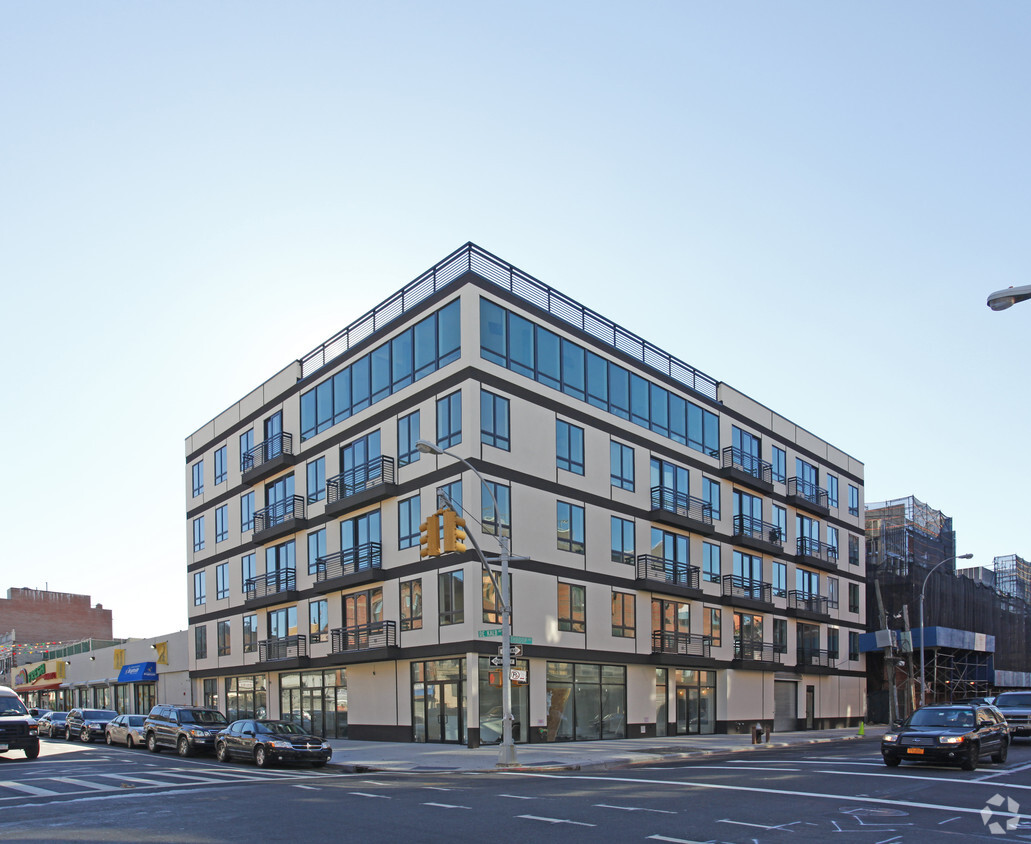
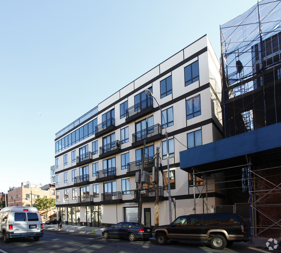
836 Dekalb Ave offers a mixture of comfort, style, and quality. The 836 Dekalb Ave location in the 11221 neighborhood of Brooklyn is convenient to everything. The leasing staff is ready to show you our community. Our apartment community offers unique amenities. These include: granite countertops, smoke-free options, and a rooftop lounge. Come see 836 Dekalb Ave today.
836 Dekalb Ave is an apartment community located in Kings County and the 11221 ZIP Code. This area is served by the New York City Geographic District #16 attendance zone.
Fitness Center
Laundry Facilities
Elevator
Roof Terrace
Air Conditioning
Dishwasher
High Speed Internet Access
Granite Countertops
Bedford-Stuyvesant, often shortened to Bed-Stuy, sits in north central Brooklyn, touting plenty of classic brownstones along tree-lined streets. Bed-Stuy is revered for its historic architecture, containing one of the highest concentrations of Victorian properties in all of New York City.
Residents enjoy a strong sense of community in Bed-Stuy along with an array of diverse eateries, cafes, and bodegas. Herbert Von King Park lies at the center of the neighborhood, exuding a lively town-square atmosphere with an outdoor amphitheater, Cultural Arts Center, and athletic facilities. Convenience to public transportation and I-278 makes commuting and traveling from Bed-Stuy a breeze.
Learn more about living in Bedford-StuyvesantCompare neighborhood and city base rent averages by bedroom.
| Bedford-Stuyvesant | Brooklyn, NY | |
|---|---|---|
| Studio | $2,324 | $2,662 |
| 1 Bedroom | $2,639 | $2,974 |
| 2 Bedrooms | $3,191 | $3,910 |
| 3 Bedrooms | $3,850 | $4,831 |
| Colleges & Universities | Distance | ||
|---|---|---|---|
| Colleges & Universities | Distance | ||
| Drive: | 4 min | 1.1 mi | |
| Drive: | 4 min | 1.4 mi | |
| Drive: | 6 min | 2.0 mi | |
| Drive: | 8 min | 2.6 mi |


Transportation options available in Brooklyn include Myrtle-Willoughby Avenues, located 0.5 mile from 836 Dekalb Ave. 836 Dekalb Ave is near LaGuardia, located 8.7 miles or 19 minutes away, and John F Kennedy International, located 11.3 miles or 22 minutes away.
| Transit / Subway | Distance | ||
|---|---|---|---|
| Transit / Subway | Distance | ||
|
|
Walk: | 10 min | 0.5 mi |
|
|
Walk: | 13 min | 0.7 mi |
|
|
Walk: | 13 min | 0.7 mi |
|
|
Walk: | 13 min | 0.7 mi |
|
|
Walk: | 17 min | 0.9 mi |
| Commuter Rail | Distance | ||
|---|---|---|---|
| Commuter Rail | Distance | ||
|
|
Drive: | 5 min | 1.5 mi |
|
|
Drive: | 7 min | 2.5 mi |
|
|
Drive: | 7 min | 2.9 mi |
|
|
Drive: | 13 min | 4.0 mi |
|
|
Drive: | 14 min | 4.3 mi |
| Airports | Distance | ||
|---|---|---|---|
| Airports | Distance | ||
|
LaGuardia
|
Drive: | 19 min | 8.7 mi |
|
John F Kennedy International
|
Drive: | 22 min | 11.3 mi |
Time and distance from 836 Dekalb Ave.
| Shopping Centers | Distance | ||
|---|---|---|---|
| Shopping Centers | Distance | ||
| Drive: | 7 min | 2.2 mi | |
| Drive: | 7 min | 2.2 mi |
| Parks and Recreation | Distance | ||
|---|---|---|---|
| Parks and Recreation | Distance | ||
|
Hattie Carthan Garden
|
Walk: | 7 min | 0.4 mi |
|
Martinez Playground
|
Drive: | 4 min | 1.2 mi |
|
Sternberg Park
|
Drive: | 4 min | 1.2 mi |
|
Brooklyn Children's Museum
|
Drive: | 5 min | 1.4 mi |
|
Crispus Attucks Playground
|
Drive: | 5 min | 1.8 mi |
| Hospitals | Distance | ||
|---|---|---|---|
| Hospitals | Distance | ||
| Walk: | 13 min | 0.7 mi | |
| Drive: | 6 min | 1.5 mi | |
| Drive: | 5 min | 1.8 mi |
| Military Bases | Distance | ||
|---|---|---|---|
| Military Bases | Distance | ||
| Drive: | 18 min | 6.7 mi | |
| Drive: | 22 min | 11.1 mi |
What Are Walk Score®, Transit Score®, and Bike Score® Ratings?
Walk Score® measures the walkability of any address. Transit Score® measures access to public transit. Bike Score® measures the bikeability of any address.
What is a Sound Score Rating?
A Sound Score Rating aggregates noise caused by vehicle traffic, airplane traffic and local sources


