
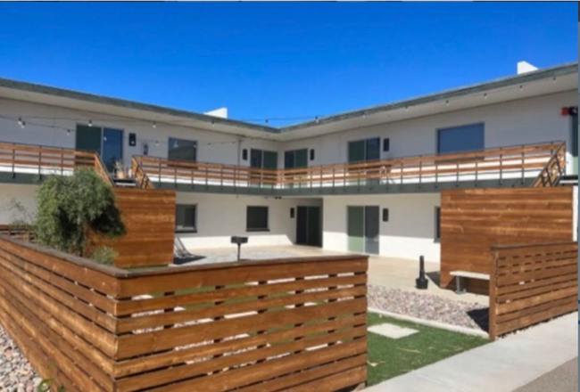
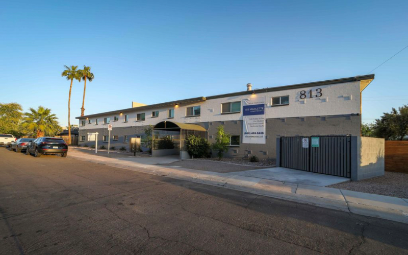
813 E Marlette Ave
Phoenix, AZ 85014
-
Bedrooms
2
-
Bathrooms
2
-
Square Feet
900 sq ft
-
Available
Available Now
Highlights
- Pets Allowed
- Security System

About This Home
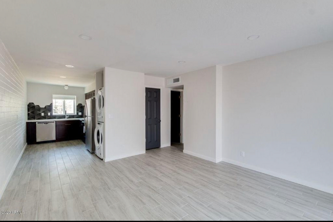
Property Id: 998242 Two bedroom two bath 900 ft.². New laminate flooring and paint. Close to shopping and Biltmore business district. Near restaurant Row and Camelback and the Phoenix mountains for hiking. 7th St connects to the I 17 in one direction and State Route 50 - Paradise Parkway. Paradise Parkway was first proposed as part of the 1960 Phoenix freeway plan. The road was originally proposed to be along the Bethany Home Road corridor, approximately four miles north of Interstate 10 and connect to Paradise Valley which leads into Scottsdale on Scottsdale road.
813 E Marlette Ave is a house located in Maricopa County and the 85014 ZIP Code. This area is served by the Madison Elementary District attendance zone.
Fees and Policies
The fees listed below are community-provided and may exclude utilities or add-ons. All payments are made directly to the property and are non-refundable unless otherwise specified. Use the Cost Calculator to determine costs based on your needs.
-
One-Time Basics
-
Due at Move-In
-
Security Deposit - RefundableCharged per unit.$1,000
-
-
Due at Move-In
-
Dogs
-
Allowed
-
-
Cats
-
Allowed
-
Property Fee Disclaimer: Based on community-supplied data and independent market research. Subject to change without notice. May exclude fees for mandatory or optional services and usage-based utilities.
Details
Utilities Included
-
Trash Removal
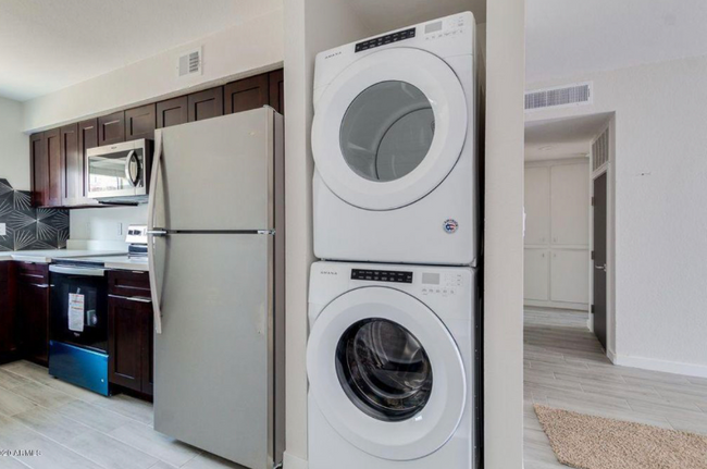
House Features
Washer/Dryer
Dishwasher
Microwave
Refrigerator
- Washer/Dryer
- Security System
- Dishwasher
- Disposal
- Microwave
- Oven
- Refrigerator
- Bicycle Storage
Contact
- Phone Number
- Contact
-
Source

North Phoenix refers to the vast swath of land that stretches from Bethany Home Road up towards the Phoenix mountains. Bounded to the east by State Route 51 and to the west by 51st Avenue, North Phoenix is home a slew of diverse communities and neighborhoods all offering a variety of rentals ranging from the upscale to the more affordable. There are numerous golf courses and of course the mountains that offer residents a number of outdoor activities to engage in. For shopping and dining, residents head to Desert Ridge Marketplace on High Street, which is filled with upscale boutiques, nightlife hotspots, restaurants, and more. Interstate 17 and Route 101 make commuting around this desirable area simple.
Learn more about living in North Phoenix- Washer/Dryer
- Security System
- Dishwasher
- Disposal
- Microwave
- Oven
- Refrigerator
- Bicycle Storage
| Colleges & Universities | Distance | ||
|---|---|---|---|
| Colleges & Universities | Distance | ||
| Drive: | 11 min | 4.6 mi | |
| Drive: | 13 min | 5.0 mi | |
| Drive: | 11 min | 5.1 mi | |
| Drive: | 12 min | 5.3 mi |


View GreatSchools Rating Methodology
Data provided by GreatSchools.org © 2026. All rights reserved.
Transportation options available in Phoenix include Central Ave/Camelback, located 2.5 miles from 813 E Marlette Ave. 813 E Marlette Ave is near Phoenix Sky Harbor International, located 9.9 miles or 18 minutes away, and Phoenix-Mesa Gateway, located 36.7 miles or 50 minutes away.
| Transit / Subway | Distance | ||
|---|---|---|---|
| Transit / Subway | Distance | ||
|
|
Drive: | 6 min | 2.5 mi |
|
|
Drive: | 6 min | 2.6 mi |
|
|
Drive: | 6 min | 2.6 mi |
|
|
Drive: | 6 min | 2.8 mi |
|
|
Drive: | 6 min | 3.0 mi |
| Commuter Rail | Distance | ||
|---|---|---|---|
| Commuter Rail | Distance | ||
|
|
Drive: | 50 min | 37.7 mi |
| Airports | Distance | ||
|---|---|---|---|
| Airports | Distance | ||
|
Phoenix Sky Harbor International
|
Drive: | 18 min | 9.9 mi |
|
Phoenix-Mesa Gateway
|
Drive: | 50 min | 36.7 mi |
Time and distance from 813 E Marlette Ave.
| Shopping Centers | Distance | ||
|---|---|---|---|
| Shopping Centers | Distance | ||
| Walk: | 6 min | 0.3 mi | |
| Walk: | 8 min | 0.4 mi | |
| Walk: | 9 min | 0.5 mi |
| Parks and Recreation | Distance | ||
|---|---|---|---|
| Parks and Recreation | Distance | ||
|
Desert Storm Park
|
Drive: | 5 min | 2.2 mi |
|
Steele Indian School Park
|
Drive: | 7 min | 2.8 mi |
|
Granada Park
|
Drive: | 7 min | 3.1 mi |
|
Tonto National Forest
|
Drive: | 11 min | 4.7 mi |
|
Dreamy Draw Recreation Area
|
Drive: | 12 min | 7.3 mi |
| Hospitals | Distance | ||
|---|---|---|---|
| Hospitals | Distance | ||
| Drive: | 6 min | 2.5 mi | |
| Drive: | 6 min | 2.7 mi | |
| Drive: | 7 min | 3.1 mi |
| Military Bases | Distance | ||
|---|---|---|---|
| Military Bases | Distance | ||
| Drive: | 18 min | 9.7 mi | |
| Drive: | 35 min | 17.9 mi | |
| Drive: | 107 min | 79.0 mi |
813 E Marlette Ave Photos
Nearby Apartments
Within 50 Miles of 813 E Marlette Ave Phoenix, AZ 85014
-
Village at Liberty Farms
5801 S 51st Dr
Phoenix, AZ 85339
Call for Rent
2-3 Br 11.1 mi
-
Bungalows at Camelback
4747 N 99th Ave
Phoenix, AZ 85037
$2,023 - $2,550
2-3 Br 12.1 mi
-
Village at Carver Mountain
8450 S 59th Ave Ave
Laveen, AZ 85339
$1,875 - $2,650
2-3 Br 13.2 mi
-
Abode At Litchfield Park
5110 N 129th Ave
Litchfield Park, AZ 85340
$1,821 - $1,866 Total Monthly Price
2 Br 15.9 mi
-
The Hillburn
2550 W North Foothills Dr Dr
Phoenix, AZ 85085
$2,325 - $3,183
2-4 Br 17.2 mi
-
Villas on Ash
1381 N Gilbert Rd
Gilbert, AZ 85234
$2,539
2-3 Br 19.1 mi
What Are Walk Score®, Transit Score®, and Bike Score® Ratings?
Walk Score® measures the walkability of any address. Transit Score® measures access to public transit. Bike Score® measures the bikeability of any address.
What is a Sound Score Rating?
A Sound Score Rating aggregates noise caused by vehicle traffic, airplane traffic and local sources
813 E Marlette Ave
Phoenix, AZ 85014